Benevolent hearts abound during the holidays, and not just on Giving Tuesday. Here are a few quick ways you can support the coasts throughout this holiday season.
Make a point to visit you favorite local coastal spot in November, December, and January and bring friends. While strolling, kayaking, or bird watching make sure they know about the significance of the area and any management issues they can play a role in as community members.
Foe example, if you are in the Maryland area, visit Mallows Bay. It is a proposed National Marine Sanctuary. Designation would allow NOAA programs to supplement and complement existing state and local programs that aim to protect, study, interpret, and manage this unique area. Photo Credit: Daryl Byrd.
2. Shop for the Holidays using Amazon Smile.
Did you know Amazon donates 0.5% of the price of purchases to your charitable organization of choice using AmazonSmile? Click the Amazon Smile link before you start your online shopping with Amazon and make sure to choose The Coastal Society. Happy Shopping!
3. Buy TCS Merchandise – it is a Great Gift for Co-Workers!
Not sure what to get a colleague for your office holiday Grab Bag? How about a cellphone case with TCS logo, a mug or reusable water bottle, a TCS polo shirt or a 3/4-sleeve woman’s raglan t-shirt? Select from other styles and colors, too. Purchase here.
4. Donate Directly to TCS Today.
Your direct donation to The Coastal Society supports our ongoing work to foster dialogue, forge partnerships and promote communications and education, and support young professionals and students in their professional development. You can donate via the TCS website.
5. Encourage a friend or colleague to become a member of TCS.
Our strength (and fun!) comes from the network of coastal professionals and students. Members receive our coveted monthly jobs list, a subscription to the international journal Coastal Management, TCS Blog digest, & more! Send them this link.
Editor’s Note: This article is a follow-up to two other TCS articles on the Great American Eclipse of 2017.
OREGON
Meg Reed | Oregon Coastal Management Program, Newport, OR
Newport, OR – The morning of the total solar eclipse started out the way many mornings on the coast in the summer do, foggy. I worried that I wouldn’t be able to fully experience the solar eclipse and that if I chose to drive further inland, I would be stuck in traffic and crowds. Instead, I decided to wait it out. By 8:30 am, the mist was burning off and by the time I brought my chair to the backyard at 9 am, the sun was fully out and there was barely a cloud in the sky! I couldn’t believe our luck!
My excitement intensified when I put on my solar eclipse glasses and saw the first sign of the eclipse starting around 9:04 am – a small chunk missing from the top right side of the sun, like someone had taken a small nibble out of a cookie. The moon was starting its movement across the sun and it was so exhilarating to see it happening right before my eyes! Over the next half hour, I continued to watch the sun disappear slowly behind the moon through my viewing glasses. After about 40-minutes or so, I noticed that the light was getting dimmer and the air temperature was getting colder. I had to put on more layers as I sat watching the light continue to dim and the temperature continue to drop.
Finally, around 10:15 am, the last sliver of the sun went behind the moon and I could take off my glasses to fully witness totality. The sky was instantly dark – comparable to the last moments of twilight – and the sun’s glow was shining around the moon. It was so incredibly wonderful! I wasn’t prepared for how amazing the moment of totality would be. It was truly awe-inspiring. While I was with only my husband in our backyard, we heard whoops and shouts of excitement across the neighborhood from others watching the event. Small fireworks starting going off nearby as people celebrated. You could feel the excitement in the air as we all stopped to observe this event.
And then, just like that, the sun started shining through the other side as the moment of totality ended and I put my glasses back on to watch the moon continue its journey the other way. The sunlight came back and over the next hour, the temperature got warmer and the light got stronger until the eclipse officially ended around 11:36 am in Newport and it was a normal sunny day again.
“My excitement intensified when I put on my solar eclipse glasses and saw the first sign of the eclipse starting around 9:04am…”
SOUTH CAROLINA
Rebecca Love | Coastal Management Specialist at NOAA Office for Coastal Management
I watched the eclipse with my family and neighbors at the end of our street. The street ends at the Ashley River so the view was great – plenty of open sky above and marsh below. It was a cloudy afternoon with a thunderstorm threatening to move in, but we were able to see the eclipse and totality through the clouds and the occasional gap in the clouds. My two daughters were so excited. We talked about what we might see and feel and how to watch safely. That morning they made eclipse cupcakes to share with fellow on-lookers.
Totality was 94 amazing seconds! Not only was it awesome and a little eerie, but it was a sort of bonding experience with those around you. As the sky grew darker, everyone became silent. Street lights came on, the temperature dropped a few degrees, a few stars became visible and everyone was in awe. Afterwards some people clapped, some left and went home, and my 8-year-old said “that was awesome!” I feel so lucky to have experienced this with my family from my own front yard.
Hanging with the neighbors at the end of the streetKids and me in the yard.
Margaret Allen | The Baldwin Group at NOAA’s Office for Coastal Management
I should have stayed close to home. I missed the whole darn thing. As I was driving out to the eclipse party, the sky was getting darker (weather-related, not eclipse-related) and it started raining. Booo. The coast (where I came from) had some clouds, but stayed pretty clear. Inland (where I went), was stormy and cloudy the whole time. Eclipse-viewing-location fail.
But even though I didn’t see it, I did have a cool eclipse experience. Actually, I did get to see one little glimpse when I made a stop and whipped out my eclipse glasses on the way out to the party–that was cool. And even though the weather was a mixture of cloudy, sprinkling, and/or pouring the whole time, at the moment of totality, we still got to experience the “everything got dark” moment. Nighttime dark, not just overcast dark. And the temperature dropped what seemed like 15 degrees. We were all a little wet from the rain, and we all were freezing. It’s a strange feeling to get the chills outside in Charleston in August. To make it even more exciting, we were looking out over the Ashley River, and you could see the lightning bolts over the water and the thunder was rumbling. Spooky. We had fun talking about what people in ancient times must have thought when something like that happened. We decided they must have thought the world was ending. Even Lizzie and Ellie weren’t sure about the whole thing, and my lap was full of chilly and slightly freaked out little girls. Actually I think their biggest concern was that they might have to go to bed since it was dark. Haha.
So I didn’t see it, but I ‘experienced’ it. And it was a fun party, we grilled out, splashed around in the puddles, roasted marshmallows, and had fun looking up when and where we could see the next total eclipse. And my kids still have their eye sight. So that’s a plus. Maybe in 2024 we’ll head to Texas or New York and try again.
By Erik Swanson, Oregon State University TCS Student Chapter
Editor’s Note: This article is a follow-up to two other TCS articles on the Great American Eclipse of 2017.
From atop Dimple Hill, part of Oregon State University’s (OSU) McDonald Research Forest, a crowd of more than a hundred people enjoyed a vantage point stretching from the Cascades through the Willamette Valley and to the Oregon Coast Range. As totality drew closer, nearly all in attendance now had donned their paper protective eye-wear. A thin speck of sun shone from behind the moon before all went black; the cosmic signal to rip off those funny glasses. The crowd cheered as the total eclipse burst on display for about two minutes. As many in attendance had migrated from all over the world to share in the wonder of the eclipse, simultaneously, millions of Pacific Ocean zooplankton in range of totality strangely migrated to the surface of the ocean.
More than just awe-inspiring, a monumental event such as blotting out the daytime sun not surprisingly impacts the natural world in many curious ways. Birds have been reported to respond by singing songs reserved for dusk, but less obvious are the impacts to the oceans. OSU, a partner with the Ocean Observatories Initiative (OOI), was uniquely positioned this year in the line of totality, an exciting opportunity for oceanographers to observe how a cosmic event like the 2017 eclipse can affect the oceans.
Ocean Observatory group recovering one of our surface moorings. These are the moorings that make the meteorological and fixed water column measurements shown in the graphic below.
Photo Credit: Jonathon Fram
Dr. Jonathan Fram, an oceanographer at the OSU operated Ocean Observing Center, in Corvallis, Oregon, facilitated those observations. He predicted that the daily zooplankton migration event would be affected, as it is dependent on the amount of sunlight penetrating the ocean. During the daylight hours, these millions of tiny creatures can be found in the deep, dark, depths of the ocean. At dusk, they begin a long migration to the water surface, where they spend the night before dawn marks a return to the deep. Fram, using bioacoustic sonar equipment stationed off the Oregon coast, found that the zooplankton responded to the eclipse and the reduction of light in the water column by beginning their daily migration to the surface. Before reaching the water surface, totality was complete and the slow increase of light signified a sort of false alarm for the tiny creatures and a return to the ocean depths.
The bioacoustic sonars located 10 miles off the coast of Newport, Oregon, and 40 miles off the coast of Waldport, Oregon, are connected to shore via hundreds of miles of cable. The University of Washington OOI team laid and maintain these cables that encase a power cord and fiber optic cable for data transmission. Connecting these data-capturing instruments directly to shore allows scientists to observe the data capture in real-time, download the data in a short amount of time, and provide results to the public with little delay. Results of this experiment were available only 12 hours following the eclipse.
“Scientists make predictions all the time but often cannot share their results in a time frame that captures the public’s interest,” said Fram. “This event was a unique opportunity to provide the public with the results of a large scale experiment on the same day it occurred.”
Shelf bioacoustic sonar instrument before deployment
Photo Credit: Jonathon Fram
Two offshore surface moorings, part of the Endurance Array, were uniquely positioned in the line of totality and captured data such as air and water temperatures and shortwave radiation during the eclipse. Air temperature on the beach and further inland was significantly reduced, as many people experienced during the eclipse, but water and offshore air temperatures were not impacted much. This is not surprising, according to Fram, as offshore air temperature is more dependent on ocean temperatures. The amount of sunlight—shortwave radiation—penetrating the ocean was also greatly reduced during the eclipse event.
Shelf bioacoustic sonar instrument while it was being deployed via ROV.
Photo Credit: Jonathon Fram
Fram’s work is one of many experiments and research projects currently underway at OSU made possible by the OSU’s operation of the Endurance Array portion of OOI. The OOI allows scientists throughout the world to access oceanographic data by tapping into an array of instruments deployed offshore to capture a vast multitude of oceanographic variables. At least one thousand instruments are located in the Pacific Northwest of the United States and Canada. Fram said, this year he hopes to improve the accessibility of data his center manages for scientists and the public.
As a NASA Space Grant, Sea Grant and Land Grant university, OSU works to bring scientists and students from a wide range of backgrounds together to confront the major challenges faced by the oceans now and in the future. The Hatfield Marine Science Center located in Newport, Oregon, is an additional OSU resource that welcomes these diverse scientists and students. It serves as a marine and oceanographic laboratory and classroom for seven OSU colleges and six state and federal agencies. The visitor center also provides educational opportunities for K-12 and the public.
The Oregon Coast provides many exciting opportunities for students and professionals in the fields of oceanography, marine biology, marine fisheries and others. An added benefit to studying or working in Oregon is that beaches are legally public lands. Within those approximately 363-miles of public beachs, bays, and estuaries there are endless scientific wonders left to explore and environmental vulnerabilities to confront for future stewards of the coasts.
Meteorological and fixed water column measurements taken during the eclipse.
By Lisa Graichen, Climate Adaptation Program Coordinator, University of New Hampshire Cooperative Extension and New Hampshire Sea Grant
Over the summer, coastal stakeholders from Maine and New Hampshire gathered in Wells, Maine, at the 2017 Beaches Conference to share updates and lessons learned from research and outreach efforts. The first Maine Beaches Conference was in 2000, and this year’s – the 11th – was the first to include New Hampshire. Over 200 people attended, with sessions on a wide range of topics, from using unmanned aerial systems (or drones) for habitat mapping to aquaculture curricula, marine mammal rescue, coastal law and policy issues, and much more.
Beaches Conference social at Wells NERR , Maine
What struck me the most about the conference was the breadth of the participants’ backgrounds. I spoke with an emergency manager from a local naval shipyard; listened to an artist describe her coastal mapping work as a means for communication and capturing love of place; learned from experts in ocean mapping, archeology, and environmental law; and heard from a representative of the US Department of Homeland Security. Colleagues shared examples translating research and monitoring programs from one state to the other. For example, a team in New Hampshire is learning from others in Maine how to build a volunteer beach profile monitoring program. While there are several unique, place-based factors in coastal management, there is a lot we can learn from the coastal management strategies and lessons in other places. Kristen Grant from Maine Sea Grant and University of Maine Extension shared stories from the Netherlands about stakeholder engagement in flood defense. She stressed the importance of providing opportunities for people to listen to, learn from, and build trust in each other.
Newcastle, Maine
The most unique part of the day was a plenary session called “Listening for a Change: Stories of Our Responses to Sea-Level Rise” that brought together a philosophy professor, a playwright, and a climatologist to share their reflections on climate change and sea-level rise. First, the philosophy professor wondered aloud what proof there was that carbon dioxide is causing global warming, and how we could distinguish between different sources of carbon dioxide. As he worked through his thinking on this subject, you could sense palpable discomfort in the room as he shared a somewhat skeptical perspective. I felt confused to hear questions being framed as unresolved that scientists know the answers to, and I saw others in the audience shake their heads and shift in their seats uncomfortably. The playwright was next. She described feeling like she is “not a native” in the world of science, and struggling to try to wrap her head around the impacts of climate change but not knowing where to look for information. She mentioned feeling scared as well as scolded for contributing to anthropogenic climate change, but not knowing where to look for valid information or what to do about it. Finally, the climatologist described his experience with a bipartisan effort in New Hampshire called the Coastal Risk and Hazards Commission and grappling with different perspectives about science and sources of information through that process. He suggested that solving problems isn’t about convincing people to see things your way, though we often feel a desire to try to do that. These were three people from different professional and personal backgrounds, all describing different experiences with understanding the science of climate change.
Seapoint Beach, Kittery, Maine
Unfortunately, there wasn’t much time left for the panel discussion and audience dialogue following the three speakers, and the only person who had a chance to ask a question used the opportunity to try to rebut the philosophy professor’s skepticism. I think there is often a desire to present scientific information to counter misinformation or misunderstandings, but we can sometimes skip the step of trying to really understand and acknowledge why people have those perspectives, where they’re coming from, and how best to engage in a productive dialogue.
I recently finished listening to Strangers in Their Own Land by Arlie Russell Hochschild, a sociologist from UC Berkeley, who journeyed to climb over what he called the “empathy wall” to gain an in-depth understanding of people who identify with the Tea Party.
“An empathy wall is an obstacle to deep understanding of another person, one that can make us feel indifferent or even hostile to those who hold different beliefs or whose childhood is rooted in different circumstances.” – Arlie Russel Hoschild
Academic or professional conferences can often be opportunities for like-minded folks to gather and learn from each other, which is certainly valuable, but it is important to remember the voices that may not be represented there. Let’s reflect on how we can bring those voices in, acknowledge different experiences and perspectives, and challenge ourselves in how we respond. I am grateful for the opportunity at this conference to be put in the uncomfortable space of confronting skepticism about climate change, feeling my initial emotional response, and reflecting on the need to really listen and figure out how to interact in a productive way. Especially in these highly polarized times, one of our most critical charges working in coastal management is to take the time to listen, face the discomfort of different perspectives, and work on communicating science-based information in ways that resonate. In other words, learning how to climb the “empathy walls,” understand other perspectives, and acknowledge others’ experiences. It’s not an easy task, but it may be our most important.
Editor’s Note: This article is a reprint from the TCS Bulletin in 2000 (Volume 22(2)) in celebration of the 33rd anniversary of Coastweeks.
by Thomas E. Bigford, Policy co-Director, American Fisheries Society
The BULLETIN thanks Ms. Fegan for sharing her memories and her inspiration.
As I contemplated the meaning of Coastweeks 2000 this past summer, I found myself thinking often of how one person’s idea coalesced into an event, then a national and international celebration, and now a tradition. Thoughts of those formative days of Coastweeks invariably reminded me of the enthusiastic leadership provided by a single visionary — Barbara Fegan. I caught up with her this past September as she was enjoying retirement in Wellfleet, Massachusetts, the Cape Cod community where she perfected her coastal advocacy roots. Although she is approaching her 80th birthday (“not till next year! “) and she “officially” retired by choice from public life in 1994, we can rest assured that Ms. Fegan remains a visionary. To me, she’s also a treasured friend. This interview offers glimpses of how Coastweeks evolved and where we might be headed in the coming decades, all foretold by a true coastal hero.
How did the concept of Coastweeks begin?
My idea can be traced back to 1980. That year had been designated as Year of the Coast, and there was great enthusiasm for coastal issues, I had great hope that the designation would inspire action, but the energy level wasn’t there yet. The next year brought another round of success when the Coastal Zone Management Act was reauthorized, but there was still no structure for real coastal activism. The Coastal Society’s 1982 conference in Baltimore on “Communicating Coastal Information” rejuvenated my creative juices. The Year of the Coast was fresh in our minds, the CZMA had been strengthened, and we received great news that President Reagan had just signed a law to protect coastal barriers. I was thinking about how to increase public participation along the lines of Earth Day rather than some corporate model. I wanted to be outside organiza~ tional structures, not constrained by them. With society racing faster and faster to get to the coast, I was convinced we should capture some of that energy in protecting our beaches and shores. The idea of a coastal festival intrigued me. Friends in more than 250 chapters of the League of Women Voters and Shirley Taylor with the Sierra Club in Florida offered the support network needed to launch the idea. I shared my concept as a comment from the floor at TCS8 and hoped the idea would grow.
Can you share some memories about that first Coastweek Celebration?
I remember the date – October 12, 1982. I was flying home from TCS8 with Rich Delaney, the new director of the Massachusetts coastal zone program. We talked about the Coastweek idea and what to do next. He was planning a fall conference and invited me so Coastweek could be part of the discussion. Rich also got Governor King to proclaim the first Coastweek that fall in Massachusetts. We were off and running! I operated Coastweek simply, with only volunteers. Those of us involved in the early years met all sorts of folks, some outright crooks who thought I was a coastal heiress and wanted some of my millions but many more who shared my hopes for a better coast. Those first few months confirmed that we had an idea that could work!
What were your early ideas for Coastweeks?
Mostly, I saw a volunteer organization. If we had a paid staff we would have been beholden to some organization. I wanted no dues, no reports, and very little structure. I organized things for the first few years but kept it very simple. I only communicated by mail, and never sent second mailings or reminders. No phone calls either-that would have taken too much time. That approach, coupled with new and old friends in the League of Women Voters, Sierra Club, and The Coastal Society started a national movement. I also wanted to work with other related efforts. Judy Nielsen with the Oregon Department of Fish and Wildlife had attended a marine debris conference in Hawaii and adopted the idea of a citizen-based, coastal beach clean-up to collect information on marine litter. There were other events around the country in late September and early October. That’s when the seven day Coastweek evolved into the longer event spanning two months that came to be known as Coastweeks with an “s”.
Do you have any fondest memories from those early years?
Certainly! There were plenty of characters, and lots of crazy ideas. But I loved it since every idea generated interest in the coast. I remember ideological people in Toledo who were driven to clean up the Ohio coast, they wanted to reverse the pollution that led to the Cuyahoga River fire and other environmental disasters. There were the ever-hopeful teachers who organized camping excursions for Texas schoolchildren. And there was the University of Colorado Glee Club that hosted a Sea Chanty party. It was landlocked events like that one in Colorado that inspired a tongue-in-cheek campaign to “Save our Kansas Coast.” Everyone was getting involved.
After a year or two, Coastweeks was here to stay! It really helped over the years to have some great individuals deeply involved. Linda Maraniss was one gem! She and her colleagues at the Center for Marine Conservation helped with Coastweeks administration, Coastsweep beach clean .. up data collection, and so much more.
How has the concept evolved?
I’ve seen some major changes, but the basic celebration continues with the same volunteer spirit we envisioned. Annual Coastweeks calendars are still dominated by small events built around education and sharing. However, the overall Coastweeks structure has changed. During the past four years or so, agencies and organizations have tried to capture the spirit. Many volunteer citizens have been replaced by people driven by their professions to exploit or protect the coast. It isn’t the same. It’s a different language, built around the need to produce results rather than simply participate. Coastweeks shouldn’t be measured in jobs and political favors, but it’s happening. I hope the new Coastweeks doesn’t become another government program or corporate marketing campaign.
What about the coasts themselves? Do you think Coastweeks has changed society, or that the issues have changed since the early 1980s?
There’s definitely a change underway. I see a shift from massive programs to local efforts. People are getting involved at the neighborhood level through local groups. I’m delighted by the trend. Whenever you can get a group of like-minded people, supported by a skeletal organization and deep convictions, you can make progress. But you need people who are fulltime participants, People can’t buy a voice; they need to enroll and engage. That’s a real issue in coastal communities where many taxpayers are seasonal residents with their own agendas. I’m hopeful that self-conceived, self-directed efforts are increasing.
Where do you think we’re headed in the next decade or so?
Coastal issues are like the tides. Issues come and go, sometimes leaving debris behind that prompts action but usually leaving nothing noticeable. There are also tides in public and political leanings. I don’t know where we’re heading because much of what I see is the same as a few years ago, but years of small changes add up over the decades to make a real difference. Sometimes it takes even longer to recognize those changes. I think that’s happening along our coasts, There are changes in social structures that will affect the mix of people and expectations for coastal management. There are also changes on the science side. The more we know, the more we realize we don’t know. We continue to make errors, only now we live longer and must face our errors personally. Some impacts are translated inland, such as storm-related damages that now affect landlocked counties and peoples. I trust the hidden genius in each of us will sense changes and prepare accordingly. I recognized a wave back in 1982 and jumped on. There are other waves now that are waiting for us. Good people will respond. If we praise their efforts they will remain engaged as citizens, small groups, and local networks. That’s how Coastweeks began and how future ideas will succeed. We just need to keep the energy level focused in the neighborhoods, supported by corporations and large groups rather than replaced by them. These changes are organic. They won’t kill us. They’ll be more successful if we focus on sources rather than fixes. Along the coast, let’s search for the reasons why something doesn’t work rather than heap solutions on a broken system. Nonpoint source pollution is one opportunity awaiting citizen action.
Thanks for sharing your philosophy on coastal activism. Do you have any closing comments?
Just one comment, one that is embedded in much of what I read and how I have shaped my actions. We need to read more history. We need to learn what has happened in the world and why. Those insights will help us to recognize behaviors, cultures, and differences. It will also help us understand where we are headed. I’m reading R.W. Davies’ enlightening book on European history. Sit down with a history book, a dictionary, and a map so you can understand our world. Then apply your new wisdom to the coast and we’ll be headed in the right direction.
Read this interview in its original form in the TCS Bulletin 2000 Volume 2(2).
While researching the coastal effects of the Great American Solar Eclipse of 2017 for TCS Blog article “Coasts in Shadow“, I reached out to fellow TCS members in Oregon and South Carolina to find out about their eclipse plans. Oregon will be the first state to experience the eclipse and South Carolina the last.
Below are their responses.
We will be following up with these TCS members post-eclipse to capture their experiences. Please share your own plans or experiences in the comments section below.
OREGON
Oregon State University’s TCS Student Chapter
The Chapter (a.k.a “Fisheries and Wildlife Science Club”) will be attending a lecture by Associate Professor Jonathan Fram on the offshore Endurance Array and the measurements it will be collecting before, during, and after the solar eclipse. We will be broadcasting the lecture live on the TCS Facebook Page on Saturday, August 19th at 2:00PM PST:
The lecture description by Associate Professor Fram is:
View from the Coast: During the eclipse, a vast network of sensors on oceanographic moorings off the Oregon Coast will be measuring its effect on the ocean through tides. Hear from oceanographer/professor Jonathan Fram about how bioacoustic sonars will measure fish and the zooplankton they eat, while other sensors will detect how the eclipse affects light and temperature at the sea surface.
David R. Perry | So. Coast Regional Representative. Department of Land Conservation and Development. Ocean and Coastal Services Division
We live within the path of totality. There is a ton of hype coming from the local chamber of commerce about visiting the coast to view the eclipse. The cost of a room or campsite on August 21st can be 5 or 10 times the usual rate. Even so, we expect to be inundated with tourists coming for the event. The problem is, meteorological records indicate that there is a 50/50 chance that a marine layer will prevail along the coastline at mid-morning when the eclipse will occur, so the sun may not be visible at the beach during that timeframe! If the marine layer is evident that day, my wife and I will head inland with some friends to higher ground in the Siuslaw National Forest where we hope to get above or beyond the cloud layer. For us, the total eclipse presents an opportunity to see one of nature’s most rare and awesome spectacles from our own back yard!
Meg Reed | Oregon Coastal Management Program, Newport, OR
Oregon is expecting about 1 million more people to be here to view the eclipse. I work with emergency managers coast-wide who have been planning and preparing for this event for a year or more. I will be heeding their advice to locals to “shelter in place!” I plan to watch the eclipse from my backyard, but if it’s cloudy or foggy, I will probably just watch NASA’s live stream. It will be exciting, either way, to experience this once-in-a-lifetime event and the sudden darkness that will occur when the moon covers the sun.
SOUTH CAROLINA
Rebecca Love | Coastal Management Specialist at NOAA Office for Coastal Management
I’m going to avoid hitting the roads and stay local to watch the eclipse. My family and I will walk to Hampton Park (in Charleston, SC) with some neighborhood friends. I’m looking forward to the period of totality and being able to experience this event with my two daughters. I’m curious to see how dark it will get and whether we’ll feel a brief drop in temperature.
Margaret Allen | The Baldwin Group at NOAA’s Office for Coastal Management
I am definitely planning to watch and do something fun! There are so many fun events here to choose from. I was thinking I’d stay close to home, but I might go out to my family plantation to watch. Wherever I am, I am just excited to see the look on Lizzie and Ellie’s faces (5 and 3), and I want to make sure they wear their glasses (don’t care to blind my children at this point).
If not out there, we’re going to our local pool club with a bunch of other families. They have a special event with eclipse themed cocktails and food.
Anyway, it is a HUGE deal here. All the local schools are closed. (they start next Thursday, go for 2 days, then are off for the eclipse). Everyone from the county parks, to county libraries, to neighborhood associations, to private clubs/restaurants are hosting events. There’s a yoga event, all kinds of things.
The other funny thing is watching/hearing about everyone trying to get their eclipse glasses–lots of places here are selling them, local libraries are giving them away, but there are a ton of places (esp online) selling fake ones that don’t really work, and that’s been a problem.
By Kasey R. Jacobs, Communications Chair, The Coastal Society. This article is also published on Marine Science Today as part of a TCS-MST Collaboration.
Photo Credit: Kasey R. Jacobs
Minutes before any eclipse observer can see the moon commandeer the light of the Sun on August 21st, the Pacific Ocean will perceive the changes first.
A serendipitous event for Jonathan Fram and the array of scientific sensors he manages off the coast of Oregon. Though not designed nor deployed for measuring how the Great American Solar Eclipse affects the ocean, Associate Professor Fram, of Oregon State University, is taking advantage of their location in the path of totality. And he is not the only one. Physical scientists on the coasts of Oregon and South Carolina are gearing up to deploy data-collecting instruments, anglers are scouting for the best fishing spots, universities are looking to draw people into the joy of science, and coastal managers are preparing for the inundation of people in parks and conservation areas.
Most eclipse observers are thinking about the bizarre occurrences they might witness on land and in the sky, and not what they can expect on the coasts and in the ocean. As the entire nation looks up to the heavens and around the land on August 21st, what will be happening off the coasts?
History of ocean-focused eclipse studies
Scientists and eclipse observers for centuries have eagerly observed land-based effects, at least as far back as a total eclipse in 1544, but very few have asked the coastal question. Surprisingly, the published literature remains meager today.
The Boston Society of Natural History conducted an extensive observation project to document the behavior of wild and domestic animals during the 1932 New England total solar eclipse, including coastal and marine wildlife. Their eclipse, like ours, took place in the month of August. In today’s terminology, we would call their survey a large-scale “citizen science” project. The Society partnered with media outlets to publish announcements prior to the eclipse to elicit observations for the survey. The Boston Globe, The Boston Herald and Traveler, The Boston Transcript, The Boston Post, The Boston American, and the Christian Science Monitor all gave important space, often on the front page, and mentioned the study in radio broadcasts. They combined these citizen observations with official reports by game wardens in the northeastern states, and reports submitted by naturalists. They mapped the observations and a special eclipse committee analyzed all 498 data points and published their findings in the Proceedings of the American Academy of Arts and Science of 1935.
The 1932 Eclipse Committee found that harbor seals were unaffected by the eclipse while wild fish were more active. Wild brook trout, white perch, and small-mouthed black bass were eating more during the eclipse and stopped when the light returned. A Mr. H. Bowley in Massachusetts reported that Common Pickerel “always jump out of the water in this part of the river at dark, began jumping out during the darkness of the eclipse.”
Shore birds, like fish hawks, lesser yellow-legs, gulls, terns, willets, and roseate terns may act differently than land birds during an eclipse. Rather than go quiet or roost, they become more active, vocal, and exposed, as is the case for other nocturnal birds. Solar eclipses tend to cause diurnal (day-time) birds to go quiet and nocturnal (night-time) birds to emerge. The committee noted that gulls showed less reaction than the terns and most other shore birds, as some did respond as though night was coming by returning to the mainland to roost. They stressed that reactions appear individual and not species-specific.
In the latter part of the 20th century, scientific instruments began to be used in coastal eclipse studies. A deep scattering layer in the North Atlantic was monitored during the 1972 total solar eclipse using an echo recorder. In 2006, an oceanographic cruise on board a Hellenic Center for Marine Research ship measured, and later modeled, effects on marine zooplankton during a total solar eclipse in the Eastern Mediterranean. The research team found underwater profiles of temperature and salinity remained almost constant yet most zooplankton reacted similarly to the changes in light. Different species responded at different rates and intensities. Ciliates responded to the decreased light intensity by adopting night-time behavior, spreading themselves vertically within the water column. Some copepodites showed a vertical migratory movement while others displayed no significant differences. Previous studies showed the free-swimming larvae of shrimp, clams, snails and barnacles vertically redistribute themselves and/or migrate upwards during total solar eclipses.
Fishermen prepare
As these planktonic crustacea swim to the surface, it would follow that the marine life that feast on them also rise. The night-time behavior of fishes and marine mammals during solar eclipse events could be due to the movement of their food sources or triggered by the decreased light. Not enough research is available on the subject to make this determination. Measuring rapid changes in a short amount of time in the ocean water column simultaneously with changes in animal distributions is no small undertaking.
Photo Credit: Kasey R. Jacobs
Fishermen have a propensity to already know about phenomena scientists stumble upon to study. In their renowned nonchalant manner, it seems they are already aware the fish will be biting on August 21st. For over a month, recreational fishermen have been sharing with one another the best fishing spots in the path of totality. Anglers are hoping to fish night-time species during the day. Though the Sportsman Channel reports some fishermen think there won’t be any effect being the change is so brief.
Anglers in partial eclipse areas shouldn’t be discouraged at the missed opportunity. In 1906, in a letter to the editor of Nature, an A. Mosely wrote about the partial eclipse of August 30, 1905 seen in England. “All the morning the sport had been indifferent, but as the eclipse neared its maximum the fish suddenly became ravenous, and I took more in that hour than all the rest of the day. My experience was also that of all the other boats out there at the time.”
There is still little information on deep-sea or coastal fishing as most of the fish-spot-sharing online has been focused on rivers and freshwater species.
Gary Lewis, host of Frontier Unlimited TV and book author, wrote in an article on The Register-Guard, “When the light goes down and the caddis pop, the fish, like the rest of us, will be looking to the sky.”
“From physics to fish.” Ocean observation during eclipse
Jonathan Fram is hoping the massive network of sensors on oceanographic moorings he helps manage, called the Endurance Array, will be able to collect data useful for fisheries and other ocean subjects. The array is operated by Oregon State University and the University of Washington for the Ocean Observatories Initiative. Bioacoustic sonars will measure fish and their prey, zooplankton, while other sensors, like gliders and profilers, will detect how the eclipse affects light and temperature at the sea surface. Fram tells The Coastal Society it can “measure everything from physics to fish.” These sensors are part of a twenty-five-year NSF-funded project that became operational in 2015. The array can monitor parameters at depths inaccessible to satellites, like oxygen, water velocity, and chlorophyll. Associate Professor Fram’s job is to keep the non-cabled infrastructure functioning, refurbishing and calibrating the sensors, and ensuring the data stream is continuous and available to any interested researchers, free of charge.
The array’s engineer will present two lectures on the capabilities of the array for observing eclipse effects during a three-day eclipse celebration by Oregon State University. His goal is to make sure researchers know about the array, the partnerships that make it function, and the existence of the data. He doesn’t analyze the data himself, but points researchers or collaborative teams to the data so they can make discoveries and write papers to further science. (Eclipse-related data can be found on a special eclipse webpage of the Endurance Array.)
Photo Credit: Kasey R. Jacobs
Fram’s excitement over the possibility of collecting ocean data on the eclipse began twenty-six years ago when he traveled to the Big Island of Hawaii and was wowed by the 1991 solar eclipse. When he found out the Endurance Array was in the path of totality for the 2017 eclipse he started thinking about what instruments could capture the effects. The instruments today are sensitive enough to observe reactions not previously documented in past solar eclipses.
The instruments measure three different frequencies and can distinguish between different size classes of fish. If fish follow the zooplankton upwards and begin feeding as though it was night the sensors will be able to perceive this behavior. If a whale passes through the array, “we can see that as well.” The array has great potential for use in fisheries research. Instruments normally mounted on the bottoms of ships are now moored in place with cables in the portion managed by the University of Washington. The extra power allows for long-term monitoring not previously attainable.
The next closest thing
While the Endurance Array collects Pacific Ocean data during the eclipse, Dr. Cassandra Runyon, Planetary Geologist with the College of Charleston, will be observing the moon’s shadow as it crosses South Carolina from 80,000 to 100,000 feet. Dr. Runyon is leading a team of six students from the College of Charleston to conduct a high-altitude balloon flight, sending live video and images from near-space to the NASA website. This will be the first time she has remotely sensed a total solar eclipse. Her launch is part of a network of launches being conducted across the country in the path of totality.
Graphic: NASA
A team of students from Oregon State University and Linn-Benton Community College will also be launching a balloon. Their flight will take place 30 miles offshore from onboard OSU’s research vessel Pacific Storm. For NASA, these coordinated balloon flights are also a first. Live coverage has never been done, nor has live footage been recorded across a continental network.
Motivating the College of Charleston’s Dr. Runyon to participate is “In short…curiosity” and the fact that she is not able to witness the eclipse from the International Space Station. “This is the next closest thing for me.”
The tides during the total solar eclipse
Dr. Runyon told The Coastal Society that the eclipse is not expected to affect the geomorphology of the coasts. However, there will be coastal flooding as the eclipse falls on a King Tide day in South Carolina. King Tides are exceptionally high tides that occur naturally and are predicted beforehand. Twice a month, during new and full moons, the moon, earth, and sun are aligned and the gravitational pull of the sun adds to that of the moon causing the ocean to bulge a bit more than usual. This means that high tides are higher than normal and low tides are lower than normal. For coastal areas in the path of totality this means that these bimonthly Spring Tides will be at their maximum Sunday, August 20th, and Monday, August 21st. The solar eclipse may cause the King Tide intensity to be “slightly higher, but not significant,” according to Dr. Runyon.
In 1932, the Boston Society of Natural History emphasized how the tides affect shorebird behavior during a total solar eclipse. When making observations of abnormal eclipse behaviors in wildlife you first need to know what is their normal behavior. For coastal organisms, this means an observer also should know what their non-eclipse behaviors are during low and high tides. In 1932, for instance, some gulls were observed to return to the mainland to roost, while others flew to feeding grounds exposed by the receding tide. Was this unusual behavior? During the eclipse the tide was falling and so some gulls decided to feed rather than return to their roosting areas because of the quick onset of darkness.
Inundated by eclipse observers in Oregon and South Carolina
The coasts of South Carolina will be inundated not only with water during the eclipse, but also eclipse chasers. Millions of people will flock to the coasts of Oregon and South Carolina on August 21st, 2017 to witness the first time in the nation’s history a total solar eclipse with a path falling entirely above the continental United States. The coverage has been intense and the enthusiasm is skyrocketing.
Universities are capitalizing on the excitement by organizing educational events and watch parties. The motivation is to enhance the public’s science literacy and showcase the capabilities of university researchers and labs. The College of Charleston will be hosting NASA’s national eclipse broadcasting. These university activities have been in the works for a while. “Members of the Oregon State University NASA Space Grant team, Astronomy Club, and other interested faculty and staff began planning for an OSU eclipse event” well over a year ago, according to Jill Peters, Eclipse Event Manager for the University Relations and Marketing department of Oregon State University. “This is like a dream come true for the scientists, engineers and astronomers on our Corvallis campus and [Hatfield Marine Science Center in] Newport to be directly in the path of a total solar eclipse.”
Photo Credit: Kasey R. Jacobs
For coastal managers, the eclipse might be bittersweet. Managing the large influx of people is proving to be a challenge for both emergency management, traffic control, and conservation.
Margaret Allen, a member of The Coastal Society, reports that Charleston developed an emergency safety plan and South Carolina emergency officials issued a warning about crazy heavy traffic. “I guess they are worried that people will be driving and not paying attention and wreck. They’re saying locals should do their best to stay off the roads (which makes me prefer to stay at my local pool club). They expect upwards of 1 million out of state folks to come to SC!”
The high tides are one of the big concerns for government officials. “We’re going to have visitors who have no idea what our waters are like or even, as crazy as it sounds, that we have tides,” said Jim Kusz, North Lincoln Fire & Rescue spokesman told the Oregonian/Oregon Live. “We’re probably going to do a sweep the evening before and tell people if you are planning on being on the beach that night you might want to consider being higher up or off the beach completely.”
Oregon State Parks and Recreation warns in an official statement that the new moon on August 21st will bring very high and very low tides. Not sugarcoating the dangers, they continue: “A very low tide exposes a lot of beach, which is deceptively dangerous when the high tide rolls in. This will happen late on the night of Aug. 20 into the early morning of Aug. 21. Don’t camp on the beach because the high tide of more than 9 feet will cover most of the normally dry sand. The best scenario is that you and your sleeping bag will get wet. The other scenarios are far worse.”
Eclipse observer safety is not the only safety concern during total solar eclipses. In 2012, visitors from around the world headed to the Great Barrier Reef Marine Park around Cairns, Australia to view the total solar eclipse. Because many islands offshore of Cairns were predicted to be the best locations to view the event there were concerns about disturbance to nesting seabirds. At the time, the Marine Park Authority Director John Day said it was “important visitors were aware of the environment around them when making the most of the rare opportunity”. For the 2017 eclipse, TravelOregon.com asks observers to “keep Oregon safe and beautiful” and provides tips for how to be a good steward while watching the eclipse.
Oregon State Parks and Recreation told The Coastal Society they are warning observers not to climb or dig into cliffs, to comply with posted signs and officials/volunteers, and to protect rocky shore habitats and sensitive wildlife areas. There are sensitive coastal habitat areas (marine reserves, rocky intertidal areas, bird nesting areas) within the path of totality. “It is important to not harass wildlife and be a good steward while enjoying these special places. The general message is to be safe – the Oregon coast is beautiful but can be dangerous if you’re not paying attention. Especially with large crowds, it is important to be aware of your surroundings, be prepared, and be a good steward.”
Jonathan Fram, and his oceanographic array that will observe the eclipse first before the rest of the nation, welcomes the masses. He reminds us that the eclipse is about experiencing the world around us. “I am looking forward to thousands of people coming to Corvallis and millions of people coming to the whole path of eclipse that are excited about science because of the eclipse. The people coming to Corvallis and our whole weekend of events will be exposed to not just eclipse-related stuff but all the neat science done here. Places all across the country are doing the same types of events are great opportunities to engage people in science.”
For those coastal enthusiasts who want to observe and report on bizarre occurrences of coastal and marine wildlife on August 21, 2017 the California Academy of Sciences is taking a page from the book of the Boston Society of Natural History’s 1932 Eclipse Committee. They are soliciting citizen scientists to record their observations of any animals they see using the academy’s iNaturalist app.
Perhaps scientific and citizen observations recorded during the Great American Solar Eclipse of 2017 will solve the mystery of how solar eclipses affect our coasts and oceans.
~Meg Reed contributed to the reporting and editing for this story.
Night dive looking up at water column and bubbles with a dive torch. Photo Credit: Kasey R. Jacobs
Sources
M. Allen, personal communication, August 10, 2017
Economou, G., E.D. Christou, A. Giannakourou, E. Gerasopoulos, D. Georgopoulos, V. Kotoulas, D. Lyra, N. Tsakalis, M. Tzortziou, P. Vahamidis, E. Papathanassiou, and A. Karamanos. 2008. Eclipse effects on field crops and marine zooplankton: the 29 March 2006 total solar eclipse. Atmos. Chem. Phys.
J. Fram (Oregon State University), personal communication, August 10, 2017
J. Peters (Oregon State University), personal communication, August 9, 2017
M. Robertson (College of Charleston), personal communication, August 9, 2017
C. Runyon (College of Charleston), personal communication, August 9, 2017
Oregon State Parks and Recreation, personal communication (by Meg Reed), August 15, 2017
Wheeler, W.M., C.V. MacCoy, L. Griscom, G. M. Allen, and H.J. Coolidge Jr. 1935. Observations on the Behavior of Animals during the Total Solar Eclipse of August 31, 1932. Proceedings of the American Academy of Arts and Sciences Vol. 70, No. 2 (Mar., 1935), pp. 33-70
Editor’s Note: This article is a reprint of a NOAA Digital Coast article printed here by request and with permission.
Summary
Coastal Oregon must consider the risks of earthquakes and tsunamis. However, moving development out of harm’s way is not possible when it is flanked by the ocean and steep, forested hills. This poses some major challenges for local officials looking for ways to make their communities more resilient. Meg Reed, a coastal hazard specialist with Oregon’s Coastal Management Program, is helping coastal cities and counties increase their resilience to tsunamis through land use planning programs.
“Our main focus is to get people out of harm’s way as quickly as possible through land use planning strategies. We are trying to balance how you make a community safer from tsunami hazards without changing a community’s character. That’s why we are focused on safety first.”
– Meg Reed, Coastal Hazards Specialist, Oregon Department of Land Conservation and Development’s Oregon Coastal Management Program
Lessons Learned
The land use planning process takes time. This public process aims to engage many people, which means it doesn’t happen quickly.
Give people something to start with. By receiving a sample plan and development code language in the tsunami land use guidance, communities have something to build on.
Maintain relationships with people in the community. It doesn’t have to be business all the time. Meg says that sometimes she stops in to a local partner office “just to say hi and see how folks are doing. That helps build rapport and trust.”
A lot can be done with a little. For this project, three communities are each getting a small grant ($5,000), along with help from NOAA, to do the tsunami land use work. The communities can get a lot done with this small amount of money.
Disasters can be motivators. When disasters happen, awareness and urgency are heightened, even if the disaster isn’t local. After the 2011 Japan tsunami, Oregon residents made planning for a major earthquake and tsunami a priority but needed resources to help them prepare in different ways. The Oregon Coastal Management Program used this opportunity to develop the Tsunami Land Use Guide, a tool to help municipalities modify their land use planning programs to be more resilient to tsunami risks.
Letting folks know about hazards doesn’t have to be bad for business. Many coastal communities are destinations that rely heavily on a tourism economy. Messages can be framed positively, as in: “We care about our tourists. We want you to be safe when you are here.”
The Process
In Oregon, residents may not have much time to get to high ground before a tsunami arrives. That is why state and local government efforts are focusing on changing land use to make development safer during an earthquake and tsunami. Meg Reed, coastal hazards specialist at the Oregon Department of Land Conservation and Development’s Oregon Coastal Management Program says, “Our main focus is to get people out of harm’s way as quickly as possible. We are trying to balance how you make a community safer from tsunami hazards without changing a community’s character. Life safety is the first priority when working toward resilient communities.”
Oregon state law guides land use planning through statewide planning goals. Each city and county meets these standards through adoption of a comprehensive plan and zoning and land-division ordinances.
The state’s coastal management program saw communities struggling with their tsunami preparation. To help meet this need, they developed the Tsunami Land Use Guide. Meg is working with a number of local coastal governments to address this issue.
“It just made sense to develop a tool that helps local governments amend their land use plans and digest new hazard information about tsunamis,” Meg says. “This work is also a way to have communities assess their land both inside and outside of tsunami inundation areas for present and future uses and development.”
Meg says this work is notable, as not many people are doing this type of planning. “We don’t have a model to follow; we are piecing together from experiences, other hazard planning processes, and examples from Japan on how to approach this risk.”
Communities are taking the sample code language from the land use guide and using it as a starting point to create development codes and identify where the focus needs to be in terms of resilience projects. “It helps people get over that initial barrier of where to start,” Meg points out.
Meg helps the communities customize the guide’s sample policies and codes to meet specific needs. Another big part of what she does is coordinating and administering the projects for each community, and finding and applying for grants to provide additional resources. “By doing the project coordination, it lifts the burden off the communities so they can focus on the issues and how to customize the approach to their community,” she says.
It is a partnership between the state agency and local governments to work toward tsunami resilience. Meg and other agency staff members provide digested hazard information, GIS and funding support, and sample land use codes, while the local governments lead the effort to update their land use planning documents through the public engagement process.
When asked how they approach communities to do this type of work, Meg attributes it to relationship building and maintenance. Meg says it has a lot to do with just showing up. Her predecessor, Laren Woolley, who retired last year, was well loved and respected by the local communities. Meg is following in his footsteps by building her own relationships with these communities.
“It’s about stopping by the office to chat. They see you are interested in their community. It builds trust,” she notes. “I think what also makes it easier for communities to use the Tsunami Land Use Guide is that many of their staff were on the development team and understand its benefits since they helped write the chapters.”
Digging into the Tsunami Guide
Communities use the guide’s sample land use policies and provisions related to tsunami risk reduction and recovery. They can use the language as is or modify it as needed. The guide contains a chapter that provides sample comprehensive plan policies and a chapter with development code provisions, including a model tsunami hazards overlay zone. Another chapter provides tsunami financing and incentive tools for implementing some of the tsunami evacuation improvements identified by the community. The guide also contains information resources for developing a tsunami-evacuation facilities improvement plan and preparations for post-disaster recovery.
Local-Level Application
“Getting to high ground is not always an option, depending on where you are and how bad an earthquake is,” Meg points out. “Therefore, vertical evacuation can be an important consideration in certain communities.”
The City of Newport, Oregon, saw this as an opportunity to increase its resilience in a vulnerable area, and used the guide to amend a building height restriction to allow for the construction of vertical evacuation structures. The city will also ensure that a newly proposed Oregon State University marine science building is constructed to withstand the worst-case scenario earthquake and tsunami event, serving as a vertical evacuation location open to the public.
Other communities are getting close to adopting amended land use plans that include tsunami provisions. Meg says, “Since this is a public process, it takes time. You want to ensure that people get a chance to review and provide input on this important issue.”
Outcome
Communities throughout Oregon are amending their current land use plans to incorporate tsunami resilience measures. The hope is that they will continue to look at how their land use plans and policies can reduce risk by locating essential development (such as schools, hospitals, and police stations) out of harm’s way and improving evacuation measures (such as hardening paths, providing lighting, and maintaining vegetation).
Next Steps
A new mapping effort called “Beat the Wave” shows how fast someone would have to travel to beat tsunami waves. This type of analysis will help municipalities pinpoint their most vulnerable areas and assets (e.g., a bridge that will fail during an earthquake and make river crossing impassable). They can then use this information to prioritize evacuation improvement projects to ensure that people know where to go and can get to safe ground in time. “Beat the Wave” provides a tailored evacuation analysis for each community’s specific geography and social context.
Three women sat slightly sweating with the electricity out, wind pounding the hurricane shutters. Each a daughter from a different generation – Generation Y, Baby Boomer, and one born on the cusp of the Greatest and Silent Generations.
Up until that point our time in darkness waiting for Hurricane Matthew had been like a snow day. Cozy together time with coffee, playing cards, watching the local weather man give updates, and reading books aloud to one another. After two wobbles that took Matthew away from our location, we were relieved to no longer have to think about extreme flooding or whether or not the house could stand up to category 4 winds.
But while others in our area probably went to bed after the second wobble, we stayed up.
One of us had a high stake in the electricity going out.
My 87-year old grandmother, Rae Dolores DePalma (b. 1929 – d. 2017), a long-time sufferer of COPD and congestive heart failure, spent the prior five years transitioning from needing oxygen part of the day, to most of the day, to all of the day. In October 2016, ten minutes off the oxygen could plummet her blood oxygen levels to 50% oxygen saturation – a critical level. Or as one paramedic told us so crudely, “I’ve seen corpses with oxygen levels higher than that.” My mother and I needed to stand guard in case the electricity cut out. Even with the electricity on, we would check her levels using an oximeter at least hourly.
Rae Dolores DePalma
Sure enough, not long after Hurricane Matthew’s second wobble, the TV and lights flickered and we were in pitch darkness. We immediately put our contingency protocol into action.
The oxygen concentrator my grandmother depended on, and that we affectionately called O2-D2, couldn’t operate without electricity. Little green tanks were Plan B. Each could last four hours and we had five tanks. If the electricity would be off longer than 20 hours we would have to switch to the large hurricane-supply tank of oxygen in the garage that could last 48 hours. If the electricity stayed off longer than that, Plan C was arranging a ride with EMS to the hospital. Past storms in the area had left my family without electricity for ten or more days. The closest hospital was also in the next town over and in a flood zone, which created additional transportation challenges should the roads be impassable.
At the start of the hurricane season I had made inquiries into the capacity of our area for dealing with special needs patients during hurricanes. I had learned the local senior center was not equipped to allow oxygen-dependent persons into the shelters. And I had been told the County did not have an official special needs shelter.
For us, the only option would be the hospital located in the flood-zone. The hospital administrator assured me the generators in the hospital would be safe as they are located on high ground, not in parking lots, which is sometimes the case for essential facilities in flood-prone areas. (I discovered this to be the case while mentoring a group of Worcester Polytechnic Institute students conducting a critical infrastructure analysis in San Juan’s coastal zone.)
Why didn’t we evacuate?
During the hurricane, my mother and I would occasionally speak in whispers so as to not to alarm my grandmother that we should have evacuated. I was witnessing risk perception study results come to life. A couple of times prior to the hurricane, I had presented to my family the reasons I felt we should evacuate. I used flood map tools from the county and explained how stormwater infrastructure functions and the uncertainties in flood modeling. Our house is located one mile from the evacuation zone and in the middle of a series of man-made retention ponds and rivers. Our neighbors were claiming that past hurricanes had flooded the streets but none of the floods went up to the doors. To me this meant a Category 4 certainly could have inundated our houses given the right conditions (storm surge direction and height combined with high tide, heavier than expected rainfall, debris clogged sewers, and overtaxed storm water retention basins). We also had family on the west coast of Florida so, unlike many others, we wouldn’t have to pay for a hotel.
The concern written all over the faces of the local horsewomen of the city had me even more worried in the days leading up to Hurricane Matthew’s arrival. They had been through this time and time again, yet this time seemed different. My sister and her friends spent hours preparing a concrete barn of a friend for extra horses, making sure no flying debris could injure a horse. Those who had non-concrete barns often relocate their horses to concrete barns during storms, if they don’t evacuate to Florida’s west coast. At the concrete barn, my sister and her friends boarded up the stalls, secured feed and water, and transported horses from other unfortified barns.
In the end, I was out-voted. It was considered to be too much of a production to transport all three of us plus two dogs to the west coast with a car full of oxygen tanks, the concentrator, wheelchair and walker, only to pack it all up again and return a few days later. With most of the coast evacuating we could be stuck in traffic for so long the green tanks would run out before we got there. Plus, in and out of cars for short trips, let alone long trips, was really taxing on my grandmother and the anxiety and stress was not good for her heart. It was already working overtime because of her COPD.
During the storm, before the two wobbles, we realized the big risk we took in the decision to stay. I couldn’t help but think of those studies that discuss how even with information (in this case, coastal scientist family member sitting there in the living room with maps and hurricane data discussing the risks) people will tend to listen to neighbors, local weather men or sheriffs before the scientists. Because we were not directly in the evacuation zone these public figures were not focusing their recommendations for our area. They repeatedly pleaded with residents and businesses in evacuation zones to evacuate. The Governor of Florida even went so far as saying, “If you stay, you will die.” I called the County emergency hotline to get advice for our area but they would not give me a specific recommendation, most likely for liability reasons. They did, however, reiterate the information I already knew and discussed the different scenarios. It was nice to have that peer review of what I was telling my family, but because we were one mile outside the evacuation zone we were left to determine our risk independently.
Our neighbors were all saying before the storm that the last hurricane wasn’t so bad. In my family we have been through so many other storms some felt we could get through anything. Days after the storm it was like memories were jogged and new stories came up about bad damage and flooding from past hurricanes.
The Human Factor
In the hours leading up to the storm while getting the shutters closed-up, and all the supplies out of the hurricane supply cabinet, including our low-sodium snack options for my grandmother, I started getting really nervous. Thinking of all the possible scenarios, and mostly the worst case scenarios, I started making an emergency bag for us and my grandmother in case we had to rush to the hospital or be rescued. The bag had an emergency whistle and skin suit in case the flooding got to be really bad, first aid kit, extra Depends, change of clothes, money, identification and insurance cards, water, snacks, waterproof bag for cell phone. My mother thought I was nuts, but I just kept thinking of all the possible scenarios and wanting to be prepared for each.
I am so thankful we never had to use the emergency bags. But I remember my thoughts as I was packing them. “This is ridiculous, why didn’t we evacuate?” “Maybe we should have put sand bags at the front door, garage door, and back door” “What if the river behind the house floods and comes in through the back?” “What if the ambulance can’t get through?” “What is my family thinking?”
I have focused on disaster risk reduction for the past nine years, in various roles in school and professionally. I have researched and written about vulnerable populations and have facilitated teams to develop recommendations from scientists, planners, and municipalities to improve conditions along the coasts and enhance resilience. In West Sumatra, Indonesia I helped during tsunami and earthquake trainings of small businesses along the coasts. But going through an acute event with an elderly, oxygen-dependent loved one, opened my eyes to the real challenges individuals and communities face in implementing recommendations. It is one thing to study and synthesize information from subject matter experts, maps, and models or even to go through hurricanes yourself; it is quite another thing entirely to go through a major hurricane as a caregiver.
I think this “human factor” is something I was failing to consider while I was disgruntled with my family members for making what I thought to be a poor decision.
But more than that I think it is something we do not consider enough in disaster risk reduction and climate adaptation work as professionals. We look at vulnerable populations as statistics and identify measurable barriers that prevent them from taking safety precautions to protect life and property. While we are far from cold to the realities and challenges of these populations, we do have the tendency to down-play the human side to the choices people make when it comes to their health and safety of themselves and loved ones.
Academically, we like to state what people should do or should not do in post-storm event analyses, and describe the poor choices that are made. When extending this work to climate change adaptation, this tendency can be more pronounced in that within community of practice circles we often express disbelief at the decisions made by individuals, businesses, and governments in siting infrastructure, removing natural protective features, or choosing to live in high-hazard areas rather than supporting planned retreat. We tend to think that if they just had the information or if the information was presented better they would choose differently. I don’t think this is necessarily the case. Vulnerable populations need the information to ensure they are making decisions with all the available information, but we need to recognize that affected individuals and communities may still make decisions we disagree with because they weigh certain factors differently than we do as outsiders. When you don’t have a direct stake in the matter, it is not so easy to understand why certain decisions get made the way they do.
In the case of Hurricane Matthew and my grandmother, her discomfort and anxiety and preference to be at home during an emergency rather than in the middle of a gridlocked highway during an emergency, was weighed more heavily than flood and wind risk.
This reminds me of my favorite scene in the movie Sully, about the Miracle on the Hudson. An investigation was launched around the decision made by the Captain to do an emergency landing in the Hudson River instead of trying to make it back to the runway after a flock of birds flew through the engines. The flight simulators showed it was possible to make it back to the runway. But the simulations didn’t consider the real-life response time of a pilot in that situation. Once they did, the simulation results supported the decision made. Tom Hanks, playing Captain Chesley ‘Sully’ Sullenberger, replies in the movie, “We’ve all heard about the computer simulations, and now we are watching actual sims, but I can’t quite believe you still have not taken into account the human factor.”
When the electricity was restored and Hurricane Matthew’s winds were far away, my mother and I were finally able to stop holding our own breaths while trying to save my grandmother’s. I don’t think I will ever look at risk perception or special needs population work in the same way again.
How to Prepare if You are an Older Adult or a Caregiver
A number of organizations and companies have great advice and check-lists for hurricane preparation if you are a caregiver or if you are a senior yourself:
Elderly special needs plans to be ready for a disaster: FEMA
Personal preparedness for older adults and their caregivers: CDC
Editors’ Note: This story is the third contribution to the TCS Storm Stories series. Due to recent hazards events, Hurricane Matthew and the Baton Rouge Flooding, we want to know how it is affecting you personally and in your work. There’s been lots of attention by national media outlets like NPR story Hurricane Matthew Took a Big Bite Out of Southeastern States’ Beaches but since we are a society of coastal professionals for coastal professions we think we should do our own reporting. Sharing experiences and lessons within our network is what we do best. Submit yours today!
By Lisa Graichen, Climate Adaptation Program Coordinator, UNH Cooperative Extension and NH Sea Grant
In North Carolina, it’s easy to get a bulkhead, and changing the regulatory framework to encourage living shorelines might be a longshot. I recently had the opportunity to talk with Whitney Jenkins, Coastal Training Program Coordinator with the North Carolina Coastal Reserve and National Estuarine Research Reserve (NCNERR) about how to combat bulkhead syndrome. NCNERR has been engaging audiences in creative, effective ways to improve awareness and understanding of shoreline management options and build support for living shoreline approaches. Their innovative approach can serve as inspiration for living shorelines efforts across the country.
A common story is that a homeowner calls up a contractor and says, “My neighbor has a bulkhead – I want a bulkhead.” They often have their mind made up going into the conversation. But they may not know about the living shoreline options available to them and the benefits those approaches have to offer. Rather than attempt to reach every individual homeowner to provide information about living shorelines, the NCNERR is focusing outreach on two key intermediary stakeholder groups: Realtors and marine contractors. This approach capitalizes on the audiences and relationships those stakeholders have in the hopes that the message will trickle down to reach more homeowners, more effectively.
Working with Realtors
The North Carolina Coastal Training Program has been conducting workshops for Realtors since 2002. Initially, workshops focused on septic systems, stormwater management and low-impact development, and barrier island development. Starting in 2011, the Program incorporated a living shorelines topic. To reach the Realtor group, the Reserve offers continuing education credits through the North Carolina Real Estate Commission. Because the Reserve is a State agency program, the Commission does not charge them to offer these workshops and credits, so they are able to offer the credits to the Realtors at no charge. Realtors are used to having to pay for credits, so these free workshops are especially well received. Being able to talk to clients about the values of marshes, oyster reefs, and other natural resources increases Realtors’ professionalism and enhances the information they’re able to provide to potential buyers.
North Carolina Coastal Reserve and National Estuarine Research Reserve
“As a realtor, I am constantly dealing with properties on marsh and water… so this workshop will help me serve my clients better, help them make informed decisions, and provide them with possible options.” – Realtor who attended a living shorelines workshop
Engaging Marine Contractors
Then the Reserve wanted to try to reach marine contractors, but in the absence of continuing education requirements for this audience, the approach had to be different. In addition, a traditional day-long workshop approach wouldn’t meet this audience’s needs. Instead, the Reserve came up with the idea of doing a “Dinner and a Living Shoreline Movie” event. They pieced together recordings from past living shorelines workshops into a 50-minute movieand hosted three events at restaurants and auditoriums. A permit official was available at each event to talk about the permitting process and answer questions from participants. The first round of this approach was held this past winter and reached 54 people, representing 22 different construction and engineering firms, with very positive feedback from participants.
North Carolina Coastal Reserve and National Estuarine Research Reserve
Making Other Connections
In addition to these efforts, the Reserve offers trainings on living shorelines for field staff in the state’s Coastal Program so that they can then provide information and guidance to homeowners during the permitting process. In the future, the program may also look into reaching homeowners’ associations, in another attempt to leverage resources to reach broader audiences, and also to explore opportunities to implement living shorelines on association-owned property.
North Carolina Coastal Reserve and National Estuarine Research Reserve) Workshop participants visiting a living shoreline on Pivers Island in Beaufort. Dr. Carolyn Currin from the NOAA Beaufort Laboratory explains how loose oyster shells and marsh plantings are protecting this shoreline from erosion.
Understanding Shoreline Decisions
Researchers at UNC Chapel Hill Institute of Marine Sciences have done homeowner perception surveys about shoreline decision-making factors (Smith et al., 2017). These results can inform the Reserve’s outreach and communication strategies to focus strategically on the factors that are most important to homeowners when making these decisions. This work highlights the benefits of advancing local living shorelines research – both natural science and social science – in coordination with implementing outreach and communication strategies so those efforts can be as targeted and impactful as possible.
According to Whitney, it takes “a little bit of experimenting and homeowners trusting that these natural infrastructure is going to protect their property.” I was encouraged to hear her report finding more and more contractors who are getting on board with living shorelines and are willing to experiment with these approaches in North Carolina.
Advice from Whitney
I asked Whitney what advice she would give, reflecting back on her experience working on living shorelines in North Carolina. She suggested that it’s critical to recognize and respect that the marine contractors bring a lot of first-hand knowledge about the coastal environment. She recommended incorporating waterman’s knowledge into your workshops if possible. For example, Whitney invited a local commercial fisherman to speak at a workshop about his work creating bags of oyster shells to make into living shoreline sills. At one of the “Dinner and a Living Shoreline Movie” events, one contractor shared his frustration that there is so much research going on in the area but no one had asked for his perspective. Not only do these workshops and events provide opportunities to inform an audience, but they can also serve as valuable opportunities to learn from and acknowledge the experience and expertise these audiences already bring to the table and to build new trust and relationships.
Whitney also mentioned that the state’s Coastal Program has an internal living shorelines workgroup that is very interdisciplinary. They meet quarterly to talk about everything from permitting and research to monitoring and outreach. This group provides a strategy to guide living shorelines work in the state, and also provides a variety of expertise and capacity that can be tapped into for trainings and events. The multi-pronged and creative approach North Carolina is taking to advance living shorelines and meet audiences where they are can likely be modified and replicated in other states. I know I will bring back some ideas from my conversation with Whitney to my colleagues in New Hampshire!
“Along densely populated coasts, the armoring of shorelines is a prevalent cause of natural habitat loss and degradation. This article explores the values and decision making of waterfront homeowners and identifies two interlinked and potentially reversible drivers of coastal degradation. We discovered that:
misperceptions regarding the environmental impacts and cost-effectiveness of different shoreline conditions was common and may promote armoring
many homeowners reported only altering their shorelines in response to damage caused by armoring on neighboring properties.
Collectively, these findings suggest that a single homeowner’s decision may trigger cascading degradation along a shoreline, which highlights the necessity of protecting existing large stretches of natural shoreline. However, our study also found that most homeowners were concerned with environmental impacts and preferred the aesthetics of natural landscapes, both of which could indicate nascent support and pathways for conservation initiatives along residential shorelines.”
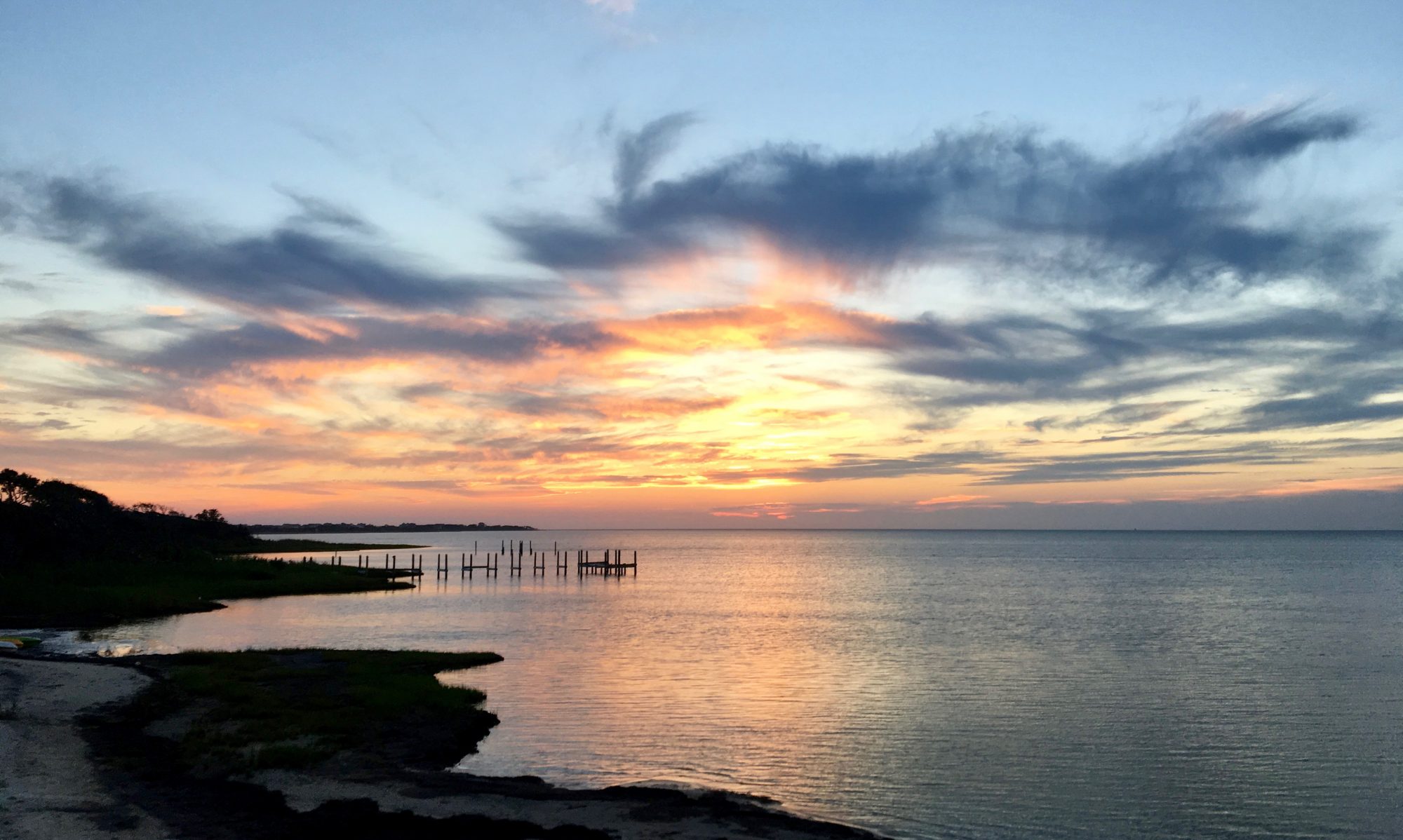


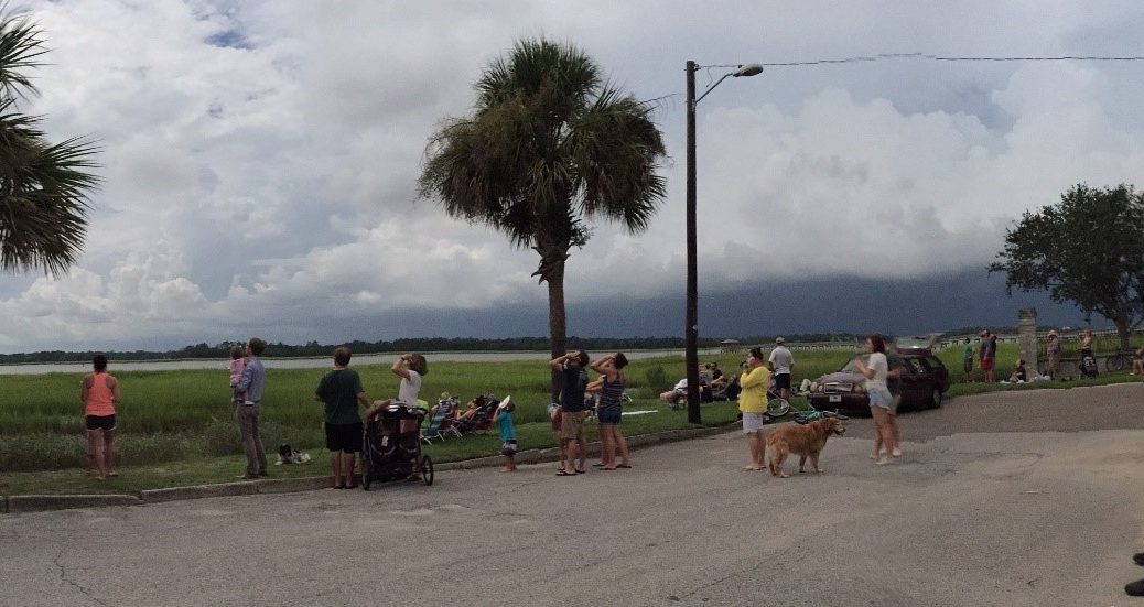


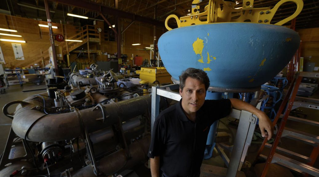


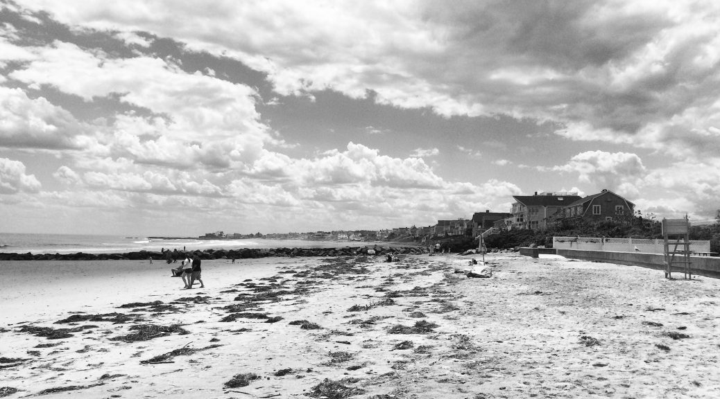


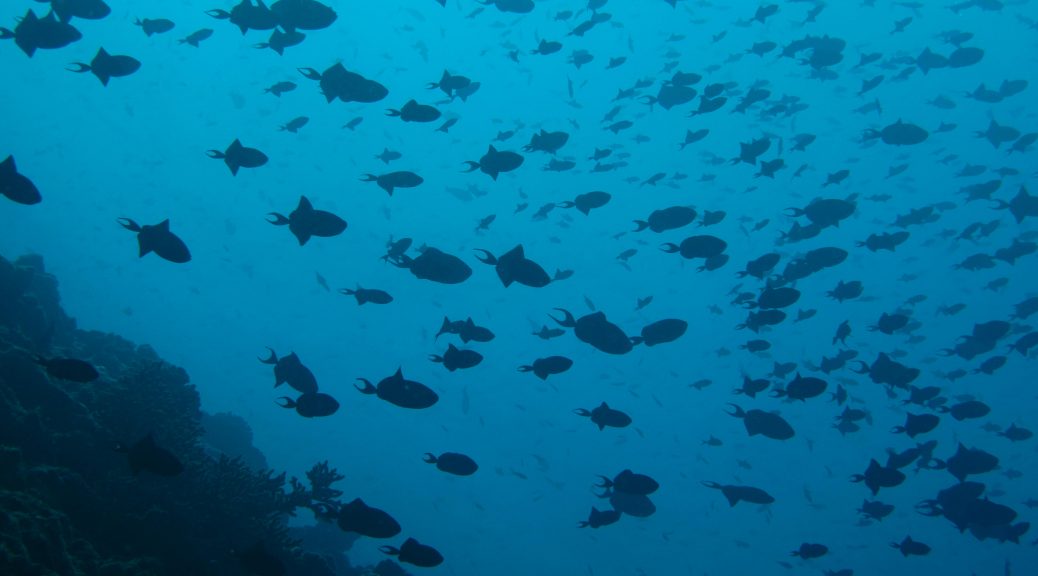


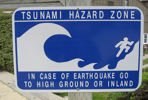


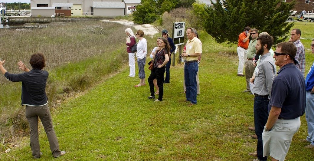


