In today’s era of heightened environmental awareness and the urgent need for sustainable practices, habitat restoration management tools play a pivotal role in guiding conservation efforts and ecosystem revitalization. One such tool is the habitat suitability index (HSI), which offers a structured approach to assess the viability of habitats and make informed decisions about restoration strategies. HSIs leverage scientific data and spatial analysis to pinpoint areas with the highest potential for restoration success, thereby maximizing the efficiency and impact of conservation initiatives. As we strive to protect and restore our natural habitats, tools like the HSI provide a blueprint for achieving tangible and lasting ecological benefits.
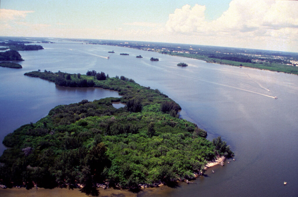
In a study recently published in Coastal Management, researchers from the Nature Conservancy and Nova Southeastern University developed a HSI for oyster reef restoration efforts in the Pensacola Bay System, Florida, with the goal of pinpointing areas most conducive to oyster habitat regeneration. The HSI framework incorporated seven critical factors influencing oyster reef viability, including contemporary oyster reef presence, bottom dissolved oxygen levels, historical oyster reef data, oyster recruitment rates, summer mean salinity, seagrass coverage, and substrate type. Each factor was scored and spatially analyzed to generate a composite HSI raster for the entire PBS area.
An oyster reef in the Pensacola Bay System, FL
Key findings from the HSI analysis revealed varying suitability scores across the study area, with higher scores concentrated in central East Bay and southeastern Escambia Bay regions. The highest suitability areas (HSI > 0.74) represented optimal locations for restoration, covering approximately 16% of the PBS. Model validation was conducted using independent data from area oyster fishers, confirming an 87% agreement with medium to high suitability HSI areas. The study emphasized the importance of stakeholder engagement in refining and validating the HSI, ensuring practical applicability and acceptance among restoration practitioners.
The HSI not only streamlines site selection for restoration projects but also aids in understanding the complex factors influencing oyster reef decline. Historical exploitation, pollution events, and sedimentation emerged as primary drivers of reef loss in PBS, highlighting the need for targeted restoration efforts in less impacted areas. The research underscores the value of integrating quantitative data and stakeholder knowledge into decision-making processes for coastal restoration. Additionally, the study demonstrates the feasibility of constructing reliable HSIs and emphasizes their role as decision support tools in ecosystem restoration initiatives.
In conclusion, the development and validation of the PBS-specific HSI represent a significant step towards effective oyster reef restoration planning. By focusing efforts on areas with the highest suitability, restoration practitioners can maximize success while conserving resources, contributing to the long-term recovery of oyster habitats in the PBS.
Citation: Geselbracht, L., Johnston, M., DeAngelis, B. M., & Birch, A. (2024). Estuary-Specific and Adaptive Habitat Suitability Index Model for the Eastern Oyster Crassostrea Virginica in the Pensacola Bay System, Florida, USA. Coastal Management, 1-18.
Disclaimer: This post does not serve as an endorsement of the author’s opinion, nor does it express the views of The Coastal Society.
The North Carolina coastline is a treasure trove of natural beauty and biodiversity. However, with this beauty comes a complex tapestry of coastal issues that are ever-evolving. From the threat of rising sea levels and intensifying storms to the delicate balance of preserving ecosystems while accommodating human activities, the coastal region of North Carolina finds itself at the intersection of environmental challenges and community resilience. Such challenges demand thoughtful discourse amongst the state’s coastal stakeholders, which prompted The Coastal Society to join forces with North Carolina Sea Grant and the University of North Carolina Wilmington (UNCW) to host a Forum on Priority Issues in North Carolina on November 6th, 2023.
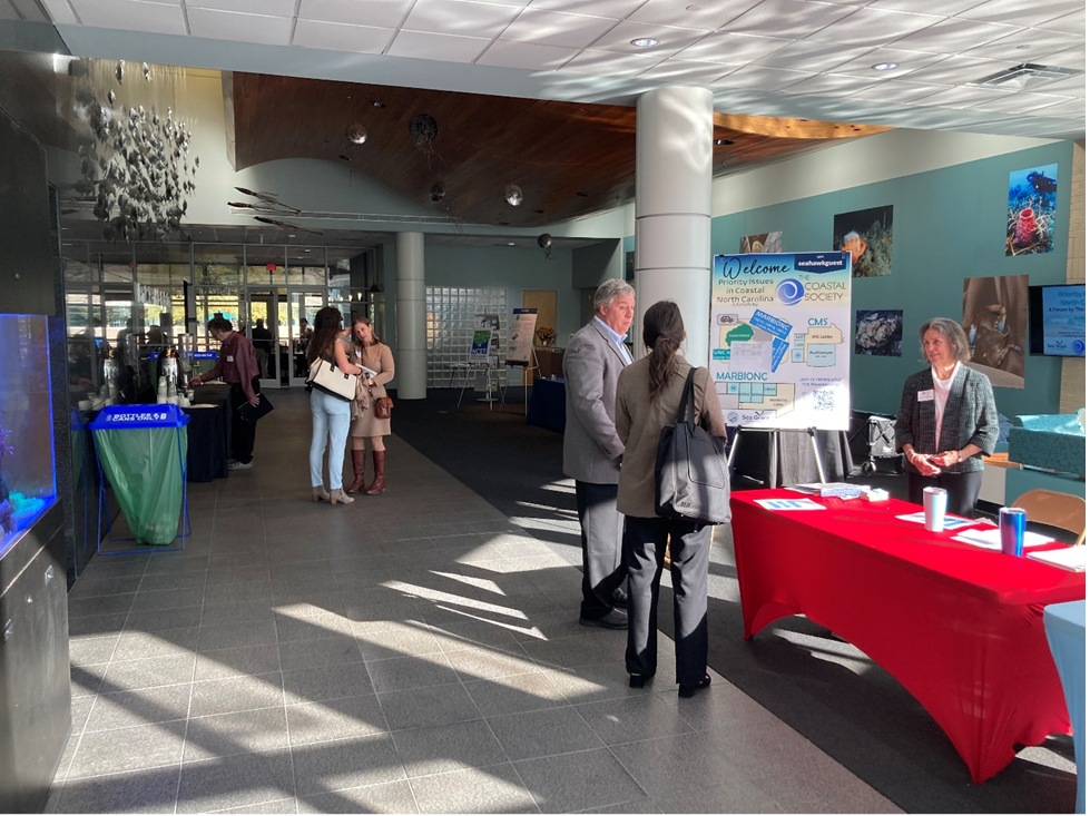
The forum was held at UNCW’s Center for Marine Science, where 85 registrants from professional organizations (50 participants) and students (35 participants) gathered for the day. The forum kicked off with a thought-provoking keynote presentation from the Director of the NC Division of Coastal Management (NCDCM), Dr. Braxton Davis, followed by the first of three plenary panels of speakers hailing from academic institutions, state government, and non-profit organizations. The first plenary panel covered topics in natural and community resilience. Amongst the panel were the Research Director of the North Carolina Policy Collaboratory, Dr. Arthur Greer, whose talk focused on the Collaboratory’s role in facilitating research partnerships and coastal marsh protection; Mackenzie Todd, the Coastal Resiliency Coordinator at the NCDM, who delved into the NC Resilient Communities Program; Ryan Davenport, Carteret County’s Shore Protection Manager, presented on the intricacies of locality beach management planning; and the Executive Director of the NC Coastal Federation, Todd Miller, who covered the policy, strategies, and lessons learned surrounding living shoreline implementation.
Karly Lohan chats with CMS Director Dr. Ken Halanych & TCS Executive Director Judy Tucker in the main lobby of the Center for Marine Science. In the background are TCS planning team members Dr. Larry Cahoon & Dr. Jenny Biddle.
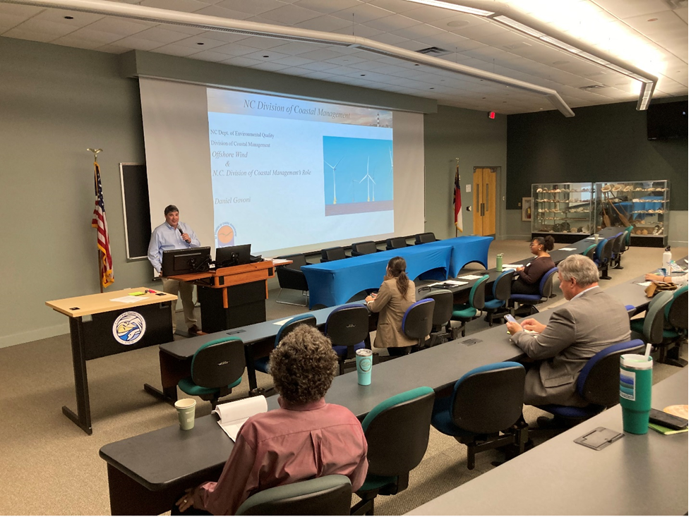
The second plenary panel delivered a series of presentations on the research and management of per- and polyfluoroalkyl substances (PFAS), which are among the most pervasive industrial compounds in NC’s watersheds. Presenters included Rachylle Hart, Program Coordinator of UNCW’s Center for Marine Science; Dr. Pingping Meng, Assistant Professor at Eastern Carolina University; Riley Lewis, White Oak Waterkeeper with Coastal Carolina Riverwatch; Dana Sargent, the Executive Director of Cape Fear River Watch; and Emily Donovan, Co-Founder of Clean Cape Fear. The final panel featured three presentations on the ecological, policy, and management dimensions of offshore wind development in NC, given by Karly Lohan, the NC Program and Outreach Manager of the Southeastern Wind Coalition; Daniel Govoni, the Federal Consistency Coordinator of the NCDCM; and Dr. Martin Posey, Professor of Biology & Marine Biology at UNCW. Concurrent breakout sessions for both panels saw active engagement and rich discourse amongst their audiences.
NCDCM’s Daniel Govoni talks about the Federal Consistency review process for offshore wind.
The forum also included a student poster presentation session, where several NC students were able to showcase their research to the forum’s audience of practitioners and fellow academics, and concluded with remarks from TCS’s newest president, Dr. Paul Ticco, and a networking event held at Wilmington Brewing Company to end the day! We would like to congratulate first-place poster presentation winner, Olivia Trahan from UNCW, on her presentation titled “Species Richness and Abundance of Ascidian Species in Larval Collector Bags from Penobscot Bay of P. magellanicus”, and Jillian Eller, a Ph.D. candidate from ECU, whose presentation titled “Exploring the MSP Challenge: A Map for Marine Energy Engagement” won second place .
Once again, TCS and its partners succeeded in facilitating fruitful conversations about coastal conservation measures of ever-increasing importance amongst a diverse landscape of coastal stakeholders. In the end, we were delighted to learn that this event introduced 70 non-members to TCS, a significant milestone in our mission to engage with broad audiences on coastal management and conservation. As always, be on the lookout for upcoming web-based and in-person events on our website!
On December
4th, 2022, TCS convened its 22nd Coastal Career workshop
in New Orleans. This ongoing workshop series is part of TCS’s Margaret A.
Davidson (MAD) Coastal Career Development Program, which was initiated in 2018
to prepare the next generation of coastal professionals. The workshop was sponsored
by Louisiana Sea Grant, the National Academy of Science’s Gulf Research
Program, and the Louisiana Science Teachers Association (LSTA), and was hosted
by the Meraux Foundation. Among the workshop’s key partners were Restore
America’s Estuaries, which was hosting its biennial summit the following week,
and the Coalition to Restore Coastal Louisiana.
Strong
sponsor support enabled TCS to test five approaches not attempted in earlier
MAD workshops:
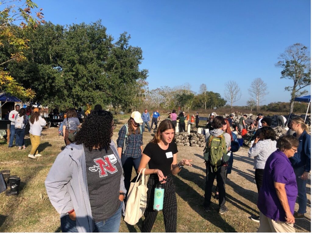
1. Given that this was the first completely in-person event in the last two years, we established clear protocols to reduce the risk of covid-19 and classroom or field accidents. We employed safe distancing when indoors and every one of our 62 attendees completed a legal release for accidents. This was very important as we switched venues for talks and breaks around the host campus and then used bus transportation to offsite destinations
2. Next, we collaborated with the LSTA to reach STEM high schools, thereby shifting beyond our traditional focus on graduate schools to include students as early as 10th grade. We had a particularly strong showing from the high school upper-classes.
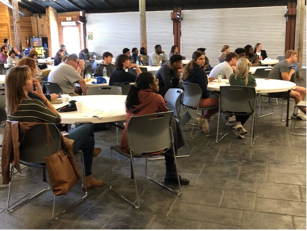
A view of the audience in the opening sessions of the MAD New Orleans workshop in December 2022. Attendees heard from four coastal experts before breaking into smaller groups for discussions about job trends, career options, professional skills, and much more.
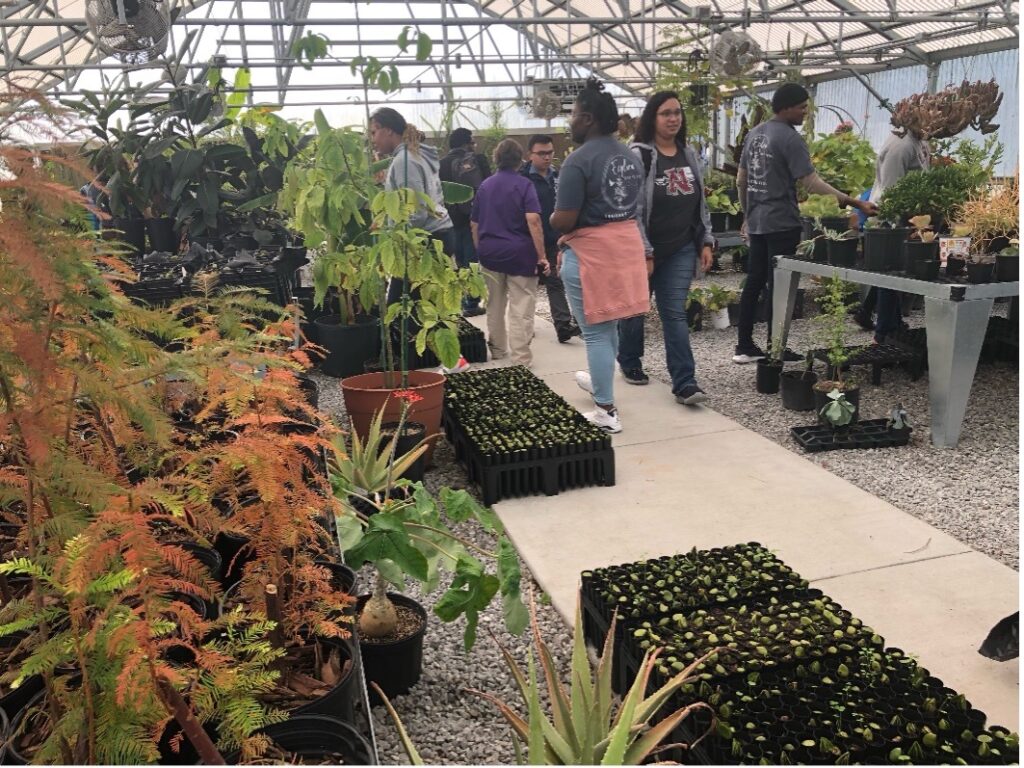
3. We designed special activities and talks for the younger students in high school, at community colleges, or early in a four-year program while continuing to provide academic and professional career advice to attendees closer to their terminal degree. The most popular hands-on module was underwater research, and favorite talks covered job-hunting skills, networking, USAJobs, and contracting with state and federal agencies.
4. We supplemented our morning of introductory talks and break-out sessions with three afternoon stops along the Mississippi River to view a sampling of the coastal careers shared by our morning speakers – tree farming to provide material for shoreline protection, oyster restoration efforts supported by shell recycling programs, and one of many diversion structures redirecting river waters into coastal marshes.
Workshop participants visit the plant and tree nursery at the Meraux Foundation campus. Roots of small shrubs and trees help to strengthen coastal lands and reduce erosion.
Shift change at the oyster shell recycling site managed by the Coalition to Restore Coastal Louisiana. Bags of recycled shells are placed in coastal waters to provide clean settling surfaces for oyster larvae and to dampen storm surge and coastal erosion.
5. Finally, we made a conscious effort to attract a more diverse audience than had participated in earlier workshops. We greatly exceeded expectations with student attendees but not our speakers. Our efforts will continue as we seek a representative cross-section of students and speakers.
This
workshop was the most recent example of how TCS is improving the MAD Coastal
Career Development Program. We look forward to continued success with our slate
of workshops in 2023. Watch https://thecoastalsociety.org/ for the latest on upcoming MAD
workshops.
Coastal communities are experiencing more
intense storms under a changing climate—this past Atlantic hurricane season was
the third most active in recorded history, hosting one of the five costliest
hurricanes to impact the US. Future storm impacts are predicted to be
exacerbated by continued sea-level rise and population growth along coastlines,
combined with climatic changes breeding favorable environmental conditions for
the development of more frequent intense storms. Building coastal community
resilience is thus continually placed on local, state, and federal agendas, and
it served as the subject of the Coastal Society’s (TCS) Coastal Connections
session, held on October, 21, 2021. A recording of the session is availablehere.
TCS President, Steve
MacLeod, initiated the session by familiarizing attendants with TCS and the
Coastal Connections web series and then inviting attending Board Members to
introduce themselves. The session was moderated by Kim Grubert, Project
Consultant on the Sustainability, Energy, and Climate Change team at WSP USA,
Inc. and TCS Chapters Committee Co-Chair. Presentations were then given by the
following panelists: Erik Heden, Warning Coordination Meteorologist at
the National Weather Service Forecast Office in Newport/Morehead City, NC, and
Jill Gambill, Coastal Resilience Specialist at University of Georgia Marine
Extension and Georgia Sea Grant.
Erik Heden provided an overview of the
National Weather Service’s (NWS) extensive community outreach initiatives. NWS
organizes hurricane outlook talks with core partners that provide information
on potential hurricane impacts. During Hurricane Preparedness Week in May, NWS
conducts outreach that includes messaging related to developing an evacuation
plan, assembling a disaster supply kit, and getting flood insurance (more
information is available athttps://www.weather.gov/wrn/hurricane-preparedness).
NWS also organizes outreach talks for schools and community groups that offer
safety information related to rip currents, floods, lightning, and hurricanes.
Mr. Heden also touched on the efforts of the NWS Newport/Morehead City office,
which coordinates with NC Sea Grant to provide information related to sea-level
rise and potential impacts. Specific outreach requests include providing talks
for military professionals related to hurricane preparedness and outreach
booths at community events. New outreach efforts include NWS hurricane
community forums (in-person and virtual) that focus on sharing key preparedness
messages and the Weather Ready Nation Ambassador program to support community
engagement. NWS Tropical SKYWARN and Integrated Warning Team training are also
available. For more information on flood risk and outreach efforts, visit
weather.gov.
Jill Gambill discussed NOAA Georgia Sea
Grant’s efforts related to coastal resilience planning for coastal storms and
sea level rise. In coastal Georgia, more than 10 inches of sea-level rise has
been measured at the NOAA Fort Pulaski tide gauge since 1935. Tide gauge data
supports that the frequency and magnitude of flooding in coastal Georgia are
increasing, and the regional rate of sea level rise is accelerating. Sea Grant
is working to increase community capacity and mitigate risk to natural hazards.
Current Georgia Sea Grant efforts include diversifying their workforce,
progressing equitable access to resources and decision-making processes, and
seeking community input on communicating flood risk. Georgia Sea Grant, with
funding from NOAA’s Weather Program Office and in collaboration with the NWS,
is developing virtual reality simulations of structural flooding from storm
surge. The platform also provides methods to explore the benefits of different
mitigation measures, such as elevating a home or purchasing flood insurance.
Ms. Gambill also highlighted the importance of considering environmental,
economic, and social benefits of community projects and provided an example of
urban tree restoration efforts in Savannah that have multiple benefits of flood
reduction, heat reduction, workforce development, and youth engagement.
To continue the TCS discussion of climate
change challenges for coastal communities, our next Coastal Connections session
will be focused on sea level rise. The
Coastal Connections discussion will be held on Wednesday. March 30th from 3-4pm
Eastern. Join
us to learn about trends in sea level rise, considering recent data in
comparison to the geological record, and participate in a discussion about sea
level rise impacts on coastal resources and general mitigation approaches.
Featured speakers include:
John Englander,
Oceanographer/Author
Molly Mitchell, PhD, Research
Assistant Professor at Virginia Institute of Marine Science
Following presentations, attendees will have
the opportunity to ask questions and share their own expertise in a moderated
discussion. To participate in this free event, please register on Eventbrite at
the following link: https://tcs-coastal-connections-web-meeting11.eventbrite.com
The year 2021 is over. As we begin 2022 and reflect on 2021, coastal hazards continue to escalate under a changing climate. This past Atlantic hurricane season was the third most active ever recorded and hosted one of the five costliest hurricanes to impact the US, for example. Coastal communities are experiencing more intense storms and planning for sea-level rise to build community resiliency (recording available on this topic from the last TCS Coastal Connections session). Needless to say, the challenges facing coastal management communities are numerous and mounting. As we approach the new year, we must ask ourselves: “How, if at all, are we adapting our coastal management institutions and approaches to meet the constantly-evolving problems we face?”. Duke University’s Dr. Michael Orbach and the University of Washington’s Dr. Marc Miller explore this prudent question in their essay, entitled How Have the U.S. Coasts Changed (and How Are They Going to Change) as Cultural and Policy Spaces? An Example from California, published in December 2021 in the Journal of Coastal Management.
This essay first explores the theoretical concepts of policy
and cultural spaces that exist within the coastal zone. As the authors explain,
a policy space is a space (geographical, temporal, historical) where societal
actions and behaviors are structured by legislation and political activities
that directly reflect the values of policymakers and their constituents. A
cultural space is a space that is structured by people who are members of a culture—which
is defined in terms of shared knowledge and values and “consists
of what it is that people know to [coexist with one another]” (p. 4)—in
a way that reflects that culture. Both spaces are dynamic; they have lifespans;
they are controlled by, among other things, the environment and politics; and
they influence each other in often unpredictable ways.
To illustrate these concepts and their interrelatedness, the
authors examine the policy and cultural spaces of coastal California over the
last 50 years. Prior to World War II, Californian coastal cultures were made up
of small, financially modest populations, and existed within intimate, “cozy”
landscapes. The authors describe Californian coastal life as slower-paced and “…driven
by sea- and coast-dependent industries and interests such as fishing, coastal recreation
and tourism, and notably…the proto-typical ‘California Lifestyle’.” (p. 6),
which the authors view as being influenced by the “cool, laid-back and casual
and free-wheeling” (p. 6) surf culture of the 60s. However, massive economic
development and human settlement following WWII changed the cultural space to
one that was “…much more dependent on leisure-tourism and other industries such
as major universities, aero-space and high-tech.” (p. 6) and inhabited by a
more cosmopolitan population.
Changes in coastal Californian political spaces followed in
response to the development pressures of the Post-WWII period. The 1970s
witnessed a proliferation of federal environmental legislation, such as the passage
of the Coastal Zone Management Act (CZMA), which induced the birth of state
coastal management agencies such as the California Coastal Commission and non-governmental
organizations (NGOs) like the Coastal Management Conference and The Coastal
Society. Yet, today, development and political pressures have stymied coastal
management in California (and other coastal states) and have overwhelmed the
limited resources of coastal public policy and management entities. In the
authors’ words: “The special policy space of coastal policy and management as a
profession—as with the special cultural space of the coast—has become
overshadowed by and submerged in other events and processes.” (p. 8). Corresponding
changes in the coastal zone have resulted—for example, the amount of armored
coastline in California increased from 26 miles in 1971 to 146 miles in 2018.
The authors conclude the essay with an assessment of future coastal management challenges presented by climate change hazards such as sea-level rise, increasingly frequent severe storms, and so forth. Encroaching sea levels will render certain coastal locales inhabitable, requiring communities and governments to engage in adaptation and planned retreat activities, which will signal the reinvention of coastal cultures and policies. New coastal cultures and management policies will be in a constant state of change and development with continued sea-level rise, which presents uncertainty and challenges unlike the cultural forces at play during the post-WWII period (economic expansion and the environmental movement). In closing, the authors offer coastal management practitioners the following recommendations:
Climate change solutions should draw on expertise
beyond that of the usual natural and social sciences, planning, and
engineering—for example, the ideas of the humanities, such as environmental
philosophy, and professional fields, such as business and activism;
Adaptive management and conflict management strategies
in coastal zone management should be revised to include more robust stakeholder
engagement and a commitment to social equity and environmental justice; and
Coastal management activities of monitoring natural
and social systems and predicting future human impacts should incorporate
insights from architects, engineers, and urban designers regarding the planning
and future design requirements of adaptation.
Citation:
Orbach, M. K., & Miller, M. L. (2021). How Have the U.S. Coasts Changed
(and How Are They Going to Change) as Cultural and Policy Spaces? An Example
from California. Coastal Management, doi:10.1080/08920753.2022.2006873.
Disclaimer:
This post does not serve as an endorsement of the author’s opinion, nor does it
express the views of the Coastal Society.
Global interest in “blue carbon” ecosystems, referring to
the world’s carbon-sequestering ocean and coastal habitats, is rooted in their
potential to mitigate climate change while achieving myriad co-benefits, such
as coastal protection and fisheries enhancement. A substantial body of research
paints a grim outlook on the future of blue carbon ecosystems, which has
prompted international efforts to protect and sustainably manage them. Yet, a
paucity of research on blue carbon ecosystem management exists, which limits
our understanding of how coastal plans can effectively integrate “blue carbon”
concepts into municipal-level coastal ecosystem management. This month’s blog
highlights a Philippines-based study that addresses this key research gap. The
study, titled “Are Municipalities Ready for Integrating Blue Carbon Concepts?:
Content Analysis of Coastal Management Plans in the Philippines”, is available
through the Journal
of Coastal Management.
Researchers conducted content analyses of existing coastal
management plans of four Philippine municipalities: Lawaan and Salcedo in
Eastern Samar province; Batan and Kalibo in Aklan province. Content analysis is
a research tool that can be used to quantify and analyze the presence of
certain words, themes, or concepts within qualitative data—in the case of this
study, the text of the management plans. Researchers used nine coding keywords,
including “ecosystem services,” “carbon sequestration,” “tourism,” and “anthropogenic
threats,” to determine the extent to which blue carbon ecosystems are accounted
for in the provinces’ management schemes. Though several habitats fall under
the category of blue carbon ecosystems, this study focused on the management of
mangrove forests and seagrass habitats.
The research team presents important findings regarding the relative
emphasis given to specific aspects of blue carbon ecosystem management and
to specific ecosystem types. The study found that management activities—such as
reforestation, coastal clean-ups, and planting—was the most frequently discussed
topic in the four plans, followed by anthropogenic threats. In general, current
directives toward resource management in the four provinces included assessment
of coastal habitats, implementation of local ordinances and policies, and a
list of possible conservation and protection services. Conversely, the topics
of tourism and carbon sequestration—important co-benefits of blue carbon
ecosystems—lacked visibility.
The researchers also discovered a greater focus on mangrove
ecosystems than seagrass habitats across the four plans. The team attributed
this discrepancy to the lack of research on seagrass ecosystems in the
Philippines relative to mangrove ecosystems, as well as the greater emphasis
placed on the coastal protection services of mangroves, given the country’s
exposure to typhoons. While discussion of the anthropogenic and natural impacts
to seagrasses is present in the plans, there were, generally, minimal actions
set forth to address these stressors; meanwhile, mangrove ecosystems were
significantly accounted for in legal frameworks, laws, policies, and local
ordinances. To address this disconnect, the researchers recommend that
Philippine national agencies should invest more in educational campaigns and
capacity building for local government agencies and stakeholders to engage in
seagrass habitat assessment, planning, protection, and monitoring.
This work highlights an existing gap in blue carbon
management strategies at the local scale. By applying the content analysis approach
to local management plans, this study offers a methodology to capture existing
implementation of management protocols and provide appropriate recommendations
for integrated coastal management practices. This study also serves as a basis
for formulating coastal plans to effectively encapsulate blue carbon ecosystems
and integrate them into existing management strategies. Moving forward, similar
approaches as those presented in this work will be necessary to investigate the
factors that facilitate best management practices and policies in different
local contexts to strategically promote blue carbon ecosystem management beyond
the scale of one nation.
Citation: Quevedo, J. M. D., Uchiyama, Y., Lukman, K. M., & Kohsaka, R. (2021). Are municipalities ready for integrating blue carbon concepts?: Content analysis of coastal management plans in the Philippines. Coastal Management, 1-22.
This blog post is the first of a new monthly series, tentatively titled “Coastal News from the Field,” which highlights new coastal management/conservation-themed research that makes us tick. We are excited about this new development for the blog and encourage our readers to reach out to admin@thecoastalsociety.org with any research or topics they would like to see featured in this series.
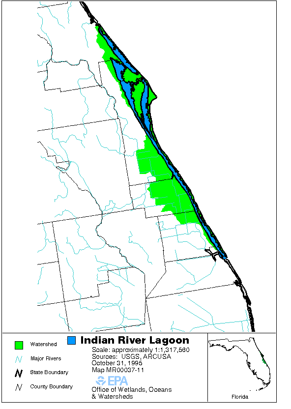
This month, we highlight a study from a research team in Florida, titled “Adaptation Actions to Reduce Impairment of Indian River Lagoon Water Quality Caused by Climate Change, Florida, USA,” as published in February 2021 in the Journal of Coastal Management. The motivation for this work comes from the increasing vulnerability of estuaries to climate change impacts of salt-water intrusion from rising sea levels, hydrological regime changes, water temperature increases, and so forth. The Indian River Lagoon (IRL) was designated as an Estuary of National Significance by the Environmental Protection Agency (EPA) in 1990 and, more recently, a Climate Ready Estuary in 2008, following a collaboration between the EPA and National Estuary Program in the form of the Climate Ready Estuaries Program.
Map of the IRL watershed (Source: EPA, 2004)
Aerial view of the IRL (Source: US Fish & Wildlife Service, 2006)
The core objective of this research was to assess the
vulnerability of the IRL’s management program to climate change and prescribe
adaptive actions designed to improve the program’s efficacy and protect the
estuary from further climate-change-induced impairment. The research team first
compiled and reviewed a list of the program goals (e.g., “water quality” or “healthy
communities”) within the IRL’s
Comprehensive Conservation and Management Plan (CCMP) that were most likely
at risk from climate change and the associated climate stressors jeopardizing
those goals. The team then weighted each risk in a matrix based on parameters
of consequence, likelihood, spatial scale, and timeline. A total of 472 risks
were identified. Of those, 50% were associated with impacts to impaired waters,
wastewater, and surface water. Nearly all (97%) of these risks were induced by
three prevalent climate change stressors of altered precipitation regimes,
increasing storminess, and sea-level rise.
From here, the research team was able to identify nine adaptation actions to mitigate water quality impairment caused by climate change. Each action focused on mitigating the major sources of elevated pollutant loadings anticipated to accompany climate change, including wastewater treatment plants, on-site treatment and disposal systems, and surface water storage and conveyance infrastructure; for example, one action was to create a GIS-based inventory of vulnerable infrastructure supporting the three systems. In addition, the team devised a five-step action plan that could be used to achieve each of the nine adaptation actions and proposed an integrated management regime based on the existing symbiosis between the state of Florida and the IRL National Estuary Program.
In the face of the emerging circumstances presented by
climate change, it is paramount that we continually review and adapt the programs
that we have instituted to protect our coastal resources. The research
highlighted in this article showcases how adaptive management—a concept based
in theory—can be operationalized to satisfy long-term conservation agendas. The
study also demonstrates how vulnerability assessments can be used to prioritize
and continually monitor program action areas that harmonize mutual interests of
a diverse stakeholder network. Most importantly, the deliverables of this applied
research have direct utility for future policymaking, community engagement
initiatives, program financing, and other efforts that may otherwise have been hindered
without recognition of the future management challenges posed by climate change.
Citation: Parkinson, R. W., Seidel, V., Henderson, C., & De Freese, D. (2021). Adaptation Actions to Reduce Impairment of Indian River Lagoon Water Quality Caused by Climate Change, Florida, USA. Coastal Management, 49(2), 215-232.
Three women sat slightly sweating with the electricity out, wind pounding the hurricane shutters. Each a daughter from a different generation – Generation Y, Baby Boomer, and one born on the cusp of the Greatest and Silent Generations.
Up until that point our time in darkness waiting for Hurricane Matthew had been like a snow day. Cozy together time with coffee, playing cards, watching the local weather man give updates, and reading books aloud to one another. After two wobbles that took Matthew away from our location, we were relieved to no longer have to think about extreme flooding or whether or not the house could stand up to category 4 winds.
But while others in our area probably went to bed after the second wobble, we stayed up.
One of us had a high stake in the electricity going out.
My 87-year old grandmother, Rae Dolores DePalma (b. 1929 – d. 2017), a long-time sufferer of COPD and congestive heart failure, spent the prior five years transitioning from needing oxygen part of the day, to most of the day, to all of the day. In October 2016, ten minutes off the oxygen could plummet her blood oxygen levels to 50% oxygen saturation – a critical level. Or as one paramedic told us so crudely, “I’ve seen corpses with oxygen levels higher than that.” My mother and I needed to stand guard in case the electricity cut out. Even with the electricity on, we would check her levels using an oximeter at least hourly.
Rae Dolores DePalma
Sure enough, not long after Hurricane Matthew’s second wobble, the TV and lights flickered and we were in pitch darkness. We immediately put our contingency protocol into action.
The oxygen concentrator my grandmother depended on, and that we affectionately called O2-D2, couldn’t operate without electricity. Little green tanks were Plan B. Each could last four hours and we had five tanks. If the electricity would be off longer than 20 hours we would have to switch to the large hurricane-supply tank of oxygen in the garage that could last 48 hours. If the electricity stayed off longer than that, Plan C was arranging a ride with EMS to the hospital. Past storms in the area had left my family without electricity for ten or more days. The closest hospital was also in the next town over and in a flood zone, which created additional transportation challenges should the roads be impassable.
At the start of the hurricane season I had made inquiries into the capacity of our area for dealing with special needs patients during hurricanes. I had learned the local senior center was not equipped to allow oxygen-dependent persons into the shelters. And I had been told the County did not have an official special needs shelter.
For us, the only option would be the hospital located in the flood-zone. The hospital administrator assured me the generators in the hospital would be safe as they are located on high ground, not in parking lots, which is sometimes the case for essential facilities in flood-prone areas. (I discovered this to be the case while mentoring a group of Worcester Polytechnic Institute students conducting a critical infrastructure analysis in San Juan’s coastal zone.)
Why didn’t we evacuate?
During the hurricane, my mother and I would occasionally speak in whispers so as to not to alarm my grandmother that we should have evacuated. I was witnessing risk perception study results come to life. A couple of times prior to the hurricane, I had presented to my family the reasons I felt we should evacuate. I used flood map tools from the county and explained how stormwater infrastructure functions and the uncertainties in flood modeling. Our house is located one mile from the evacuation zone and in the middle of a series of man-made retention ponds and rivers. Our neighbors were claiming that past hurricanes had flooded the streets but none of the floods went up to the doors. To me this meant a Category 4 certainly could have inundated our houses given the right conditions (storm surge direction and height combined with high tide, heavier than expected rainfall, debris clogged sewers, and overtaxed storm water retention basins). We also had family on the west coast of Florida so, unlike many others, we wouldn’t have to pay for a hotel.
The concern written all over the faces of the local horsewomen of the city had me even more worried in the days leading up to Hurricane Matthew’s arrival. They had been through this time and time again, yet this time seemed different. My sister and her friends spent hours preparing a concrete barn of a friend for extra horses, making sure no flying debris could injure a horse. Those who had non-concrete barns often relocate their horses to concrete barns during storms, if they don’t evacuate to Florida’s west coast. At the concrete barn, my sister and her friends boarded up the stalls, secured feed and water, and transported horses from other unfortified barns.
In the end, I was out-voted. It was considered to be too much of a production to transport all three of us plus two dogs to the west coast with a car full of oxygen tanks, the concentrator, wheelchair and walker, only to pack it all up again and return a few days later. With most of the coast evacuating we could be stuck in traffic for so long the green tanks would run out before we got there. Plus, in and out of cars for short trips, let alone long trips, was really taxing on my grandmother and the anxiety and stress was not good for her heart. It was already working overtime because of her COPD.
During the storm, before the two wobbles, we realized the big risk we took in the decision to stay. I couldn’t help but think of those studies that discuss how even with information (in this case, coastal scientist family member sitting there in the living room with maps and hurricane data discussing the risks) people will tend to listen to neighbors, local weather men or sheriffs before the scientists. Because we were not directly in the evacuation zone these public figures were not focusing their recommendations for our area. They repeatedly pleaded with residents and businesses in evacuation zones to evacuate. The Governor of Florida even went so far as saying, “If you stay, you will die.” I called the County emergency hotline to get advice for our area but they would not give me a specific recommendation, most likely for liability reasons. They did, however, reiterate the information I already knew and discussed the different scenarios. It was nice to have that peer review of what I was telling my family, but because we were one mile outside the evacuation zone we were left to determine our risk independently.
Our neighbors were all saying before the storm that the last hurricane wasn’t so bad. In my family we have been through so many other storms some felt we could get through anything. Days after the storm it was like memories were jogged and new stories came up about bad damage and flooding from past hurricanes.
The Human Factor
In the hours leading up to the storm while getting the shutters closed-up, and all the supplies out of the hurricane supply cabinet, including our low-sodium snack options for my grandmother, I started getting really nervous. Thinking of all the possible scenarios, and mostly the worst case scenarios, I started making an emergency bag for us and my grandmother in case we had to rush to the hospital or be rescued. The bag had an emergency whistle and skin suit in case the flooding got to be really bad, first aid kit, extra Depends, change of clothes, money, identification and insurance cards, water, snacks, waterproof bag for cell phone. My mother thought I was nuts, but I just kept thinking of all the possible scenarios and wanting to be prepared for each.
I am so thankful we never had to use the emergency bags. But I remember my thoughts as I was packing them. “This is ridiculous, why didn’t we evacuate?” “Maybe we should have put sand bags at the front door, garage door, and back door” “What if the river behind the house floods and comes in through the back?” “What if the ambulance can’t get through?” “What is my family thinking?”
I have focused on disaster risk reduction for the past nine years, in various roles in school and professionally. I have researched and written about vulnerable populations and have facilitated teams to develop recommendations from scientists, planners, and municipalities to improve conditions along the coasts and enhance resilience. In West Sumatra, Indonesia I helped during tsunami and earthquake trainings of small businesses along the coasts. But going through an acute event with an elderly, oxygen-dependent loved one, opened my eyes to the real challenges individuals and communities face in implementing recommendations. It is one thing to study and synthesize information from subject matter experts, maps, and models or even to go through hurricanes yourself; it is quite another thing entirely to go through a major hurricane as a caregiver.
I think this “human factor” is something I was failing to consider while I was disgruntled with my family members for making what I thought to be a poor decision.
But more than that I think it is something we do not consider enough in disaster risk reduction and climate adaptation work as professionals. We look at vulnerable populations as statistics and identify measurable barriers that prevent them from taking safety precautions to protect life and property. While we are far from cold to the realities and challenges of these populations, we do have the tendency to down-play the human side to the choices people make when it comes to their health and safety of themselves and loved ones.
Academically, we like to state what people should do or should not do in post-storm event analyses, and describe the poor choices that are made. When extending this work to climate change adaptation, this tendency can be more pronounced in that within community of practice circles we often express disbelief at the decisions made by individuals, businesses, and governments in siting infrastructure, removing natural protective features, or choosing to live in high-hazard areas rather than supporting planned retreat. We tend to think that if they just had the information or if the information was presented better they would choose differently. I don’t think this is necessarily the case. Vulnerable populations need the information to ensure they are making decisions with all the available information, but we need to recognize that affected individuals and communities may still make decisions we disagree with because they weigh certain factors differently than we do as outsiders. When you don’t have a direct stake in the matter, it is not so easy to understand why certain decisions get made the way they do.
In the case of Hurricane Matthew and my grandmother, her discomfort and anxiety and preference to be at home during an emergency rather than in the middle of a gridlocked highway during an emergency, was weighed more heavily than flood and wind risk.
This reminds me of my favorite scene in the movie Sully, about the Miracle on the Hudson. An investigation was launched around the decision made by the Captain to do an emergency landing in the Hudson River instead of trying to make it back to the runway after a flock of birds flew through the engines. The flight simulators showed it was possible to make it back to the runway. But the simulations didn’t consider the real-life response time of a pilot in that situation. Once they did, the simulation results supported the decision made. Tom Hanks, playing Captain Chesley ‘Sully’ Sullenberger, replies in the movie, “We’ve all heard about the computer simulations, and now we are watching actual sims, but I can’t quite believe you still have not taken into account the human factor.”
When the electricity was restored and Hurricane Matthew’s winds were far away, my mother and I were finally able to stop holding our own breaths while trying to save my grandmother’s. I don’t think I will ever look at risk perception or special needs population work in the same way again.
How to Prepare if You are an Older Adult or a Caregiver
A number of organizations and companies have great advice and check-lists for hurricane preparation if you are a caregiver or if you are a senior yourself:
Elderly special needs plans to be ready for a disaster: FEMA
Personal preparedness for older adults and their caregivers: CDC
Editors’ Note: This story is the third contribution to the TCS Storm Stories series. Due to recent hazards events, Hurricane Matthew and the Baton Rouge Flooding, we want to know how it is affecting you personally and in your work. There’s been lots of attention by national media outlets like NPR story Hurricane Matthew Took a Big Bite Out of Southeastern States’ Beaches but since we are a society of coastal professionals for coastal professions we think we should do our own reporting. Sharing experiences and lessons within our network is what we do best. Submit yours today!
By Lisa Graichen, Climate Adaptation Program Coordinator for UNH Cooperative Extension and NH Sea Grant
Looking for some coastal inspiration? We’ve got some for you! As a coastal professional and resident, I think it’s so exciting and motivating to learn about the diversity of projects coastal communities and states are working on, whether it be research and vulnerability assessments, planning and zoning improvements, engineering designs for resilient infrastructure, or actual on-the-ground restoration and conservation. Now more than ever, we should be highlighting all the great ways state coastal programs help coastal communities thrive.
First, a little context: All 35 coastal and Great Lakes states and territories (except Alaska) participate in the National Coastal Zone Management Program, a voluntary partnership between the National Oceanic and Atmospheric Administration and coastal states, focused on implementing the Coastal Zone Management Act (CZMA) and supporting responsible coastal resource management. Many of these programs award projects to coastal municipalities to support climate adaptation and resilient communities. :
Massachusetts Coastal Management Program is funding 19 Coastal Resilience projects in local cities and towns, for a total of $1,824,732. Here are a few examples:
The City of Boston will build on a vulnerability assessment to design nature-based strategies to support coastal resiliency (e.g., living shorelines, green infrastructure) for two priority sites.
The Town of Dennis will evaluate and design a pilot project to determine whether the beneficial reuse of dredged material is an effective way to address marsh loss and restore storm protection benefits.
The Town of Marshfield will evaluate modifications to a culvert and tide gate structure under existing and future sea level rise conditions.
The City of Salem will design and permit a living shoreline project at Collins Cove, using coir rolls (cylinder-shaped mesh rolls filled with coconut husk fibers) and natural vegetation to provide more natural protection from erosion.
The Washington County Council of Governments will restore commercial river herring fisheries to the greater Cobscook Bay ecosystem.
The Town of Vinalhaven will conduct a vulnerability study for its downtown, which is home to 40 businesses, dozens of fishing wharves, and a ferry landing. This project will improve understanding of the flood risk to this area and identify potential adaptation options.
The Lincoln County Regional Planning Commission will analyze flood risks for commercial and governmental structures in downtown Boothbay Harbor and provide recommendations to improve flood resiliency and raise community awareness of the flood insurance program.
The City of Bath will assess downtown stormwater runoff patterns and management options to mitigate the risk of flash-flooding and the volume of pollutants discharged into the Kennebec River. The project will also develop conceptual designs for improving infrastructure.
The City of Gardiner will study its downtown storm drainage system, evaluate options to mitigate the impacts of periodic flooding, and make recommendations.
Vinalhaven, ME (Tom Groening)
New Hampshire Coastal Program is funding four Design Solutions for Coastal Resilience projects, for a total of over $271,000.
The University of New Hampshire Cooperative Extension and NH Sea Grant will continue dune restoration work in Hampton and Seabrook, promote a dune grass community garden, and design new strategies to reduce dune impacts.
The Town of North Hampton will evaluate drainage issues at the flood-prone Philbrick’s Pond salt marsh adjacent to Route 1A.
The Town of Durham will analyze erosion issues at Wagon Hill Farm and design a nature-based erosion control solution.
The Rockingham Planning Commission will work with the City of Portsmouth and the towns of Rye, Hampton, and Seabrook to implement high-water mark installations to raise awareness about historical and projected future flood levels.
The Harrison Township will develop a Waterfront Zoning Overlay District, a Developer’s Guide Brochure, and a Complete Streets Design for the district. These products will help inform smart growth and development for the coastal area.
The Michigan Environmental Council will map the extent of Michigan’s coastal sand dunes and conduct outreach to better understand public values of the dunes and build a constituency of dune supporters.
The County of Van Buren will restore and stabilize 20 acres of dunes, improve a public trail system, and develop signage and a video about dunes.
The City of St. Joseph will conduct a five-year review and update of their 2012 coastal study to validate the engineering model and evaluate whether current regulations still provide sufficient protection, given rising water levels and potential increases in erosion.
Emmet County will construct an accessible pathway and boardwalk in Headlands Park to provide access to the Lake Michigan shoreline to all users.
Charlevoix County will develop a comprehensive master plan for a water trail system around Beaver Island, the largest island in Lake Michigan. The project will include a stakeholder summit, data collection and mapping, an asset inventory, an accessibility assessment, and development of promotional materials.
The City of Port Huron will improve public access to a constructed wetland through a boardwalk, wetland overlook, interpretive signage, and plaza.
In addition, the Michigan Coastal Zone Management Program is funding the second phase of a Coastal Resiliency Initiative project (a $125,000 grant) to work with the Michigan Association of Planning to incorporate coastal resiliency into communities’ plans and ordinances.
Flooding during a 2016 King Tide in Portsmouth, NH (Sean Maxwell)
Texas A&M University-Corpus Christis (TAMU-CC) aims to develop a comprehensive database for monitoring living shoreline projects and mitigation sites.
The Galveston Bay Foundation will construct a mile-long hike and bike trail, install an irrigation system, and plant native trees and grasses at Exploration Green in Harris County. This project will improve public accessibility and use natural wetland habitats to filter stormwater runoff.
The Texas Parks and Wildlife Department will create artificial reef habitat at the Rio Grande Valley Reef Site in the Gulf of Mexico, improving fisheries habitat and supporting fishing and diving.
TAMU-CC will generate information related to groundwater discharge rates to improve environmental flow recommendations and nutrient criteria in south Texas estuaries.
The West Creek Conservancy will develop an app for mobile devices to promote watershed stewardship and public engagement in the Lake Erie Basin.
The Ohio Department of Natural Resources will work with the City of Sandusky to develop a Strategic Restoration Initiative for Sandusky Bay.
The Cuyahoga Soil and Water Conservation District will identify and prioritize stormwater options in four subwatersheds of the Rocky River. The project will produce conceptual designs for the top priority projects.
The City of Rocky River will develop a master plan for redeveloping Bradstreet’s Landing to improve lake access and water quality.
This is just a taste of projects being funded this year. Many thanks to the state Coastal Programs and to NOAA for supporting this impressive and important work!
Sources:
Individual State Websites (linked to above)
Personal communications with author and state programs
By Christina Wiegand, Coastal Resources Management PhD Student, East Carolina University
If you’ve spent time in West Haven, Connecticut, chances are you’ve spent some time on Beach Street. With beautiful views of Long Island Sound, Sandy Point shorebirds, and lobster rolls from the famous Chick’s Drive-In (RIP Mr. Celentano), it is a destination for residents and tourists alike. However, the one-two punch of Hurricanes Irene and Sandy illustrated the susceptibility of the area to coastal hazards. To address coastal hazard risk along Beach Street and other vulnerable areas, the City of West Haven has been preparing a Coastal Resilience Plan.
Now in the final stages of development, the goal of the Coastal Resilience Plan (CRP) is to address the city’s resilience to impacts from increasing storm frequency and sea level rise. The New Haven Register has quoted assistant city planner David Killeen saying the plan “will develop options for adapting to coastal risks over the long term, with an emphasis on protecting people, buildings and West Haven’s infrastructure.”
Development of the CRP is timely, with NOAA’s most recent report on sea level rise indicating a 1-8 feet rise in relative sea level along the Connecticut coast. Coupled with increases in storm severity and flooding, West Haven is likely to become increasingly vulnerable without improvements to resilience.
Purple areas indicate 5 feet of sea level rise in West Haven. Source: Connecticut Department of Energy and Environmental Protection (CT DEEP)
Planning for the CRP was based on The Nature Conservancy’s coastal resilience program approach. This approach involves: assessing risk and vulnerability, identifying solutions, taking action, and measuring effectiveness. Throughout the process, West Haven ensured there was ample opportunity for public input. Three public meetings were held to discuss the types of hazards facing the city, avenues for adaptation, and finally long-term recommendations. Additionally, a survey of coastal residents was conducted.
The most recent draft of the CRP focuses resilience efforts on 13 coastal communities with an emphasis on underserved communities where income may limit their ability to adapt to coastal hazards. Resilience efforts will vary based on each community’s needs. Structural adaptations are likely to include: beach and dune re-nourishment, bioengineered banks, and flood protection for large residential and commercial areas. Bioengineered banks, where native plants and natural materials are used to stabilize the shoreline, are typically preferred over hard structures. Political changes are likely to include changes in city floodplain and zoning regulations.
With the right motivation and support, hopefully the CRP will ensure Beach Street and the rest of West Haven remain one of Connecticut’s premier coastal destinations.
The CRP is being prepared by Milone and MacBroom Inc. in conjunction with the Black and Veatch Corporation. Funding comes from the US Department of Housing and Urban Development’s Community Development Block Grant Disaster Recovery Program.


