In today’s era of heightened environmental awareness and the urgent need for sustainable practices, habitat restoration management tools play a pivotal role in guiding conservation efforts and ecosystem revitalization. One such tool is the habitat suitability index (HSI), which offers a structured approach to assess the viability of habitats and make informed decisions about restoration strategies. HSIs leverage scientific data and spatial analysis to pinpoint areas with the highest potential for restoration success, thereby maximizing the efficiency and impact of conservation initiatives. As we strive to protect and restore our natural habitats, tools like the HSI provide a blueprint for achieving tangible and lasting ecological benefits.
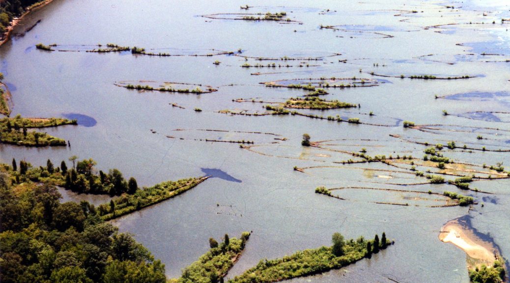
In a study recently published in Coastal Management, researchers from the Nature Conservancy and Nova Southeastern University developed a HSI for oyster reef restoration efforts in the Pensacola Bay System, Florida, with the goal of pinpointing areas most conducive to oyster habitat regeneration. The HSI framework incorporated seven critical factors influencing oyster reef viability, including contemporary oyster reef presence, bottom dissolved oxygen levels, historical oyster reef data, oyster recruitment rates, summer mean salinity, seagrass coverage, and substrate type. Each factor was scored and spatially analyzed to generate a composite HSI raster for the entire PBS area.
An oyster reef in the Pensacola Bay System, FL
Key findings from the HSI analysis revealed varying suitability scores across the study area, with higher scores concentrated in central East Bay and southeastern Escambia Bay regions. The highest suitability areas (HSI > 0.74) represented optimal locations for restoration, covering approximately 16% of the PBS. Model validation was conducted using independent data from area oyster fishers, confirming an 87% agreement with medium to high suitability HSI areas. The study emphasized the importance of stakeholder engagement in refining and validating the HSI, ensuring practical applicability and acceptance among restoration practitioners.
The HSI not only streamlines site selection for restoration projects but also aids in understanding the complex factors influencing oyster reef decline. Historical exploitation, pollution events, and sedimentation emerged as primary drivers of reef loss in PBS, highlighting the need for targeted restoration efforts in less impacted areas. The research underscores the value of integrating quantitative data and stakeholder knowledge into decision-making processes for coastal restoration. Additionally, the study demonstrates the feasibility of constructing reliable HSIs and emphasizes their role as decision support tools in ecosystem restoration initiatives.
In conclusion, the development and validation of the PBS-specific HSI represent a significant step towards effective oyster reef restoration planning. By focusing efforts on areas with the highest suitability, restoration practitioners can maximize success while conserving resources, contributing to the long-term recovery of oyster habitats in the PBS.
Citation: Geselbracht, L., Johnston, M., DeAngelis, B. M., & Birch, A. (2024). Estuary-Specific and Adaptive Habitat Suitability Index Model for the Eastern Oyster Crassostrea Virginica in the Pensacola Bay System, Florida, USA. Coastal Management, 1-18.
Disclaimer: This post does not serve as an endorsement of the author’s opinion, nor does it express the views of The Coastal Society.
By Kasey R. Jacobs, Communications Chair, The Coastal Society. This article is also published on Marine Science Today as part of a TCS-MST Collaboration.
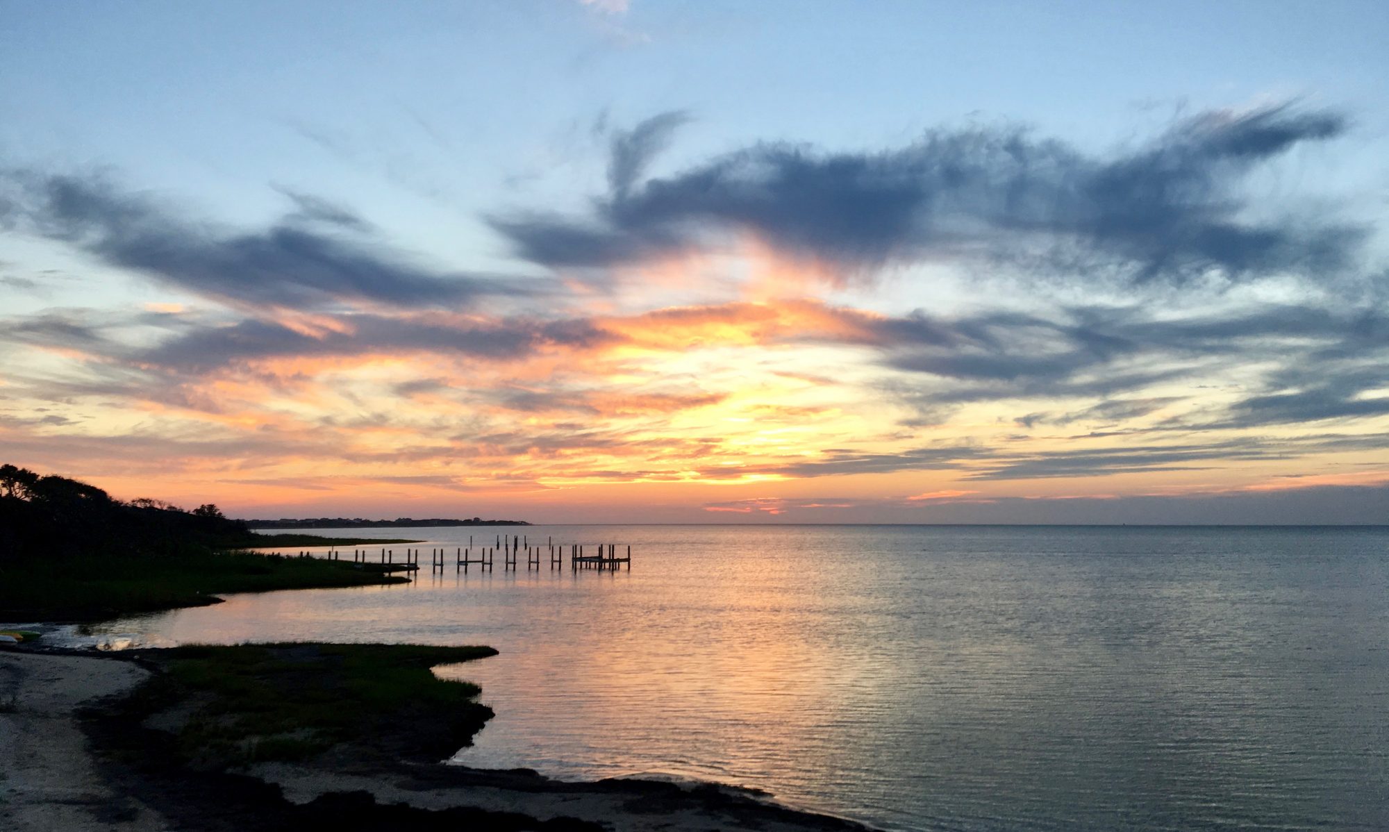
Photo Credit: Kasey R. Jacobs
Minutes before any eclipse observer can see the moon commandeer the light of the Sun on August 21st, the Pacific Ocean will perceive the changes first.
A serendipitous event for Jonathan Fram and the array of scientific sensors he manages off the coast of Oregon. Though not designed nor deployed for measuring how the Great American Solar Eclipse affects the ocean, Associate Professor Fram, of Oregon State University, is taking advantage of their location in the path of totality. And he is not the only one. Physical scientists on the coasts of Oregon and South Carolina are gearing up to deploy data-collecting instruments, anglers are scouting for the best fishing spots, universities are looking to draw people into the joy of science, and coastal managers are preparing for the inundation of people in parks and conservation areas.
Most eclipse observers are thinking about the bizarre occurrences they might witness on land and in the sky, and not what they can expect on the coasts and in the ocean. As the entire nation looks up to the heavens and around the land on August 21st, what will be happening off the coasts?
History of ocean-focused eclipse studies
Scientists and eclipse observers for centuries have eagerly observed land-based effects, at least as far back as a total eclipse in 1544, but very few have asked the coastal question. Surprisingly, the published literature remains meager today.
The Boston Society of Natural History conducted an extensive observation project to document the behavior of wild and domestic animals during the 1932 New England total solar eclipse, including coastal and marine wildlife. Their eclipse, like ours, took place in the month of August. In today’s terminology, we would call their survey a large-scale “citizen science” project. The Society partnered with media outlets to publish announcements prior to the eclipse to elicit observations for the survey. The Boston Globe, The Boston Herald and Traveler, The Boston Transcript, The Boston Post, The Boston American, and the Christian Science Monitor all gave important space, often on the front page, and mentioned the study in radio broadcasts. They combined these citizen observations with official reports by game wardens in the northeastern states, and reports submitted by naturalists. They mapped the observations and a special eclipse committee analyzed all 498 data points and published their findings in the Proceedings of the American Academy of Arts and Science of 1935.
The 1932 Eclipse Committee found that harbor seals were unaffected by the eclipse while wild fish were more active. Wild brook trout, white perch, and small-mouthed black bass were eating more during the eclipse and stopped when the light returned. A Mr. H. Bowley in Massachusetts reported that Common Pickerel “always jump out of the water in this part of the river at dark, began jumping out during the darkness of the eclipse.”
Shore birds, like fish hawks, lesser yellow-legs, gulls, terns, willets, and roseate terns may act differently than land birds during an eclipse. Rather than go quiet or roost, they become more active, vocal, and exposed, as is the case for other nocturnal birds. Solar eclipses tend to cause diurnal (day-time) birds to go quiet and nocturnal (night-time) birds to emerge. The committee noted that gulls showed less reaction than the terns and most other shore birds, as some did respond as though night was coming by returning to the mainland to roost. They stressed that reactions appear individual and not species-specific.
In the latter part of the 20th century, scientific instruments began to be used in coastal eclipse studies. A deep scattering layer in the North Atlantic was monitored during the 1972 total solar eclipse using an echo recorder. In 2006, an oceanographic cruise on board a Hellenic Center for Marine Research ship measured, and later modeled, effects on marine zooplankton during a total solar eclipse in the Eastern Mediterranean. The research team found underwater profiles of temperature and salinity remained almost constant yet most zooplankton reacted similarly to the changes in light. Different species responded at different rates and intensities. Ciliates responded to the decreased light intensity by adopting night-time behavior, spreading themselves vertically within the water column. Some copepodites showed a vertical migratory movement while others displayed no significant differences. Previous studies showed the free-swimming larvae of shrimp, clams, snails and barnacles vertically redistribute themselves and/or migrate upwards during total solar eclipses.
Fishermen prepare
As these planktonic crustacea swim to the surface, it would follow that the marine life that feast on them also rise. The night-time behavior of fishes and marine mammals during solar eclipse events could be due to the movement of their food sources or triggered by the decreased light. Not enough research is available on the subject to make this determination. Measuring rapid changes in a short amount of time in the ocean water column simultaneously with changes in animal distributions is no small undertaking.
Photo Credit: Kasey R. Jacobs
Fishermen have a propensity to already know about phenomena scientists stumble upon to study. In their renowned nonchalant manner, it seems they are already aware the fish will be biting on August 21st. For over a month, recreational fishermen have been sharing with one another the best fishing spots in the path of totality. Anglers are hoping to fish night-time species during the day. Though the Sportsman Channel reports some fishermen think there won’t be any effect being the change is so brief.
Anglers in partial eclipse areas shouldn’t be discouraged at the missed opportunity. In 1906, in a letter to the editor of Nature, an A. Mosely wrote about the partial eclipse of August 30, 1905 seen in England. “All the morning the sport had been indifferent, but as the eclipse neared its maximum the fish suddenly became ravenous, and I took more in that hour than all the rest of the day. My experience was also that of all the other boats out there at the time.”
There is still little information on deep-sea or coastal fishing as most of the fish-spot-sharing online has been focused on rivers and freshwater species.
Gary Lewis, host of Frontier Unlimited TV and book author, wrote in an article on The Register-Guard, “When the light goes down and the caddis pop, the fish, like the rest of us, will be looking to the sky.”
“From physics to fish.” Ocean observation during eclipse
Jonathan Fram is hoping the massive network of sensors on oceanographic moorings he helps manage, called the Endurance Array, will be able to collect data useful for fisheries and other ocean subjects. The array is operated by Oregon State University and the University of Washington for the Ocean Observatories Initiative. Bioacoustic sonars will measure fish and their prey, zooplankton, while other sensors, like gliders and profilers, will detect how the eclipse affects light and temperature at the sea surface. Fram tells The Coastal Society it can “measure everything from physics to fish.” These sensors are part of a twenty-five-year NSF-funded project that became operational in 2015. The array can monitor parameters at depths inaccessible to satellites, like oxygen, water velocity, and chlorophyll. Associate Professor Fram’s job is to keep the non-cabled infrastructure functioning, refurbishing and calibrating the sensors, and ensuring the data stream is continuous and available to any interested researchers, free of charge.
The array’s engineer will present two lectures on the capabilities of the array for observing eclipse effects during a three-day eclipse celebration by Oregon State University. His goal is to make sure researchers know about the array, the partnerships that make it function, and the existence of the data. He doesn’t analyze the data himself, but points researchers or collaborative teams to the data so they can make discoveries and write papers to further science. (Eclipse-related data can be found on a special eclipse webpage of the Endurance Array.)
Photo Credit: Kasey R. Jacobs
Fram’s excitement over the possibility of collecting ocean data on the eclipse began twenty-six years ago when he traveled to the Big Island of Hawaii and was wowed by the 1991 solar eclipse. When he found out the Endurance Array was in the path of totality for the 2017 eclipse he started thinking about what instruments could capture the effects. The instruments today are sensitive enough to observe reactions not previously documented in past solar eclipses.
The instruments measure three different frequencies and can distinguish between different size classes of fish. If fish follow the zooplankton upwards and begin feeding as though it was night the sensors will be able to perceive this behavior. If a whale passes through the array, “we can see that as well.” The array has great potential for use in fisheries research. Instruments normally mounted on the bottoms of ships are now moored in place with cables in the portion managed by the University of Washington. The extra power allows for long-term monitoring not previously attainable.
The next closest thing
While the Endurance Array collects Pacific Ocean data during the eclipse, Dr. Cassandra Runyon, Planetary Geologist with the College of Charleston, will be observing the moon’s shadow as it crosses South Carolina from 80,000 to 100,000 feet. Dr. Runyon is leading a team of six students from the College of Charleston to conduct a high-altitude balloon flight, sending live video and images from near-space to the NASA website. This will be the first time she has remotely sensed a total solar eclipse. Her launch is part of a network of launches being conducted across the country in the path of totality.
Graphic: NASA
A team of students from Oregon State University and Linn-Benton Community College will also be launching a balloon. Their flight will take place 30 miles offshore from onboard OSU’s research vessel Pacific Storm. For NASA, these coordinated balloon flights are also a first. Live coverage has never been done, nor has live footage been recorded across a continental network.
Motivating the College of Charleston’s Dr. Runyon to participate is “In short…curiosity” and the fact that she is not able to witness the eclipse from the International Space Station. “This is the next closest thing for me.”
The tides during the total solar eclipse
Dr. Runyon told The Coastal Society that the eclipse is not expected to affect the geomorphology of the coasts. However, there will be coastal flooding as the eclipse falls on a King Tide day in South Carolina. King Tides are exceptionally high tides that occur naturally and are predicted beforehand. Twice a month, during new and full moons, the moon, earth, and sun are aligned and the gravitational pull of the sun adds to that of the moon causing the ocean to bulge a bit more than usual. This means that high tides are higher than normal and low tides are lower than normal. For coastal areas in the path of totality this means that these bimonthly Spring Tides will be at their maximum Sunday, August 20th, and Monday, August 21st. The solar eclipse may cause the King Tide intensity to be “slightly higher, but not significant,” according to Dr. Runyon.
In 1932, the Boston Society of Natural History emphasized how the tides affect shorebird behavior during a total solar eclipse. When making observations of abnormal eclipse behaviors in wildlife you first need to know what is their normal behavior. For coastal organisms, this means an observer also should know what their non-eclipse behaviors are during low and high tides. In 1932, for instance, some gulls were observed to return to the mainland to roost, while others flew to feeding grounds exposed by the receding tide. Was this unusual behavior? During the eclipse the tide was falling and so some gulls decided to feed rather than return to their roosting areas because of the quick onset of darkness.
Inundated by eclipse observers in Oregon and South Carolina
The coasts of South Carolina will be inundated not only with water during the eclipse, but also eclipse chasers. Millions of people will flock to the coasts of Oregon and South Carolina on August 21st, 2017 to witness the first time in the nation’s history a total solar eclipse with a path falling entirely above the continental United States. The coverage has been intense and the enthusiasm is skyrocketing.
Universities are capitalizing on the excitement by organizing educational events and watch parties. The motivation is to enhance the public’s science literacy and showcase the capabilities of university researchers and labs. The College of Charleston will be hosting NASA’s national eclipse broadcasting. These university activities have been in the works for a while. “Members of the Oregon State University NASA Space Grant team, Astronomy Club, and other interested faculty and staff began planning for an OSU eclipse event” well over a year ago, according to Jill Peters, Eclipse Event Manager for the University Relations and Marketing department of Oregon State University. “This is like a dream come true for the scientists, engineers and astronomers on our Corvallis campus and [Hatfield Marine Science Center in] Newport to be directly in the path of a total solar eclipse.”
Photo Credit: Kasey R. Jacobs
For coastal managers, the eclipse might be bittersweet. Managing the large influx of people is proving to be a challenge for both emergency management, traffic control, and conservation.
Margaret Allen, a member of The Coastal Society, reports that Charleston developed an emergency safety plan and South Carolina emergency officials issued a warning about crazy heavy traffic. “I guess they are worried that people will be driving and not paying attention and wreck. They’re saying locals should do their best to stay off the roads (which makes me prefer to stay at my local pool club). They expect upwards of 1 million out of state folks to come to SC!”
The high tides are one of the big concerns for government officials. “We’re going to have visitors who have no idea what our waters are like or even, as crazy as it sounds, that we have tides,” said Jim Kusz, North Lincoln Fire & Rescue spokesman told the Oregonian/Oregon Live. “We’re probably going to do a sweep the evening before and tell people if you are planning on being on the beach that night you might want to consider being higher up or off the beach completely.”
Oregon State Parks and Recreation warns in an official statement that the new moon on August 21st will bring very high and very low tides. Not sugarcoating the dangers, they continue: “A very low tide exposes a lot of beach, which is deceptively dangerous when the high tide rolls in. This will happen late on the night of Aug. 20 into the early morning of Aug. 21. Don’t camp on the beach because the high tide of more than 9 feet will cover most of the normally dry sand. The best scenario is that you and your sleeping bag will get wet. The other scenarios are far worse.”
Eclipse observer safety is not the only safety concern during total solar eclipses. In 2012, visitors from around the world headed to the Great Barrier Reef Marine Park around Cairns, Australia to view the total solar eclipse. Because many islands offshore of Cairns were predicted to be the best locations to view the event there were concerns about disturbance to nesting seabirds. At the time, the Marine Park Authority Director John Day said it was “important visitors were aware of the environment around them when making the most of the rare opportunity”. For the 2017 eclipse, TravelOregon.com asks observers to “keep Oregon safe and beautiful” and provides tips for how to be a good steward while watching the eclipse.
Oregon State Parks and Recreation told The Coastal Society they are warning observers not to climb or dig into cliffs, to comply with posted signs and officials/volunteers, and to protect rocky shore habitats and sensitive wildlife areas. There are sensitive coastal habitat areas (marine reserves, rocky intertidal areas, bird nesting areas) within the path of totality. “It is important to not harass wildlife and be a good steward while enjoying these special places. The general message is to be safe – the Oregon coast is beautiful but can be dangerous if you’re not paying attention. Especially with large crowds, it is important to be aware of your surroundings, be prepared, and be a good steward.”
Jonathan Fram, and his oceanographic array that will observe the eclipse first before the rest of the nation, welcomes the masses. He reminds us that the eclipse is about experiencing the world around us. “I am looking forward to thousands of people coming to Corvallis and millions of people coming to the whole path of eclipse that are excited about science because of the eclipse. The people coming to Corvallis and our whole weekend of events will be exposed to not just eclipse-related stuff but all the neat science done here. Places all across the country are doing the same types of events are great opportunities to engage people in science.”
For those coastal enthusiasts who want to observe and report on bizarre occurrences of coastal and marine wildlife on August 21, 2017 the California Academy of Sciences is taking a page from the book of the Boston Society of Natural History’s 1932 Eclipse Committee. They are soliciting citizen scientists to record their observations of any animals they see using the academy’s iNaturalist app.
Perhaps scientific and citizen observations recorded during the Great American Solar Eclipse of 2017 will solve the mystery of how solar eclipses affect our coasts and oceans.
~Meg Reed contributed to the reporting and editing for this story.
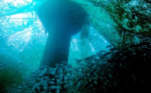
Night dive looking up at water column and bubbles with a dive torch. Photo Credit: Kasey R. Jacobs
Sources
M. Allen, personal communication, August 10, 2017
Economou, G., E.D. Christou, A. Giannakourou, E. Gerasopoulos, D. Georgopoulos, V. Kotoulas, D. Lyra, N. Tsakalis, M. Tzortziou, P. Vahamidis, E. Papathanassiou, and A. Karamanos. 2008. Eclipse effects on field crops and marine zooplankton: the 29 March 2006 total solar eclipse. Atmos. Chem. Phys.
J. Fram (Oregon State University), personal communication, August 10, 2017
J. Peters (Oregon State University), personal communication, August 9, 2017
M. Robertson (College of Charleston), personal communication, August 9, 2017
C. Runyon (College of Charleston), personal communication, August 9, 2017
Oregon State Parks and Recreation, personal communication (by Meg Reed), August 15, 2017
Wheeler, W.M., C.V. MacCoy, L. Griscom, G. M. Allen, and H.J. Coolidge Jr. 1935. Observations on the Behavior of Animals during the Total Solar Eclipse of August 31, 1932. Proceedings of the American Academy of Arts and Sciences Vol. 70, No. 2 (Mar., 1935), pp. 33-70
By Emily Tripp, Publisher and Editor of MarineScienceToday.com
Editor’s Note: This article first appeared in Marine Science Today and is reprinted here as part of a TCS-MST Collaboration.
Aquaculture is one of the fastest growing sectors of agriculture in the world. It’s seen as a way to handle the increasing demand for seafood without putting additional pressure on wild fish populations. However, it has its own set of challenges, ranging from the food given to farm-raised fish to wastewater treatment.
View from inside a Hawaii offshore aquaculture cage. Photo credit: NOAA.
A new study from the University of Illinois shows that a simple, organic system may clean aquaculture wastewater effectively and inexpensively.
In this new system, water from a fish tank enters a bioreactor (a long container filled with wood chips) at one end, flows through the wood chips, and exits through a pipe at the other end. While flowing through the container, solids settle and bacteria in the wood chips filter out nitrogen, which is a highly regulated pollutant.
The researchers compared four flow rates (the amount of time water has to flow from one end of the bioreactor to the other) and found that the optimal time was about 24 hours.
“The long and the short of it is that the bioreactors worked great,” Laura Christianson, assistant professor of water quality at the University of Illinois, lead author of the study, and bioreactor expert said. “They worked as a filter for the solids and took nitrates out. But for systems that need to move a lot of water in a short amount of time, we recommend an additional microscreen filter to settle some of the solids out before they enter and clog up the bioreactor.”
By Amanda Leinberger, NOAA Coastal Management Fellow with the Puerto Rico Coastal Zone Management Program and TCS Communications Subcommittee Member.
Editor’s Note: This article is also published on Marine Science Today as part of a TCS-MST Collaboration.
Ecosystem-based Adaptation is good for communities and the environment as it promotes community engagement, restores natural habitats, and builds local resilience. The experience of a small island in the Caribbean is case in point.
Map of the Lesser Antilles. Photo credit: Google.
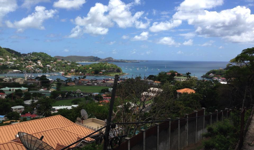
In the turquoise waters of the Eastern Caribbean Sea sits Grenada, a small island of about 105,000 people. The island is the southernmost of the Windward Islands and is located between Saint Vincent and the Grenadines to the north and Trinidad and Tobago to the south. Due to its location, Grenada is prone to natural hazards such as hurricanes, floods, earthquakes, landslides, and tsunamis. The country’s two largest cities, St. George’s and Grenville, are both located on the coast, and people depend heavily on agriculture and tourism for sources of income.
Coastal communities and marine resources on the island have already begun to experience the effects of climate change and are currently at risk from an increase in severe storm events, flooding, sea level rise, coastal erosion, drought, saltwater intrusion of coastal aquifers, and degradation of coral reefs. High coastal population densities, development, and limited land space have made Grenada all the more vulnerable. Damage from events that included two hurricanes, various tropical storms, and multiple extreme rainfall events served as a catalyst for projects focused on disaster preparedness, coastal resilience, and Ecosystem-based Adaptation (EbA) to help protect communities at risk from future coastal hazards.
According to the International Union for the Conservation of Nature (IUCN), adaptation can occur in physical, ecological, and human systems and “takes place through reducing vulnerability or enhancing resilience in response to climate change.” Adaptation activities include increasing community members’ knowledge and awareness about climate change effects to actually implementing adaptation strategies like creating a rain garden to help improve stormwater management.
EbA specifically focuses on “the conservation, sustainable management, and restoration of ecosystems to help people adapt to the impacts of climate change (IUCN)” as opposed to hard strategies that sometimes work against natural processes, such as concrete seawalls. EbA, also known as nature-based adaptation or a soft adaptation strategy, consists of multiple co-benefits as it not only protects livelihoods and communities but also restores natural habitat, supports vital ecosystem services, and boosts economies by increasing tourism.
Photo credit: Tom McCann, The Nature Conservancy (found in National Geographic Ocean Views, 2014).
The At the Water’s Edge (AWE) project, a great example of EbA work in the Caribbean, promotes coastal resilience and aids local communities in Grenada in responding to coastal hazards. As part of AWE, a partnership was formed between The Nature Conservancy, the Grenada Red Cross Society, and the Grenada Fund for Conservation as well as other local partners to conduct a Vulnerability Capacity Assessment (VCA). Combining the strengths of these different organizations helped make the process not only nature-based, but community-based as well. The VCA focused on four communities in the Grenville area of Grenada on the east coast of the island: Marquis, Soubise, Grenville, and Telescope. Previous assessments of these sites showed them to be the most vulnerable areas in Grenada for various reasons including their location, dependence on marine resources for income, and damage caused by past extreme events and storms. These communities are situated just steps away from the ocean, leaving them more susceptible to future changes.
Example of mangrove restoration on east coast of Grenada. Photo credit: Amanda Leinberger, 2014.
The AWE project represents a holistic, community-based approach to adaptation and coastal management processes. For example, the project used participatory 3-dimensional mapping, which is a method of community based-mapping. The map depicts local knowledge and information like landmarks, houses, resources, and ecological features that would be difficult to express on a traditional or even a digitized map. Community members also attended various meetings and trainings as well as formed part of a community committee that was responsible for leading projects and making decisions.
Under this same project, two main EbA approaches were implemented in the Telescope area: mangrove restoration along the shoreline and a pilot coral reef enhancement project off the coast. On an island like Grenada where mangroves occur naturally but have historically been cleared for development, replanting mangroves can bring back a wealth of benefits such as protection from waves, water filtration, and fish habitat. The reefs off the coast of Grenada have also been degraded due to climate change effects as well as land-based pollution sources. The reef enhancement project’s goal was to help with wave attenuation, meaning to
decrease the amount of wave energy reaching the shore thereby decreasing coastal erosion and the risk of damage during high tide and storm surge events.
Climate adaptation often elicits images of giant seawalls separating cities from the sea. Gray infrastructure projects like seawalls are expensive, and they can lead to negative ecological and social impacts like disruption of sand distribution, loss of beach, and elimination of natural habitat. EbA, or green responses, are more sustainable than traditional hard approaches in more ways than one. The work in Grenada demonstrates the importance of natural infrastructure and can serve as an example not only to other Caribbean islands, but to coastal communities around the world.
By Kim Hernandez, Coastal Resources Planner at the Maryland Department of Natural Resources. This article is also published on Marine Science Today as part of a TCS-MST Collaboration initiated earlier this year.
In the tidal Potomac River, about 30 miles downstream from Washington D.C., lay the remains of the “Ghost Fleet of Mallows Bay” – over 100 wooden steamships built for the U.S. Emergency Fleet as part of the nation’s engagement in World War I. Dozens of other historic maritime resources also rest in the Potomac River, as well as 12,000 year old archaeological artifacts dating back to some of the region’s earliest Native American cultures. The significance of the area was enough to warrant its listing on the National Register of Historic Places in 2015. Now, thanks to abundant community support, it is in the running to become Maryland’s first national marine sanctuary.
One of the World War I shipwrecks visible at low tide in Mallows Bay, Maryland. Photo Credit: Kim Hernandez.
The National Oceanic and Atmospheric Administration (NOAA), the federal agency with authority to designate an area as a sanctuary, for the first time in two decades has been seeking engagement from the American public to nominate areas with significant community support. As nominations are submitted, NOAA reviews each one in several steps and those that pass the review will be added to an inventory of areas NOAA may consider for potential designation as national marine sanctuaries.
The Mallows Bay-Potomac River National Marine Sanctuary nomination was submitted in September 2014 by the State of Maryland with a broad-base of local government and non-government support. The nomination itself included letters of support from over 60 community organizations and individuals. Sanctuary designation would allow NOAA programs to supplement and complement existing state and local programs that aim to protect, study, interpret, and manage this unique area.
The original nomination cited improved opportunities for public access if the area is designated a sanctuary. Photo Credit: Stephen Badger.
In addition to protecting the fragile remains of the shipwrecks, the nomination also cites opportunities to expand public access, recreation, tourism, research, and education. The area is contiguous to the Captain John Smith Chesapeake National Historic Trail, the Star Spangled Banner National Historic Trail, the Potomac Heritage National Scenic Trail and the Lower Potomac Water Trail, allowing paddlers a unique glimpse into our Nation’s history. Below the water, the area offers important habitat for popular recreational fisheries, including Striped Bass and White Perch. Above the water, ghostly shipwreck hulls jut out and provide perches for migrating waterfowl and thriving populations of Bald Eagles. The middle Potomac River truly is a historic and ecological treasure.
Four months after the original nomination was submitted, NOAA announced it would add the area to the inventory of nominations that are eligible for designation. It is important to note that the original nomination in September 2014 did not designate anything; it only suggested that NOAA consider designation. The January 2015 announcement meant NOAA would now seriously consider a sanctuary in the Potomac River – a huge step forward for the dozens of community supporters.
The ghostly shipwreck hulls lure recreationalists and historians to this area of the Potomac to get a unique glimpse into the past. Photo Credit: Kim Hernandez.
Nationally, the designation process is a separate public process that, by law, is highly public and participatory and often takes several years to complete. Nominated areas go through four main steps with NOAA before it is determined whether they are designated or not: (1) Scoping: NOAA announces its intent to designate a new national marine sanctuary and asks the public for input on potential boundaries, resources that could be protected, issues NOAA should consider and any information that should be included in the resource analysis; (2) Sanctuary Proposal: NOAA prepares draft designation documents including a draft management plan, draft environmental impact statement that analyzes a range of alternatives, proposed regulations and proposed boundaries; (3) Public Review: The public, agency partners, tribes and other stakeholders provide input on the draft documents. NOAA considers all input and determines appropriate changes; and (4) Sanctuary Designation: NOAA makes a final decision and prepares final documents. Before the designation becomes effective, the Governor reviews the documents. Congress also has the opportunity to review the documents.
Many birds, such as the osprey pictured here, have built nests atop the shipwrecks. Bald eagles are also often seen nesting along the shoreline. Photo Credit: K. Thayer.
For Mallow’s Bay, NOAA considered the nomination action until October 2015 when they issued a formal “Notice of Intent” to designate. Along with the Wisconsin – Lake Michigan National Marine Sanctuary, which is going through this same designation process right now, the Potomac River has the potential to be the home of one of the first new national marine sanctuaries designated in nearly 20 years.
In early spring 2016, a federal, state, and local government committee formed to grapple with all of possible management questions a sanctuary designation could spark. Currently, that committee is developing the draft documents required for the sanctuary – including an environmental impact statement and management plan. If all goes as planned, drafts will be available for public comment sometime in late 2016 and designation of this World War I paragon will coincide with the 100-year anniversary of the United States’ entry into the world war, in April 2017.
Sanctuary designation will allow NOAA programs to supplement and complement existing state and local programs that aim to protect, study, interpret, and manage this unique area. Photo Credit: Daryl Byrd.
If designated, the proposed sanctuary would be managed jointly by NOAA, the State of Maryland, and Charles County, Maryland. The original coalition of organizations and individuals at local, state, regional, and national levels that supported the nomination – including elected officials, businesses, Native Americans, environmental, recreation, conservation, fishing, tourism, museums, historical societies, and education groups – will continue to help mold the vision for the sanctuary and ensure effective protection and management moving forward.
For more information about the National Marine Sanctuary Program and nomination process, visit: http://www.nominate.noaa.gov/
Kim Hernandez is a Coastal Resources Planner with the Maryland Department of Natural Resources Chesapeake and Coastal Service. She assists with the coordination of state and regional ocean planning, with the planning and implementation of the Mallows Bay – Potomac River National Marine Sanctuary, and with programs that address coastal hazards and climate resiliency. She also serves as the agency representative on a number of planning bodies and stakeholder groups throughout the Mid-Atlantic region.
Editor’s Note: TCS members working on a national marine sanctuary nomination are invited to contribute a story on your proposed site and current efforts moving through the nomination process. Story ideas or full submissions can be sent to the TCS Communications Chair at kaseyrjacobs (at) gmail (dot) com.