Coastal News from the Field: Adaptive Management of the Indian River Lagoon, Florida

By Ellis Kalaidjian

This blog post is the first of a new monthly series, tentatively titled “Coastal News from the Field,” which highlights new coastal management/conservation-themed research that makes us tick. We are excited about this new development for the blog and encourage our readers to reach out to admin@thecoastalsociety.org with any research or topics they would like to see featured in this series.

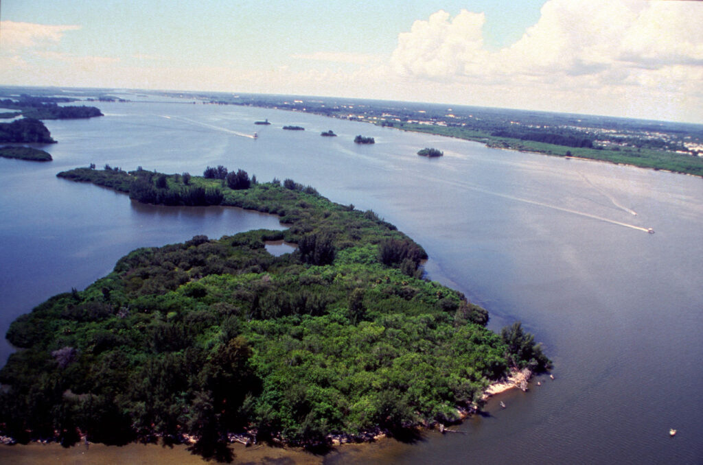
This month, we highlight a study from a research team in Florida, titled “Adaptation Actions to Reduce Impairment of Indian River Lagoon Water Quality Caused by Climate Change, Florida, USA,” as published in February 2021 in the Journal of Coastal Management. The motivation for this work comes from the increasing vulnerability of estuaries to climate change impacts of salt-water intrusion from rising sea levels, hydrological regime changes, water temperature increases, and so forth. The Indian River Lagoon (IRL) was designated as an Estuary of National Significance by the Environmental Protection Agency (EPA) in 1990 and, more recently, a Climate Ready Estuary in 2008, following a collaboration between the EPA and National Estuary Program in the form of the Climate Ready Estuaries Program.

Map of the IRL watershed (Source: EPA, 2004)
Aerial view of the IRL (Source: US Fish & Wildlife Service, 2006)

The core objective of this research was to assess the vulnerability of the IRL’s management program to climate change and prescribe adaptive actions designed to improve the program’s efficacy and protect the estuary from further climate-change-induced impairment. The research team first compiled and reviewed a list of the program goals (e.g., “water quality” or “healthy communities”) within the IRL’s Comprehensive Conservation and Management Plan (CCMP) that were most likely at risk from climate change and the associated climate stressors jeopardizing those goals. The team then weighted each risk in a matrix based on parameters of consequence, likelihood, spatial scale, and timeline. A total of 472 risks were identified. Of those, 50% were associated with impacts to impaired waters, wastewater, and surface water. Nearly all (97%) of these risks were induced by three prevalent climate change stressors of altered precipitation regimes, increasing storminess, and sea-level rise.

From here, the research team was able to identify nine adaptation actions to mitigate water quality impairment caused by climate change. Each action focused on mitigating the major sources of elevated pollutant loadings anticipated to accompany climate change, including wastewater treatment plants, on-site treatment and disposal systems, and surface water storage and conveyance infrastructure; for example, one action was to create a GIS-based inventory of vulnerable infrastructure supporting the three systems. In addition, the team devised a five-step action plan that could be used to achieve each of the nine adaptation actions and proposed an integrated management regime based on the existing symbiosis between the state of Florida and the IRL National Estuary Program.

In the face of the emerging circumstances presented by climate change, it is paramount that we continually review and adapt the programs that we have instituted to protect our coastal resources. The research highlighted in this article showcases how adaptive management—a concept based in theory—can be operationalized to satisfy long-term conservation agendas. The study also demonstrates how vulnerability assessments can be used to prioritize and continually monitor program action areas that harmonize mutual interests of a diverse stakeholder network. Most importantly, the deliverables of this applied research have direct utility for future policymaking, community engagement initiatives, program financing, and other efforts that may otherwise have been hindered without recognition of the future management challenges posed by climate change.

Citation:
Parkinson, R. W., Seidel, V., Henderson, C., & De Freese, D. (2021). Adaptation Actions to Reduce Impairment of Indian River Lagoon Water Quality Caused by Climate Change, Florida, USA. Coastal Management, 49(2), 215-232.

HELPING COASTAL COMMUNITIES THRIVE: INSPIRATIONAL PROJECTS FROM SIX STATE COASTAL PROGRAMS

By Lisa Graichen, Climate Adaptation Program Coordinator for UNH Cooperative Extension and NH Sea Grant

Looking for some coastal inspiration? We’ve got some for you! As a coastal professional and resident, I think it’s so exciting and motivating to learn about the diversity of projects coastal communities and states are working on, whether it be research and vulnerability assessments, planning and zoning improvements, engineering designs for resilient infrastructure, or actual on-the-ground restoration and conservation. Now more than ever, we should be highlighting all the great ways state coastal programs help coastal communities thrive.

First, a little context: All 35 coastal and Great Lakes states and territories (except Alaska) participate in the National Coastal Zone Management Program, a voluntary partnership between the National Oceanic and Atmospheric Administration and coastal states, focused on implementing the Coastal Zone Management Act (CZMA) and supporting responsible coastal resource management. Many of these programs award projects to coastal municipalities to support climate adaptation and resilient communities. :

Massachusetts Coastal Management Program is funding 19 Coastal Resilience projects in local cities and towns, for a total of $1,824,732. Here are a few examples:

  • The City of Boston will build on a vulnerability assessment to design nature-based strategies to support coastal resiliency (e.g., living shorelines, green infrastructure) for two priority sites.
  • The Town of Dennis will evaluate and design a pilot project to determine whether the beneficial reuse of dredged material is an effective way to address marsh loss and restore storm protection benefits.
  • The Town of Marshfield will evaluate modifications to a culvert and tide gate structure under existing and future sea level rise conditions.
  • The City of Salem will design and permit a living shoreline project at Collins Cove, using coir rolls (cylinder-shaped mesh rolls filled with coconut husk fibers) and natural vegetation to provide more natural protection from erosion.
  • Full project list is available here: http://www.mass.gov/eea/docs/czm/stormsmart/grants/2017-coastal-resilience-grants.pdf
Flooding in Marshfield, MA, in 2013 (Barry Chin, Boston Globe)


Maine Coastal Management Program is funding five Coastal Community Grant projects, for a total of nearly $186,280.

  • The Washington County Council of Governments will restore commercial river herring fisheries to the greater Cobscook Bay ecosystem.
  • The Town of Vinalhaven will conduct a vulnerability study for its downtown, which is home to 40 businesses, dozens of fishing wharves, and a ferry landing. This project will improve understanding of the flood risk to this area and identify potential adaptation options.
  • The Lincoln County Regional Planning Commission will analyze flood risks for commercial and governmental structures in downtown Boothbay Harbor and provide recommendations to improve flood resiliency and raise community awareness of the flood insurance program.
  • The City of Bath will assess downtown stormwater runoff patterns and management options to mitigate the risk of flash-flooding and the volume of pollutants discharged into the Kennebec River. The project will also develop conceptual designs for improving infrastructure.
  • The City of Gardiner will study its downtown storm drainage system, evaluate options to mitigate the impacts of periodic flooding, and make recommendations.
Vinalhaven, ME (Tom Groening)


New Hampshire Coastal Program is funding four Design Solutions for Coastal Resilience projects, for a total of over $271,000.

  • The University of New Hampshire Cooperative Extension and NH Sea Grant will continue dune restoration work in Hampton and Seabrook, promote a dune grass community garden, and design new strategies to reduce dune impacts.
  • The Town of North Hampton will evaluate drainage issues at the flood-prone Philbrick’s Pond salt marsh adjacent to Route 1A.
  • The Town of Durham will analyze erosion issues at Wagon Hill Farm and design a nature-based erosion control solution.
  • The Rockingham Planning Commission will work with the City of Portsmouth and the towns of Rye, Hampton, and Seabrook to implement high-water mark installations to raise awareness about historical and projected future flood levels.
  • Learn more here: https://www.des.nh.gov/media/pr/2017/20170322-coastal-grant-awards.htm
Flooding during a 2016 King Tide in Portsmouth, NH (Sean Maxwell)


Michigan Coastal Zone Management Program is providing $332,500 for seven coastal projects.

  • The Harrison Township will develop a Waterfront Zoning Overlay District, a Developer’s Guide Brochure, and a Complete Streets Design for the district. These products will help inform smart growth and development for the coastal area.
  • The Michigan Environmental Council will map the extent of Michigan’s coastal sand dunes and conduct outreach to better understand public values of the dunes and build a constituency of dune supporters.
  • The County of Van Buren will restore and stabilize 20 acres of dunes, improve a public trail system, and develop signage and a video about dunes.
  • The City of St. Joseph will conduct a five-year review and update of their 2012 coastal study to validate the engineering model and evaluate whether current regulations still provide sufficient protection, given rising water levels and potential increases in erosion.
  • Emmet County will construct an accessible pathway and boardwalk in Headlands Park to provide access to the Lake Michigan shoreline to all users.
  • Charlevoix County will develop a comprehensive master plan for a water trail system around Beaver Island, the largest island in Lake Michigan. The project will include a stakeholder summit, data collection and mapping, an asset inventory, an accessibility assessment, and development of promotional materials.
  • The City of Port Huron will improve public access to a constructed wetland through a boardwalk, wetland overlook, interpretive signage, and plaza.
  • In addition, the Michigan Coastal Zone Management Program is funding the second phase of a Coastal Resiliency Initiative project (a $125,000 grant) to work with the Michigan Association of Planning to incorporate coastal resiliency into communities’ plans and ordinances.
Flooding during a 2016 King Tide in Portsmouth, NH (Sean Maxwell)


Texas Coastal Management Program is funding 17 projects, for a total of over $2.6 million. Here are a few examples:

  • Texas A&M University-Corpus Christis (TAMU-CC) aims to develop a comprehensive database for monitoring living shoreline projects and mitigation sites.
  • The Galveston Bay Foundation will construct a mile-long hike and bike trail, install an irrigation system, and plant native trees and grasses at Exploration Green in Harris County. This project will improve public accessibility and use natural wetland habitats to filter stormwater runoff.
  • The Texas Parks and Wildlife Department will create artificial reef habitat at the Rio Grande Valley Reef Site in the Gulf of Mexico, improving fisheries habitat and supporting fishing and diving.
  • TAMU-CC will generate information related to groundwater discharge rates to improve environmental flow recommendations and nutrient criteria in south Texas estuaries.
  • Learn more about these and other projects here: http://www.glo.texas.gov/coastal-grants/#search/groupcsv=Coastal%20Management%20Program%20%28CMP%29|cycleYearcsv=2017
Artificial-Reef-Red-Baby-Snapper-Fish
Artificial reef (Friends of RGV Reef)


Ohio Coastal Management Program is providing over $500,000 to support 12 projects, including the following examples:

  • The West Creek Conservancy will develop an app for mobile devices to promote watershed stewardship and public engagement in the Lake Erie Basin.
  • The Ohio Department of Natural Resources will work with the City of Sandusky to develop a Strategic Restoration Initiative for Sandusky Bay.
  • The Cuyahoga Soil and Water Conservation District will identify and prioritize stormwater options in four subwatersheds of the Rocky River. The project will produce conceptual designs for the top priority projects.
  • The City of Rocky River will develop a master plan for redeveloping Bradstreet’s Landing to improve lake access and water quality.

This is just a taste of projects being funded this year. Many thanks to the state Coastal Programs and to NOAA for supporting this impressive and important work!


Sources:

  • Individual State Websites (linked to above)
  • Personal communications with author and state programs

WEST HAVEN, CONNECTICUT TAKES AIM AT COASTAL HAZARDS WITH NEW COASTAL RESILIENCE PLAN

By Christina Wiegand, Coastal Resources Management PhD Student, East Carolina University

If you’ve spent time in West Haven, Connecticut, chances are you’ve spent some time on Beach Street. With beautiful views of Long Island Sound, Sandy Point shorebirds, and lobster rolls from the famous Chick’s Drive-In (RIP Mr. Celentano), it is a destination for residents and tourists alike. However, the one-two punch of Hurricanes Irene and Sandy illustrated the susceptibility of the area to coastal hazards. To address coastal hazard risk along Beach Street and other vulnerable areas, the City of West Haven has been preparing a Coastal Resilience Plan.

Now in the final stages of development, the goal of the Coastal Resilience Plan (CRP) is to address the city’s resilience to impacts from increasing storm frequency and sea level rise. The New Haven Register has quoted assistant city planner David Killeen saying the plan “will develop options for adapting to coastal risks over the long term, with an emphasis on protecting people, buildings and West Haven’s infrastructure.”

Development of the CRP is timely, with NOAA’s most recent report on sea level rise indicating a 1-8 feet rise in relative sea level along the Connecticut coast. Coupled with increases in storm severity and flooding, West Haven is likely to become increasingly vulnerable without improvements to resilience.

Purple areas indicate 5 feet of sea level rise in West Haven Source: Connecticut Department of Energy and Environmental Protection (CT DEEP)
Purple areas indicate 5 feet of sea level rise in West Haven. Source: Connecticut Department of Energy and Environmental Protection (CT DEEP)

Planning for the CRP was based on The Nature Conservancy’s coastal resilience program approach. This approach involves: assessing risk and vulnerability, identifying solutions, taking action, and measuring effectiveness. Throughout the process, West Haven ensured there was ample opportunity for public input. Three public meetings were held to discuss the types of hazards facing the city, avenues for adaptation, and finally long-term recommendations. Additionally, a survey of coastal residents was conducted.

The most recent draft of the CRP focuses resilience efforts on 13 coastal communities with an emphasis on underserved communities where income may limit their ability to adapt to coastal hazards. Resilience efforts will vary based on each community’s needs. Structural adaptations are likely to include: beach and dune re-nourishment, bioengineered banks, and flood protection for large residential and commercial areas. Bioengineered banks, where native plants and natural materials are used to stabilize the shoreline, are typically preferred over hard structures. Political changes are likely to include changes in city floodplain and zoning regulations.

With the right motivation and support, hopefully the CRP will ensure Beach Street and the rest of West Haven remain one of Connecticut’s premier coastal destinations.

The CRP is being prepared by Milone and MacBroom Inc. in conjunction with the Black and Veatch Corporation. Funding comes from the US Department of Housing and Urban Development’s Community Development Block Grant Disaster Recovery Program.


For more information: City of West Haven Coastal Resilience Plan – March 2017 Draft