The year 2021 is over. As we begin 2022 and reflect on 2021, coastal hazards continue to escalate under a changing climate. This past Atlantic hurricane season was the third most active ever recorded and hosted one of the five costliest hurricanes to impact the US, for example. Coastal communities are experiencing more intense storms and planning for sea-level rise to build community resiliency (recording available on this topic from the last TCS Coastal Connections session). Needless to say, the challenges facing coastal management communities are numerous and mounting. As we approach the new year, we must ask ourselves: “How, if at all, are we adapting our coastal management institutions and approaches to meet the constantly-evolving problems we face?”. Duke University’s Dr. Michael Orbach and the University of Washington’s Dr. Marc Miller explore this prudent question in their essay, entitled How Have the U.S. Coasts Changed (and How Are They Going to Change) as Cultural and Policy Spaces? An Example from California, published in December 2021 in the Journal of Coastal Management.
This essay first explores the theoretical concepts of policy
and cultural spaces that exist within the coastal zone. As the authors explain,
a policy space is a space (geographical, temporal, historical) where societal
actions and behaviors are structured by legislation and political activities
that directly reflect the values of policymakers and their constituents. A
cultural space is a space that is structured by people who are members of a culture—which
is defined in terms of shared knowledge and values and “consists
of what it is that people know to [coexist with one another]” (p. 4)—in
a way that reflects that culture. Both spaces are dynamic; they have lifespans;
they are controlled by, among other things, the environment and politics; and
they influence each other in often unpredictable ways.
To illustrate these concepts and their interrelatedness, the
authors examine the policy and cultural spaces of coastal California over the
last 50 years. Prior to World War II, Californian coastal cultures were made up
of small, financially modest populations, and existed within intimate, “cozy”
landscapes. The authors describe Californian coastal life as slower-paced and “…driven
by sea- and coast-dependent industries and interests such as fishing, coastal recreation
and tourism, and notably…the proto-typical ‘California Lifestyle’.” (p. 6),
which the authors view as being influenced by the “cool, laid-back and casual
and free-wheeling” (p. 6) surf culture of the 60s. However, massive economic
development and human settlement following WWII changed the cultural space to
one that was “…much more dependent on leisure-tourism and other industries such
as major universities, aero-space and high-tech.” (p. 6) and inhabited by a
more cosmopolitan population.
Changes in coastal Californian political spaces followed in
response to the development pressures of the Post-WWII period. The 1970s
witnessed a proliferation of federal environmental legislation, such as the passage
of the Coastal Zone Management Act (CZMA), which induced the birth of state
coastal management agencies such as the California Coastal Commission and non-governmental
organizations (NGOs) like the Coastal Management Conference and The Coastal
Society. Yet, today, development and political pressures have stymied coastal
management in California (and other coastal states) and have overwhelmed the
limited resources of coastal public policy and management entities. In the
authors’ words: “The special policy space of coastal policy and management as a
profession—as with the special cultural space of the coast—has become
overshadowed by and submerged in other events and processes.” (p. 8). Corresponding
changes in the coastal zone have resulted—for example, the amount of armored
coastline in California increased from 26 miles in 1971 to 146 miles in 2018.
The authors conclude the essay with an assessment of future coastal management challenges presented by climate change hazards such as sea-level rise, increasingly frequent severe storms, and so forth. Encroaching sea levels will render certain coastal locales inhabitable, requiring communities and governments to engage in adaptation and planned retreat activities, which will signal the reinvention of coastal cultures and policies. New coastal cultures and management policies will be in a constant state of change and development with continued sea-level rise, which presents uncertainty and challenges unlike the cultural forces at play during the post-WWII period (economic expansion and the environmental movement). In closing, the authors offer coastal management practitioners the following recommendations:
Climate change solutions should draw on expertise
beyond that of the usual natural and social sciences, planning, and
engineering—for example, the ideas of the humanities, such as environmental
philosophy, and professional fields, such as business and activism;
Adaptive management and conflict management strategies
in coastal zone management should be revised to include more robust stakeholder
engagement and a commitment to social equity and environmental justice; and
Coastal management activities of monitoring natural
and social systems and predicting future human impacts should incorporate
insights from architects, engineers, and urban designers regarding the planning
and future design requirements of adaptation.
Citation:
Orbach, M. K., & Miller, M. L. (2021). How Have the U.S. Coasts Changed
(and How Are They Going to Change) as Cultural and Policy Spaces? An Example
from California. Coastal Management, doi:10.1080/08920753.2022.2006873.
Disclaimer:
This post does not serve as an endorsement of the author’s opinion, nor does it
express the views of the Coastal Society.
Changing climactic conditions, advanced harvesting technologies, and population increases have collectively stressed the United States seafood stock. Offshore aquaculture shows prospect as an avenue to a future with sustainable seafood, yet the public’s enthusiasm for this industry has waned as a result of a variety of longstanding and inaccurate myths and assumptions directed at offshore aquaculture farming and its regulation. In response to this dilemma, a team of authors with combined marine aquaculture regulatory and/or production experience exceeding 120 years, has published in Reviews in Fisheries Science and Aquaculture a paper, entitled “Refuting Marine Aquaculture Myths, Unfounded Criticisms, and Assumptions”. The paper is available as open access. To read or download, click here.
Maine farmers began producing Atlantic Salmon in the 1970s using net pens in coastal waters.
The authors discuss sustainable domestic aquaculture development as a critical component to achieving greater U.S. seafood security in the future, yet detrimental allegations have corrupted public support. This paper refutes the most prevalent critiques by reviewing current policies, regulations, research, and industry production practices. These criticisms include: inadequate regulatory oversight; portrayal of farms as being high density factories unconcerned by feed waste, untreated discharge, use of antibiotic and antifungal treatments; entanglement of marine mammals; impacts on wild stocks and habitats; use of feed additives to pigment fish flesh; unsustainable use of fish meal in feed formulations; potential market disruption by producing cheap, low quality products; and commercial farms and commercial fishers cannot coexist as for-profit businesses.
Shellfish (clams, oysters, mussels, and scallops) are tended by farmers in all of the 23 U.S. coastal states using a variety of gear.
Like other industries striving to mitigate future resource insecurities, marine aquaculture is not risk-free in terms of potential environmental, economic, social, and cultural impacts–and challenges remain to achieve a sustainable industry. Nevertheless, these challenges are well known and addressable by the U.S. and global research community.
The authors conclude that current offshore farming realities bode well for the future:
There is a clear global imperative to sustainably produce more seafood to meet growing demand. The U.S. has the marine resources to become a major exporter, so long as U.S. law can be amended to grant offshore farmers a property right or security of tenure for sites in federal waters;
U.S. ocean farmers work within a very complex and effective legal, regulatory, science-driven environment to anticipate and mitigate potential impacts;
Farm level management decisions and federal and state regulatory frameworks have worked together to bring about environmentally friendly siting, operational, and production outcomes; and,
The farming community and its advocates in government, universities, and industry recognize it is essential to reach out to decision-makers and the interested public, as well as critics, with the latest research and empirical results to present an accurate picture of risks and rewards to development.
Citation: Zajicek, P., Corbin, J., Belle, S., & Rheault, R. (2021). Refuting Marine Aquaculture Myths, Unfounded Criticisms, and Assumptions. Reviews in Fisheries Science & Aquaculture, 1-28.
Disclaimer: This post does not serve as an endorsement of the author’s opinion, nor does it express the views of the Coastal Society.
Global interest in “blue carbon” ecosystems, referring to
the world’s carbon-sequestering ocean and coastal habitats, is rooted in their
potential to mitigate climate change while achieving myriad co-benefits, such
as coastal protection and fisheries enhancement. A substantial body of research
paints a grim outlook on the future of blue carbon ecosystems, which has
prompted international efforts to protect and sustainably manage them. Yet, a
paucity of research on blue carbon ecosystem management exists, which limits
our understanding of how coastal plans can effectively integrate “blue carbon”
concepts into municipal-level coastal ecosystem management. This month’s blog
highlights a Philippines-based study that addresses this key research gap. The
study, titled “Are Municipalities Ready for Integrating Blue Carbon Concepts?:
Content Analysis of Coastal Management Plans in the Philippines”, is available
through the Journal
of Coastal Management.
Researchers conducted content analyses of existing coastal
management plans of four Philippine municipalities: Lawaan and Salcedo in
Eastern Samar province; Batan and Kalibo in Aklan province. Content analysis is
a research tool that can be used to quantify and analyze the presence of
certain words, themes, or concepts within qualitative data—in the case of this
study, the text of the management plans. Researchers used nine coding keywords,
including “ecosystem services,” “carbon sequestration,” “tourism,” and “anthropogenic
threats,” to determine the extent to which blue carbon ecosystems are accounted
for in the provinces’ management schemes. Though several habitats fall under
the category of blue carbon ecosystems, this study focused on the management of
mangrove forests and seagrass habitats.
The research team presents important findings regarding the relative
emphasis given to specific aspects of blue carbon ecosystem management and
to specific ecosystem types. The study found that management activities—such as
reforestation, coastal clean-ups, and planting—was the most frequently discussed
topic in the four plans, followed by anthropogenic threats. In general, current
directives toward resource management in the four provinces included assessment
of coastal habitats, implementation of local ordinances and policies, and a
list of possible conservation and protection services. Conversely, the topics
of tourism and carbon sequestration—important co-benefits of blue carbon
ecosystems—lacked visibility.
The researchers also discovered a greater focus on mangrove
ecosystems than seagrass habitats across the four plans. The team attributed
this discrepancy to the lack of research on seagrass ecosystems in the
Philippines relative to mangrove ecosystems, as well as the greater emphasis
placed on the coastal protection services of mangroves, given the country’s
exposure to typhoons. While discussion of the anthropogenic and natural impacts
to seagrasses is present in the plans, there were, generally, minimal actions
set forth to address these stressors; meanwhile, mangrove ecosystems were
significantly accounted for in legal frameworks, laws, policies, and local
ordinances. To address this disconnect, the researchers recommend that
Philippine national agencies should invest more in educational campaigns and
capacity building for local government agencies and stakeholders to engage in
seagrass habitat assessment, planning, protection, and monitoring.
This work highlights an existing gap in blue carbon
management strategies at the local scale. By applying the content analysis approach
to local management plans, this study offers a methodology to capture existing
implementation of management protocols and provide appropriate recommendations
for integrated coastal management practices. This study also serves as a basis
for formulating coastal plans to effectively encapsulate blue carbon ecosystems
and integrate them into existing management strategies. Moving forward, similar
approaches as those presented in this work will be necessary to investigate the
factors that facilitate best management practices and policies in different
local contexts to strategically promote blue carbon ecosystem management beyond
the scale of one nation.
Citation: Quevedo, J. M. D., Uchiyama, Y., Lukman, K. M., & Kohsaka, R. (2021). Are municipalities ready for integrating blue carbon concepts?: Content analysis of coastal management plans in the Philippines. Coastal Management, 1-22.
This blog post is the first of a new monthly series, tentatively titled “Coastal News from the Field,” which highlights new coastal management/conservation-themed research that makes us tick. We are excited about this new development for the blog and encourage our readers to reach out to admin@thecoastalsociety.org with any research or topics they would like to see featured in this series.
This month, we highlight a study from a research team in Florida, titled “Adaptation Actions to Reduce Impairment of Indian River Lagoon Water Quality Caused by Climate Change, Florida, USA,” as published in February 2021 in the Journal of Coastal Management. The motivation for this work comes from the increasing vulnerability of estuaries to climate change impacts of salt-water intrusion from rising sea levels, hydrological regime changes, water temperature increases, and so forth. The Indian River Lagoon (IRL) was designated as an Estuary of National Significance by the Environmental Protection Agency (EPA) in 1990 and, more recently, a Climate Ready Estuary in 2008, following a collaboration between the EPA and National Estuary Program in the form of the Climate Ready Estuaries Program.
Map of the IRL watershed (Source: EPA, 2004)
Aerial view of the IRL (Source: US Fish & Wildlife Service, 2006)
The core objective of this research was to assess the
vulnerability of the IRL’s management program to climate change and prescribe
adaptive actions designed to improve the program’s efficacy and protect the
estuary from further climate-change-induced impairment. The research team first
compiled and reviewed a list of the program goals (e.g., “water quality” or “healthy
communities”) within the IRL’s
Comprehensive Conservation and Management Plan (CCMP) that were most likely
at risk from climate change and the associated climate stressors jeopardizing
those goals. The team then weighted each risk in a matrix based on parameters
of consequence, likelihood, spatial scale, and timeline. A total of 472 risks
were identified. Of those, 50% were associated with impacts to impaired waters,
wastewater, and surface water. Nearly all (97%) of these risks were induced by
three prevalent climate change stressors of altered precipitation regimes,
increasing storminess, and sea-level rise.
From here, the research team was able to identify nine adaptation actions to mitigate water quality impairment caused by climate change. Each action focused on mitigating the major sources of elevated pollutant loadings anticipated to accompany climate change, including wastewater treatment plants, on-site treatment and disposal systems, and surface water storage and conveyance infrastructure; for example, one action was to create a GIS-based inventory of vulnerable infrastructure supporting the three systems. In addition, the team devised a five-step action plan that could be used to achieve each of the nine adaptation actions and proposed an integrated management regime based on the existing symbiosis between the state of Florida and the IRL National Estuary Program.
In the face of the emerging circumstances presented by
climate change, it is paramount that we continually review and adapt the programs
that we have instituted to protect our coastal resources. The research
highlighted in this article showcases how adaptive management—a concept based
in theory—can be operationalized to satisfy long-term conservation agendas. The
study also demonstrates how vulnerability assessments can be used to prioritize
and continually monitor program action areas that harmonize mutual interests of
a diverse stakeholder network. Most importantly, the deliverables of this applied
research have direct utility for future policymaking, community engagement
initiatives, program financing, and other efforts that may otherwise have been hindered
without recognition of the future management challenges posed by climate change.
Citation: Parkinson, R. W., Seidel, V., Henderson, C., & De Freese, D. (2021). Adaptation Actions to Reduce Impairment of Indian River Lagoon Water Quality Caused by Climate Change, Florida, USA. Coastal Management, 49(2), 215-232.
By: Tom Bigford, Tricia Hooper, Kim Grubert, Steve MacLeod
Connecting the Next Generation of Coastal Professionals
Entering or advancing in the field of coastal science and management can be overwhelming. To go to grad school, or not? Should you pursue a research-based or policy-oriented career path? Where are the best places to network? How do you know your resumé is really putting your best foot forward? With all of these questions, The Coastal Society (TCS) recognized a need to provide a forum for up-and-coming students and early-career professionals to get the answers. Enter: the Margaret A. Davidson (MAD) Coastal Career Development Program.
The foundation of the MAD Program is a series of regional workshops designed to help participants build the specialized tools and skills for securing and excelling in a coastal career.
While all MAD workshops are built off the same foundational goal of sharing information, tools, and resources to assist the next generation of coastal professionals in growing their careers, each workshop is slightly different and tailored to the needs of the participants.
Since late 2018, TCS and partners have hosted five workshops across the country, and several more are in the planning process. Since we have received very positive feedback from attendees, we wanted to share some insights into what makes these workshops so great and what participants can expect from attending future events.
December 2018: Long Beach, CA
We were naturally anxious about this first event but all agreed it was a nice debut! We hosted the workshop in coordination with the Restore America’s Estuaries/Coastal States Organization conference. After a week of technical sessions, participants were primed for a career development workshop aimed at helping them to apply new-found connections and information into their own career plans.
The workshop began with a morning of talks about employment trends, regional opportunities, and success stories followed by an afternoon with smaller group discussions focusing on job skills such as interview strategies, communication skills, networking, and publishing your work. Our audience of 19 students and early professionals and 21 speakers and mentors was just right for the setting. It was very refreshing to see the side conversations extending into breaks and through lunch.
Feedback from students and early professionals confirmed that our blend of experts from across the coastal professions provided much-needed guidance and optimism. Some attendees benefited most from insights on coastal jobs. Others preferred small group conversations about career skills. And everyone appreciated the handouts.
For The Coastal Society, the Long Beach workshop provided proof of our concept. We were on our way to identifying topics and skills of most interest to potential attendees. We confirmed that these workshops need to be regional, near prospective registrants. We learned the value of solid sponsors to offset the costs of a full-day event. And, perhaps most importantly, we were reminded of how valuable it is to have a solid planning team to handle the details. Long Beach was a very nice first step.
January 2019: Washington, D.C.
We built off the momentum of a successful first event and kicked off January 2019 with the next MAD workshop in Washington DC. Held in conjunction with the National Council for Science and the Environment (NCSE), we had over 40 participants in attendance. We were pleasantly surprised to have a wide range of participants in the room, including many from organizations not typically associated with the coastal field, such as the local Washington DC government. Despite the unforeseen difficulty of a federal government shutdown, the entire team stepped up to the challenge and we had a fantastic, robust agenda of speakers from the Coastal States Organization, Alice Ferguson Foundation, National Aquarium, American Geophysical Union, Maryland Department of Natural Resources, Rare, US Naval Facilities Engineering Command, Ocean Conservancy, Chesapeake Conservancy, and Restore America’s Estuaries.
After listening to feedback from the December event, we honed the agenda to provide even more opportunities for early career professionals and students to make critical connections and expand the tools in their career toolbox. Afternoon skill building sessions focused on a range of topics, includingresume writing, practicing interview skills, crafting your elevator speech, establishing a mentor relationship, and making the most of professional networks in DC.
A continued theme across the MAD professional development program is the importance of partnerships in convening successful workshops. This event would not have been possible without the outstanding in-kind support from the Women’s Aquatic Network, and generous financial support from Ocean Conservancy.
Photo courtesy of Kim Grubert
April 2019: Woodbridge, VA
The Coastal Society traveled to George Mason University’s Potomac Science Center in Woodbridge, Virginia, for its third MAD Coastal Career Program workshop on April 4, 2019. This event mirrored earlier workshops with a morning of career talks from sector leaders, an afternoon focused on the personal skills needed to launch a successful coastal career, and stories of personal success throughout. TCS partnered with the Coastal and Estuarine Research Federation’s Atlantic Estuarine Research Society to design a program relevant to the natural sciences, resource management, and other interdisciplinary fields. The blend worked well, with spirited conversation across an audience of about 45. TCS will be looking for opportunities to partner with CERF regional affiliates on future workshops, and to reach out to other organizations and societies.
Based on feedback from our survey, attendees most appreciated the personal stories about different pathways to a coastal career. Those talks and informal conversations were inspirational and optimistic, two reactions TCS had hoped to generate. Perspectives from the National Aquarium in Baltimore, Dewberry Consultants, Inc., and several government agencies revealed the diversity of career directions in public and private sectors, and made for one of the “best career events” several registrants had ever attended. Attendees also rated a talk on navigating USAJobs for federal positions as a highlight. TCS definitely learned from those comments and other feedback as it plans for 2020 and beyond.
June 2019: Washington, D.C.
With so many TCS members in the Washington DC area, we capitalized on the opportunity to host a second MAD workshop in our nation’s capital, this time in association with Capitol Hill Ocean Week (CHOW). We partnered with the National Marine Sanctuary Foundation to advertise the workshop as part of the CHOW programming. We also partnered with the Duke University Nicholas School of the Environment, who allowed us to host the workshop at the Duke In DC office building just across the street from the CHOW facility. The Ocean Conservancy and the Ocean Foundation sponsored the workshop, enabling us to offer a reduced registration rate for students and young professionals.
Thanks to our partners and sponsors, we were able to bring in a record-breaking 57 people in the room throughout the day, including 36 students and young professionals, 15 speakers, 2 sponsors, and 4 members of the planning team. It was a tremendously successful event!
In order to improve and make these workshops as meaningful to participants as possible, we administer surveys at the end so that participants can provide anonymous feedback on their experience. We received and overwhelming expression of gratitude for the event, as well as a few thoughtful recommendations for how to improve, which we will incorporate into future workshops.
Photo courtesy of Kim Grubert
June 2019: Brockport, NY
Recognizing that the Great Lakes are nationally recognized freshwater coastal systems with challenges and opportunities for those pursuing a coastal career path, we coordinated with International Association for Great Lakes Research (IAGLR) conference to host a workshop at SUNY Brockport, just south of Lake Ontario, New York. The format was again a full-day event with morning presentations from representatives in the government, academic, consultant, and NGO sectors, followed by afternoon break-out sessions to focus on career skills.
We had approximately 25 participants and support from multiple sponsors, including the International Joint Commission, the Great Lakes Research Commission, New York Sea Grant, Ecology & Environment, and the Ocean Conservancy. Several attendees reported being encouraged to attend by professors who recognized early-on the value of the event; the attendees were glad to have followed that advice.
Similar to previous workshops, participants said it was most helpful to hear professionals discuss their journeys to their current position; to have one-on-one conversations with professionals in the different sectors about mentoring; and to learn job search strategies and demystify the job hiring process. 100% of the participants who responded rated the workshop as either “excellent” or “good;” it was clear that participants found value in all aspects of the workshop.
Suggestions to improve the workshop included more discussion on day-to-day job activities and moving some of the break-out skill sessions to the morning to help maintain participant energy. We will consider these suggestions to fine-tune future workshops so they continue to provide the ideal platform for diving into a new coastal career!
Photo courtesy of Sarah Quintal
Looking to the Future
Overall, feedback for the workshops has been overwhelmingly positive. One recent graduate even told the event planners that attending the workshop was “life-changing” for her! We also received the following praise from post-workshop surveys:
“Thank you so much for hosting this event, this has been really helpful for me especially in gaining some more confidence in my career search.‘
“I wanted to thank you for helping make the Coastal Careers Workshop happen, and for your inspiring words on Margaret A. Davidson. I felt the event was both helpful and energizing and, after talking with the other participants, I gathered that they felt similarly.‘
“I wanted to reach out to you to let you know how much I loved this workshop. It was so helpful in terms of all of the information provided, but also in the invaluable connections and relationships made.‘
“Overall, well done- I have recommended to friends and colleagues in the areas you are visiting next and value my experience!‘
TCS is currently planning 2020 workshops in Wilmington, NC, and Charleston, SC. We are actively seeking sponsors, partners, and volunteers to help us continue these enriching professional development opportunities. These workshops are entirely volunteer-run, and continued engagement from the TCS community is critical for their continued success. Please contact Tom Bigford if you are interested in getting involved.
By Lisa Graichen, Climate Adaptation Program Coordinator, University of New Hampshire Cooperative Extension and New Hampshire Sea Grant
Over the summer, coastal stakeholders from Maine and New Hampshire gathered in Wells, Maine, at the 2017 Beaches Conference to share updates and lessons learned from research and outreach efforts. The first Maine Beaches Conference was in 2000, and this year’s – the 11th – was the first to include New Hampshire. Over 200 people attended, with sessions on a wide range of topics, from using unmanned aerial systems (or drones) for habitat mapping to aquaculture curricula, marine mammal rescue, coastal law and policy issues, and much more.
Beaches Conference social at Wells NERR , Maine
What struck me the most about the conference was the breadth of the participants’ backgrounds. I spoke with an emergency manager from a local naval shipyard; listened to an artist describe her coastal mapping work as a means for communication and capturing love of place; learned from experts in ocean mapping, archeology, and environmental law; and heard from a representative of the US Department of Homeland Security. Colleagues shared examples translating research and monitoring programs from one state to the other. For example, a team in New Hampshire is learning from others in Maine how to build a volunteer beach profile monitoring program. While there are several unique, place-based factors in coastal management, there is a lot we can learn from the coastal management strategies and lessons in other places. Kristen Grant from Maine Sea Grant and University of Maine Extension shared stories from the Netherlands about stakeholder engagement in flood defense. She stressed the importance of providing opportunities for people to listen to, learn from, and build trust in each other.
Newcastle, Maine
The most unique part of the day was a plenary session called “Listening for a Change: Stories of Our Responses to Sea-Level Rise” that brought together a philosophy professor, a playwright, and a climatologist to share their reflections on climate change and sea-level rise. First, the philosophy professor wondered aloud what proof there was that carbon dioxide is causing global warming, and how we could distinguish between different sources of carbon dioxide. As he worked through his thinking on this subject, you could sense palpable discomfort in the room as he shared a somewhat skeptical perspective. I felt confused to hear questions being framed as unresolved that scientists know the answers to, and I saw others in the audience shake their heads and shift in their seats uncomfortably. The playwright was next. She described feeling like she is “not a native” in the world of science, and struggling to try to wrap her head around the impacts of climate change but not knowing where to look for information. She mentioned feeling scared as well as scolded for contributing to anthropogenic climate change, but not knowing where to look for valid information or what to do about it. Finally, the climatologist described his experience with a bipartisan effort in New Hampshire called the Coastal Risk and Hazards Commission and grappling with different perspectives about science and sources of information through that process. He suggested that solving problems isn’t about convincing people to see things your way, though we often feel a desire to try to do that. These were three people from different professional and personal backgrounds, all describing different experiences with understanding the science of climate change.
Seapoint Beach, Kittery, Maine
Unfortunately, there wasn’t much time left for the panel discussion and audience dialogue following the three speakers, and the only person who had a chance to ask a question used the opportunity to try to rebut the philosophy professor’s skepticism. I think there is often a desire to present scientific information to counter misinformation or misunderstandings, but we can sometimes skip the step of trying to really understand and acknowledge why people have those perspectives, where they’re coming from, and how best to engage in a productive dialogue.
I recently finished listening to Strangers in Their Own Land by Arlie Russell Hochschild, a sociologist from UC Berkeley, who journeyed to climb over what he called the “empathy wall” to gain an in-depth understanding of people who identify with the Tea Party.
“An empathy wall is an obstacle to deep understanding of another person, one that can make us feel indifferent or even hostile to those who hold different beliefs or whose childhood is rooted in different circumstances.” – Arlie Russel Hoschild
Academic or professional conferences can often be opportunities for like-minded folks to gather and learn from each other, which is certainly valuable, but it is important to remember the voices that may not be represented there. Let’s reflect on how we can bring those voices in, acknowledge different experiences and perspectives, and challenge ourselves in how we respond. I am grateful for the opportunity at this conference to be put in the uncomfortable space of confronting skepticism about climate change, feeling my initial emotional response, and reflecting on the need to really listen and figure out how to interact in a productive way. Especially in these highly polarized times, one of our most critical charges working in coastal management is to take the time to listen, face the discomfort of different perspectives, and work on communicating science-based information in ways that resonate. In other words, learning how to climb the “empathy walls,” understand other perspectives, and acknowledge others’ experiences. It’s not an easy task, but it may be our most important.
By Kasey R. Jacobs, Communications Chair, The Coastal Society. This article is also published on Marine Science Today as part of a TCS-MST Collaboration.
Photo Credit: Kasey R. Jacobs
Minutes before any eclipse observer can see the moon commandeer the light of the Sun on August 21st, the Pacific Ocean will perceive the changes first.
A serendipitous event for Jonathan Fram and the array of scientific sensors he manages off the coast of Oregon. Though not designed nor deployed for measuring how the Great American Solar Eclipse affects the ocean, Associate Professor Fram, of Oregon State University, is taking advantage of their location in the path of totality. And he is not the only one. Physical scientists on the coasts of Oregon and South Carolina are gearing up to deploy data-collecting instruments, anglers are scouting for the best fishing spots, universities are looking to draw people into the joy of science, and coastal managers are preparing for the inundation of people in parks and conservation areas.
Most eclipse observers are thinking about the bizarre occurrences they might witness on land and in the sky, and not what they can expect on the coasts and in the ocean. As the entire nation looks up to the heavens and around the land on August 21st, what will be happening off the coasts?
History of ocean-focused eclipse studies
Scientists and eclipse observers for centuries have eagerly observed land-based effects, at least as far back as a total eclipse in 1544, but very few have asked the coastal question. Surprisingly, the published literature remains meager today.
The Boston Society of Natural History conducted an extensive observation project to document the behavior of wild and domestic animals during the 1932 New England total solar eclipse, including coastal and marine wildlife. Their eclipse, like ours, took place in the month of August. In today’s terminology, we would call their survey a large-scale “citizen science” project. The Society partnered with media outlets to publish announcements prior to the eclipse to elicit observations for the survey. The Boston Globe, The Boston Herald and Traveler, The Boston Transcript, The Boston Post, The Boston American, and the Christian Science Monitor all gave important space, often on the front page, and mentioned the study in radio broadcasts. They combined these citizen observations with official reports by game wardens in the northeastern states, and reports submitted by naturalists. They mapped the observations and a special eclipse committee analyzed all 498 data points and published their findings in the Proceedings of the American Academy of Arts and Science of 1935.
The 1932 Eclipse Committee found that harbor seals were unaffected by the eclipse while wild fish were more active. Wild brook trout, white perch, and small-mouthed black bass were eating more during the eclipse and stopped when the light returned. A Mr. H. Bowley in Massachusetts reported that Common Pickerel “always jump out of the water in this part of the river at dark, began jumping out during the darkness of the eclipse.”
Shore birds, like fish hawks, lesser yellow-legs, gulls, terns, willets, and roseate terns may act differently than land birds during an eclipse. Rather than go quiet or roost, they become more active, vocal, and exposed, as is the case for other nocturnal birds. Solar eclipses tend to cause diurnal (day-time) birds to go quiet and nocturnal (night-time) birds to emerge. The committee noted that gulls showed less reaction than the terns and most other shore birds, as some did respond as though night was coming by returning to the mainland to roost. They stressed that reactions appear individual and not species-specific.
In the latter part of the 20th century, scientific instruments began to be used in coastal eclipse studies. A deep scattering layer in the North Atlantic was monitored during the 1972 total solar eclipse using an echo recorder. In 2006, an oceanographic cruise on board a Hellenic Center for Marine Research ship measured, and later modeled, effects on marine zooplankton during a total solar eclipse in the Eastern Mediterranean. The research team found underwater profiles of temperature and salinity remained almost constant yet most zooplankton reacted similarly to the changes in light. Different species responded at different rates and intensities. Ciliates responded to the decreased light intensity by adopting night-time behavior, spreading themselves vertically within the water column. Some copepodites showed a vertical migratory movement while others displayed no significant differences. Previous studies showed the free-swimming larvae of shrimp, clams, snails and barnacles vertically redistribute themselves and/or migrate upwards during total solar eclipses.
Fishermen prepare
As these planktonic crustacea swim to the surface, it would follow that the marine life that feast on them also rise. The night-time behavior of fishes and marine mammals during solar eclipse events could be due to the movement of their food sources or triggered by the decreased light. Not enough research is available on the subject to make this determination. Measuring rapid changes in a short amount of time in the ocean water column simultaneously with changes in animal distributions is no small undertaking.
Photo Credit: Kasey R. Jacobs
Fishermen have a propensity to already know about phenomena scientists stumble upon to study. In their renowned nonchalant manner, it seems they are already aware the fish will be biting on August 21st. For over a month, recreational fishermen have been sharing with one another the best fishing spots in the path of totality. Anglers are hoping to fish night-time species during the day. Though the Sportsman Channel reports some fishermen think there won’t be any effect being the change is so brief.
Anglers in partial eclipse areas shouldn’t be discouraged at the missed opportunity. In 1906, in a letter to the editor of Nature, an A. Mosely wrote about the partial eclipse of August 30, 1905 seen in England. “All the morning the sport had been indifferent, but as the eclipse neared its maximum the fish suddenly became ravenous, and I took more in that hour than all the rest of the day. My experience was also that of all the other boats out there at the time.”
There is still little information on deep-sea or coastal fishing as most of the fish-spot-sharing online has been focused on rivers and freshwater species.
Gary Lewis, host of Frontier Unlimited TV and book author, wrote in an article on The Register-Guard, “When the light goes down and the caddis pop, the fish, like the rest of us, will be looking to the sky.”
“From physics to fish.” Ocean observation during eclipse
Jonathan Fram is hoping the massive network of sensors on oceanographic moorings he helps manage, called the Endurance Array, will be able to collect data useful for fisheries and other ocean subjects. The array is operated by Oregon State University and the University of Washington for the Ocean Observatories Initiative. Bioacoustic sonars will measure fish and their prey, zooplankton, while other sensors, like gliders and profilers, will detect how the eclipse affects light and temperature at the sea surface. Fram tells The Coastal Society it can “measure everything from physics to fish.” These sensors are part of a twenty-five-year NSF-funded project that became operational in 2015. The array can monitor parameters at depths inaccessible to satellites, like oxygen, water velocity, and chlorophyll. Associate Professor Fram’s job is to keep the non-cabled infrastructure functioning, refurbishing and calibrating the sensors, and ensuring the data stream is continuous and available to any interested researchers, free of charge.
The array’s engineer will present two lectures on the capabilities of the array for observing eclipse effects during a three-day eclipse celebration by Oregon State University. His goal is to make sure researchers know about the array, the partnerships that make it function, and the existence of the data. He doesn’t analyze the data himself, but points researchers or collaborative teams to the data so they can make discoveries and write papers to further science. (Eclipse-related data can be found on a special eclipse webpage of the Endurance Array.)
Photo Credit: Kasey R. Jacobs
Fram’s excitement over the possibility of collecting ocean data on the eclipse began twenty-six years ago when he traveled to the Big Island of Hawaii and was wowed by the 1991 solar eclipse. When he found out the Endurance Array was in the path of totality for the 2017 eclipse he started thinking about what instruments could capture the effects. The instruments today are sensitive enough to observe reactions not previously documented in past solar eclipses.
The instruments measure three different frequencies and can distinguish between different size classes of fish. If fish follow the zooplankton upwards and begin feeding as though it was night the sensors will be able to perceive this behavior. If a whale passes through the array, “we can see that as well.” The array has great potential for use in fisheries research. Instruments normally mounted on the bottoms of ships are now moored in place with cables in the portion managed by the University of Washington. The extra power allows for long-term monitoring not previously attainable.
The next closest thing
While the Endurance Array collects Pacific Ocean data during the eclipse, Dr. Cassandra Runyon, Planetary Geologist with the College of Charleston, will be observing the moon’s shadow as it crosses South Carolina from 80,000 to 100,000 feet. Dr. Runyon is leading a team of six students from the College of Charleston to conduct a high-altitude balloon flight, sending live video and images from near-space to the NASA website. This will be the first time she has remotely sensed a total solar eclipse. Her launch is part of a network of launches being conducted across the country in the path of totality.
Graphic: NASA
A team of students from Oregon State University and Linn-Benton Community College will also be launching a balloon. Their flight will take place 30 miles offshore from onboard OSU’s research vessel Pacific Storm. For NASA, these coordinated balloon flights are also a first. Live coverage has never been done, nor has live footage been recorded across a continental network.
Motivating the College of Charleston’s Dr. Runyon to participate is “In short…curiosity” and the fact that she is not able to witness the eclipse from the International Space Station. “This is the next closest thing for me.”
The tides during the total solar eclipse
Dr. Runyon told The Coastal Society that the eclipse is not expected to affect the geomorphology of the coasts. However, there will be coastal flooding as the eclipse falls on a King Tide day in South Carolina. King Tides are exceptionally high tides that occur naturally and are predicted beforehand. Twice a month, during new and full moons, the moon, earth, and sun are aligned and the gravitational pull of the sun adds to that of the moon causing the ocean to bulge a bit more than usual. This means that high tides are higher than normal and low tides are lower than normal. For coastal areas in the path of totality this means that these bimonthly Spring Tides will be at their maximum Sunday, August 20th, and Monday, August 21st. The solar eclipse may cause the King Tide intensity to be “slightly higher, but not significant,” according to Dr. Runyon.
In 1932, the Boston Society of Natural History emphasized how the tides affect shorebird behavior during a total solar eclipse. When making observations of abnormal eclipse behaviors in wildlife you first need to know what is their normal behavior. For coastal organisms, this means an observer also should know what their non-eclipse behaviors are during low and high tides. In 1932, for instance, some gulls were observed to return to the mainland to roost, while others flew to feeding grounds exposed by the receding tide. Was this unusual behavior? During the eclipse the tide was falling and so some gulls decided to feed rather than return to their roosting areas because of the quick onset of darkness.
Inundated by eclipse observers in Oregon and South Carolina
The coasts of South Carolina will be inundated not only with water during the eclipse, but also eclipse chasers. Millions of people will flock to the coasts of Oregon and South Carolina on August 21st, 2017 to witness the first time in the nation’s history a total solar eclipse with a path falling entirely above the continental United States. The coverage has been intense and the enthusiasm is skyrocketing.
Universities are capitalizing on the excitement by organizing educational events and watch parties. The motivation is to enhance the public’s science literacy and showcase the capabilities of university researchers and labs. The College of Charleston will be hosting NASA’s national eclipse broadcasting. These university activities have been in the works for a while. “Members of the Oregon State University NASA Space Grant team, Astronomy Club, and other interested faculty and staff began planning for an OSU eclipse event” well over a year ago, according to Jill Peters, Eclipse Event Manager for the University Relations and Marketing department of Oregon State University. “This is like a dream come true for the scientists, engineers and astronomers on our Corvallis campus and [Hatfield Marine Science Center in] Newport to be directly in the path of a total solar eclipse.”
Photo Credit: Kasey R. Jacobs
For coastal managers, the eclipse might be bittersweet. Managing the large influx of people is proving to be a challenge for both emergency management, traffic control, and conservation.
Margaret Allen, a member of The Coastal Society, reports that Charleston developed an emergency safety plan and South Carolina emergency officials issued a warning about crazy heavy traffic. “I guess they are worried that people will be driving and not paying attention and wreck. They’re saying locals should do their best to stay off the roads (which makes me prefer to stay at my local pool club). They expect upwards of 1 million out of state folks to come to SC!”
The high tides are one of the big concerns for government officials. “We’re going to have visitors who have no idea what our waters are like or even, as crazy as it sounds, that we have tides,” said Jim Kusz, North Lincoln Fire & Rescue spokesman told the Oregonian/Oregon Live. “We’re probably going to do a sweep the evening before and tell people if you are planning on being on the beach that night you might want to consider being higher up or off the beach completely.”
Oregon State Parks and Recreation warns in an official statement that the new moon on August 21st will bring very high and very low tides. Not sugarcoating the dangers, they continue: “A very low tide exposes a lot of beach, which is deceptively dangerous when the high tide rolls in. This will happen late on the night of Aug. 20 into the early morning of Aug. 21. Don’t camp on the beach because the high tide of more than 9 feet will cover most of the normally dry sand. The best scenario is that you and your sleeping bag will get wet. The other scenarios are far worse.”
Eclipse observer safety is not the only safety concern during total solar eclipses. In 2012, visitors from around the world headed to the Great Barrier Reef Marine Park around Cairns, Australia to view the total solar eclipse. Because many islands offshore of Cairns were predicted to be the best locations to view the event there were concerns about disturbance to nesting seabirds. At the time, the Marine Park Authority Director John Day said it was “important visitors were aware of the environment around them when making the most of the rare opportunity”. For the 2017 eclipse, TravelOregon.com asks observers to “keep Oregon safe and beautiful” and provides tips for how to be a good steward while watching the eclipse.
Oregon State Parks and Recreation told The Coastal Society they are warning observers not to climb or dig into cliffs, to comply with posted signs and officials/volunteers, and to protect rocky shore habitats and sensitive wildlife areas. There are sensitive coastal habitat areas (marine reserves, rocky intertidal areas, bird nesting areas) within the path of totality. “It is important to not harass wildlife and be a good steward while enjoying these special places. The general message is to be safe – the Oregon coast is beautiful but can be dangerous if you’re not paying attention. Especially with large crowds, it is important to be aware of your surroundings, be prepared, and be a good steward.”
Jonathan Fram, and his oceanographic array that will observe the eclipse first before the rest of the nation, welcomes the masses. He reminds us that the eclipse is about experiencing the world around us. “I am looking forward to thousands of people coming to Corvallis and millions of people coming to the whole path of eclipse that are excited about science because of the eclipse. The people coming to Corvallis and our whole weekend of events will be exposed to not just eclipse-related stuff but all the neat science done here. Places all across the country are doing the same types of events are great opportunities to engage people in science.”
For those coastal enthusiasts who want to observe and report on bizarre occurrences of coastal and marine wildlife on August 21, 2017 the California Academy of Sciences is taking a page from the book of the Boston Society of Natural History’s 1932 Eclipse Committee. They are soliciting citizen scientists to record their observations of any animals they see using the academy’s iNaturalist app.
Perhaps scientific and citizen observations recorded during the Great American Solar Eclipse of 2017 will solve the mystery of how solar eclipses affect our coasts and oceans.
~Meg Reed contributed to the reporting and editing for this story.
Night dive looking up at water column and bubbles with a dive torch. Photo Credit: Kasey R. Jacobs
Sources
M. Allen, personal communication, August 10, 2017
Economou, G., E.D. Christou, A. Giannakourou, E. Gerasopoulos, D. Georgopoulos, V. Kotoulas, D. Lyra, N. Tsakalis, M. Tzortziou, P. Vahamidis, E. Papathanassiou, and A. Karamanos. 2008. Eclipse effects on field crops and marine zooplankton: the 29 March 2006 total solar eclipse. Atmos. Chem. Phys.
J. Fram (Oregon State University), personal communication, August 10, 2017
J. Peters (Oregon State University), personal communication, August 9, 2017
M. Robertson (College of Charleston), personal communication, August 9, 2017
C. Runyon (College of Charleston), personal communication, August 9, 2017
Oregon State Parks and Recreation, personal communication (by Meg Reed), August 15, 2017
Wheeler, W.M., C.V. MacCoy, L. Griscom, G. M. Allen, and H.J. Coolidge Jr. 1935. Observations on the Behavior of Animals during the Total Solar Eclipse of August 31, 1932. Proceedings of the American Academy of Arts and Sciences Vol. 70, No. 2 (Mar., 1935), pp. 33-70
Editor’s Note: This article is a reprint of a NOAA Digital Coast article printed here by request and with permission.
Summary
Coastal Oregon must consider the risks of earthquakes and tsunamis. However, moving development out of harm’s way is not possible when it is flanked by the ocean and steep, forested hills. This poses some major challenges for local officials looking for ways to make their communities more resilient. Meg Reed, a coastal hazard specialist with Oregon’s Coastal Management Program, is helping coastal cities and counties increase their resilience to tsunamis through land use planning programs.
“Our main focus is to get people out of harm’s way as quickly as possible through land use planning strategies. We are trying to balance how you make a community safer from tsunami hazards without changing a community’s character. That’s why we are focused on safety first.”
– Meg Reed, Coastal Hazards Specialist, Oregon Department of Land Conservation and Development’s Oregon Coastal Management Program
Lessons Learned
The land use planning process takes time. This public process aims to engage many people, which means it doesn’t happen quickly.
Give people something to start with. By receiving a sample plan and development code language in the tsunami land use guidance, communities have something to build on.
Maintain relationships with people in the community. It doesn’t have to be business all the time. Meg says that sometimes she stops in to a local partner office “just to say hi and see how folks are doing. That helps build rapport and trust.”
A lot can be done with a little. For this project, three communities are each getting a small grant ($5,000), along with help from NOAA, to do the tsunami land use work. The communities can get a lot done with this small amount of money.
Disasters can be motivators. When disasters happen, awareness and urgency are heightened, even if the disaster isn’t local. After the 2011 Japan tsunami, Oregon residents made planning for a major earthquake and tsunami a priority but needed resources to help them prepare in different ways. The Oregon Coastal Management Program used this opportunity to develop the Tsunami Land Use Guide, a tool to help municipalities modify their land use planning programs to be more resilient to tsunami risks.
Letting folks know about hazards doesn’t have to be bad for business. Many coastal communities are destinations that rely heavily on a tourism economy. Messages can be framed positively, as in: “We care about our tourists. We want you to be safe when you are here.”
The Process
In Oregon, residents may not have much time to get to high ground before a tsunami arrives. That is why state and local government efforts are focusing on changing land use to make development safer during an earthquake and tsunami. Meg Reed, coastal hazards specialist at the Oregon Department of Land Conservation and Development’s Oregon Coastal Management Program says, “Our main focus is to get people out of harm’s way as quickly as possible. We are trying to balance how you make a community safer from tsunami hazards without changing a community’s character. Life safety is the first priority when working toward resilient communities.”
Oregon state law guides land use planning through statewide planning goals. Each city and county meets these standards through adoption of a comprehensive plan and zoning and land-division ordinances.
The state’s coastal management program saw communities struggling with their tsunami preparation. To help meet this need, they developed the Tsunami Land Use Guide. Meg is working with a number of local coastal governments to address this issue.
“It just made sense to develop a tool that helps local governments amend their land use plans and digest new hazard information about tsunamis,” Meg says. “This work is also a way to have communities assess their land both inside and outside of tsunami inundation areas for present and future uses and development.”
Meg says this work is notable, as not many people are doing this type of planning. “We don’t have a model to follow; we are piecing together from experiences, other hazard planning processes, and examples from Japan on how to approach this risk.”
Communities are taking the sample code language from the land use guide and using it as a starting point to create development codes and identify where the focus needs to be in terms of resilience projects. “It helps people get over that initial barrier of where to start,” Meg points out.
Meg helps the communities customize the guide’s sample policies and codes to meet specific needs. Another big part of what she does is coordinating and administering the projects for each community, and finding and applying for grants to provide additional resources. “By doing the project coordination, it lifts the burden off the communities so they can focus on the issues and how to customize the approach to their community,” she says.
It is a partnership between the state agency and local governments to work toward tsunami resilience. Meg and other agency staff members provide digested hazard information, GIS and funding support, and sample land use codes, while the local governments lead the effort to update their land use planning documents through the public engagement process.
When asked how they approach communities to do this type of work, Meg attributes it to relationship building and maintenance. Meg says it has a lot to do with just showing up. Her predecessor, Laren Woolley, who retired last year, was well loved and respected by the local communities. Meg is following in his footsteps by building her own relationships with these communities.
“It’s about stopping by the office to chat. They see you are interested in their community. It builds trust,” she notes. “I think what also makes it easier for communities to use the Tsunami Land Use Guide is that many of their staff were on the development team and understand its benefits since they helped write the chapters.”
Digging into the Tsunami Guide
Communities use the guide’s sample land use policies and provisions related to tsunami risk reduction and recovery. They can use the language as is or modify it as needed. The guide contains a chapter that provides sample comprehensive plan policies and a chapter with development code provisions, including a model tsunami hazards overlay zone. Another chapter provides tsunami financing and incentive tools for implementing some of the tsunami evacuation improvements identified by the community. The guide also contains information resources for developing a tsunami-evacuation facilities improvement plan and preparations for post-disaster recovery.
Local-Level Application
“Getting to high ground is not always an option, depending on where you are and how bad an earthquake is,” Meg points out. “Therefore, vertical evacuation can be an important consideration in certain communities.”
The City of Newport, Oregon, saw this as an opportunity to increase its resilience in a vulnerable area, and used the guide to amend a building height restriction to allow for the construction of vertical evacuation structures. The city will also ensure that a newly proposed Oregon State University marine science building is constructed to withstand the worst-case scenario earthquake and tsunami event, serving as a vertical evacuation location open to the public.
Other communities are getting close to adopting amended land use plans that include tsunami provisions. Meg says, “Since this is a public process, it takes time. You want to ensure that people get a chance to review and provide input on this important issue.”
Outcome
Communities throughout Oregon are amending their current land use plans to incorporate tsunami resilience measures. The hope is that they will continue to look at how their land use plans and policies can reduce risk by locating essential development (such as schools, hospitals, and police stations) out of harm’s way and improving evacuation measures (such as hardening paths, providing lighting, and maintaining vegetation).
Next Steps
A new mapping effort called “Beat the Wave” shows how fast someone would have to travel to beat tsunami waves. This type of analysis will help municipalities pinpoint their most vulnerable areas and assets (e.g., a bridge that will fail during an earthquake and make river crossing impassable). They can then use this information to prioritize evacuation improvement projects to ensure that people know where to go and can get to safe ground in time. “Beat the Wave” provides a tailored evacuation analysis for each community’s specific geography and social context.
By Lisa Graichen, Climate Adaptation Program Coordinator, UNH Cooperative Extension and NH Sea Grant
In North Carolina, it’s easy to get a bulkhead, and changing the regulatory framework to encourage living shorelines might be a longshot. I recently had the opportunity to talk with Whitney Jenkins, Coastal Training Program Coordinator with the North Carolina Coastal Reserve and National Estuarine Research Reserve (NCNERR) about how to combat bulkhead syndrome. NCNERR has been engaging audiences in creative, effective ways to improve awareness and understanding of shoreline management options and build support for living shoreline approaches. Their innovative approach can serve as inspiration for living shorelines efforts across the country.
A common story is that a homeowner calls up a contractor and says, “My neighbor has a bulkhead – I want a bulkhead.” They often have their mind made up going into the conversation. But they may not know about the living shoreline options available to them and the benefits those approaches have to offer. Rather than attempt to reach every individual homeowner to provide information about living shorelines, the NCNERR is focusing outreach on two key intermediary stakeholder groups: Realtors and marine contractors. This approach capitalizes on the audiences and relationships those stakeholders have in the hopes that the message will trickle down to reach more homeowners, more effectively.
Working with Realtors
The North Carolina Coastal Training Program has been conducting workshops for Realtors since 2002. Initially, workshops focused on septic systems, stormwater management and low-impact development, and barrier island development. Starting in 2011, the Program incorporated a living shorelines topic. To reach the Realtor group, the Reserve offers continuing education credits through the North Carolina Real Estate Commission. Because the Reserve is a State agency program, the Commission does not charge them to offer these workshops and credits, so they are able to offer the credits to the Realtors at no charge. Realtors are used to having to pay for credits, so these free workshops are especially well received. Being able to talk to clients about the values of marshes, oyster reefs, and other natural resources increases Realtors’ professionalism and enhances the information they’re able to provide to potential buyers.
North Carolina Coastal Reserve and National Estuarine Research Reserve
“As a realtor, I am constantly dealing with properties on marsh and water… so this workshop will help me serve my clients better, help them make informed decisions, and provide them with possible options.” – Realtor who attended a living shorelines workshop
Engaging Marine Contractors
Then the Reserve wanted to try to reach marine contractors, but in the absence of continuing education requirements for this audience, the approach had to be different. In addition, a traditional day-long workshop approach wouldn’t meet this audience’s needs. Instead, the Reserve came up with the idea of doing a “Dinner and a Living Shoreline Movie” event. They pieced together recordings from past living shorelines workshops into a 50-minute movieand hosted three events at restaurants and auditoriums. A permit official was available at each event to talk about the permitting process and answer questions from participants. The first round of this approach was held this past winter and reached 54 people, representing 22 different construction and engineering firms, with very positive feedback from participants.
North Carolina Coastal Reserve and National Estuarine Research Reserve
Making Other Connections
In addition to these efforts, the Reserve offers trainings on living shorelines for field staff in the state’s Coastal Program so that they can then provide information and guidance to homeowners during the permitting process. In the future, the program may also look into reaching homeowners’ associations, in another attempt to leverage resources to reach broader audiences, and also to explore opportunities to implement living shorelines on association-owned property.
North Carolina Coastal Reserve and National Estuarine Research Reserve) Workshop participants visiting a living shoreline on Pivers Island in Beaufort. Dr. Carolyn Currin from the NOAA Beaufort Laboratory explains how loose oyster shells and marsh plantings are protecting this shoreline from erosion.
Understanding Shoreline Decisions
Researchers at UNC Chapel Hill Institute of Marine Sciences have done homeowner perception surveys about shoreline decision-making factors (Smith et al., 2017). These results can inform the Reserve’s outreach and communication strategies to focus strategically on the factors that are most important to homeowners when making these decisions. This work highlights the benefits of advancing local living shorelines research – both natural science and social science – in coordination with implementing outreach and communication strategies so those efforts can be as targeted and impactful as possible.
According to Whitney, it takes “a little bit of experimenting and homeowners trusting that these natural infrastructure is going to protect their property.” I was encouraged to hear her report finding more and more contractors who are getting on board with living shorelines and are willing to experiment with these approaches in North Carolina.
Advice from Whitney
I asked Whitney what advice she would give, reflecting back on her experience working on living shorelines in North Carolina. She suggested that it’s critical to recognize and respect that the marine contractors bring a lot of first-hand knowledge about the coastal environment. She recommended incorporating waterman’s knowledge into your workshops if possible. For example, Whitney invited a local commercial fisherman to speak at a workshop about his work creating bags of oyster shells to make into living shoreline sills. At one of the “Dinner and a Living Shoreline Movie” events, one contractor shared his frustration that there is so much research going on in the area but no one had asked for his perspective. Not only do these workshops and events provide opportunities to inform an audience, but they can also serve as valuable opportunities to learn from and acknowledge the experience and expertise these audiences already bring to the table and to build new trust and relationships.
Whitney also mentioned that the state’s Coastal Program has an internal living shorelines workgroup that is very interdisciplinary. They meet quarterly to talk about everything from permitting and research to monitoring and outreach. This group provides a strategy to guide living shorelines work in the state, and also provides a variety of expertise and capacity that can be tapped into for trainings and events. The multi-pronged and creative approach North Carolina is taking to advance living shorelines and meet audiences where they are can likely be modified and replicated in other states. I know I will bring back some ideas from my conversation with Whitney to my colleagues in New Hampshire!
“Along densely populated coasts, the armoring of shorelines is a prevalent cause of natural habitat loss and degradation. This article explores the values and decision making of waterfront homeowners and identifies two interlinked and potentially reversible drivers of coastal degradation. We discovered that:
misperceptions regarding the environmental impacts and cost-effectiveness of different shoreline conditions was common and may promote armoring
many homeowners reported only altering their shorelines in response to damage caused by armoring on neighboring properties.
Collectively, these findings suggest that a single homeowner’s decision may trigger cascading degradation along a shoreline, which highlights the necessity of protecting existing large stretches of natural shoreline. However, our study also found that most homeowners were concerned with environmental impacts and preferred the aesthetics of natural landscapes, both of which could indicate nascent support and pathways for conservation initiatives along residential shorelines.”
By Lisa Graichen, Climate Adaptation Program Coordinator for UNH Cooperative Extension and NH Sea Grant
Looking for some coastal inspiration? We’ve got some for you! As a coastal professional and resident, I think it’s so exciting and motivating to learn about the diversity of projects coastal communities and states are working on, whether it be research and vulnerability assessments, planning and zoning improvements, engineering designs for resilient infrastructure, or actual on-the-ground restoration and conservation. Now more than ever, we should be highlighting all the great ways state coastal programs help coastal communities thrive.
First, a little context: All 35 coastal and Great Lakes states and territories (except Alaska) participate in the National Coastal Zone Management Program, a voluntary partnership between the National Oceanic and Atmospheric Administration and coastal states, focused on implementing the Coastal Zone Management Act (CZMA) and supporting responsible coastal resource management. Many of these programs award projects to coastal municipalities to support climate adaptation and resilient communities. :
Massachusetts Coastal Management Program is funding 19 Coastal Resilience projects in local cities and towns, for a total of $1,824,732. Here are a few examples:
The City of Boston will build on a vulnerability assessment to design nature-based strategies to support coastal resiliency (e.g., living shorelines, green infrastructure) for two priority sites.
The Town of Dennis will evaluate and design a pilot project to determine whether the beneficial reuse of dredged material is an effective way to address marsh loss and restore storm protection benefits.
The Town of Marshfield will evaluate modifications to a culvert and tide gate structure under existing and future sea level rise conditions.
The City of Salem will design and permit a living shoreline project at Collins Cove, using coir rolls (cylinder-shaped mesh rolls filled with coconut husk fibers) and natural vegetation to provide more natural protection from erosion.
The Washington County Council of Governments will restore commercial river herring fisheries to the greater Cobscook Bay ecosystem.
The Town of Vinalhaven will conduct a vulnerability study for its downtown, which is home to 40 businesses, dozens of fishing wharves, and a ferry landing. This project will improve understanding of the flood risk to this area and identify potential adaptation options.
The Lincoln County Regional Planning Commission will analyze flood risks for commercial and governmental structures in downtown Boothbay Harbor and provide recommendations to improve flood resiliency and raise community awareness of the flood insurance program.
The City of Bath will assess downtown stormwater runoff patterns and management options to mitigate the risk of flash-flooding and the volume of pollutants discharged into the Kennebec River. The project will also develop conceptual designs for improving infrastructure.
The City of Gardiner will study its downtown storm drainage system, evaluate options to mitigate the impacts of periodic flooding, and make recommendations.
Vinalhaven, ME (Tom Groening)
New Hampshire Coastal Program is funding four Design Solutions for Coastal Resilience projects, for a total of over $271,000.
The University of New Hampshire Cooperative Extension and NH Sea Grant will continue dune restoration work in Hampton and Seabrook, promote a dune grass community garden, and design new strategies to reduce dune impacts.
The Town of North Hampton will evaluate drainage issues at the flood-prone Philbrick’s Pond salt marsh adjacent to Route 1A.
The Town of Durham will analyze erosion issues at Wagon Hill Farm and design a nature-based erosion control solution.
The Rockingham Planning Commission will work with the City of Portsmouth and the towns of Rye, Hampton, and Seabrook to implement high-water mark installations to raise awareness about historical and projected future flood levels.
The Harrison Township will develop a Waterfront Zoning Overlay District, a Developer’s Guide Brochure, and a Complete Streets Design for the district. These products will help inform smart growth and development for the coastal area.
The Michigan Environmental Council will map the extent of Michigan’s coastal sand dunes and conduct outreach to better understand public values of the dunes and build a constituency of dune supporters.
The County of Van Buren will restore and stabilize 20 acres of dunes, improve a public trail system, and develop signage and a video about dunes.
The City of St. Joseph will conduct a five-year review and update of their 2012 coastal study to validate the engineering model and evaluate whether current regulations still provide sufficient protection, given rising water levels and potential increases in erosion.
Emmet County will construct an accessible pathway and boardwalk in Headlands Park to provide access to the Lake Michigan shoreline to all users.
Charlevoix County will develop a comprehensive master plan for a water trail system around Beaver Island, the largest island in Lake Michigan. The project will include a stakeholder summit, data collection and mapping, an asset inventory, an accessibility assessment, and development of promotional materials.
The City of Port Huron will improve public access to a constructed wetland through a boardwalk, wetland overlook, interpretive signage, and plaza.
In addition, the Michigan Coastal Zone Management Program is funding the second phase of a Coastal Resiliency Initiative project (a $125,000 grant) to work with the Michigan Association of Planning to incorporate coastal resiliency into communities’ plans and ordinances.
Flooding during a 2016 King Tide in Portsmouth, NH (Sean Maxwell)
Texas A&M University-Corpus Christis (TAMU-CC) aims to develop a comprehensive database for monitoring living shoreline projects and mitigation sites.
The Galveston Bay Foundation will construct a mile-long hike and bike trail, install an irrigation system, and plant native trees and grasses at Exploration Green in Harris County. This project will improve public accessibility and use natural wetland habitats to filter stormwater runoff.
The Texas Parks and Wildlife Department will create artificial reef habitat at the Rio Grande Valley Reef Site in the Gulf of Mexico, improving fisheries habitat and supporting fishing and diving.
TAMU-CC will generate information related to groundwater discharge rates to improve environmental flow recommendations and nutrient criteria in south Texas estuaries.
The West Creek Conservancy will develop an app for mobile devices to promote watershed stewardship and public engagement in the Lake Erie Basin.
The Ohio Department of Natural Resources will work with the City of Sandusky to develop a Strategic Restoration Initiative for Sandusky Bay.
The Cuyahoga Soil and Water Conservation District will identify and prioritize stormwater options in four subwatersheds of the Rocky River. The project will produce conceptual designs for the top priority projects.
The City of Rocky River will develop a master plan for redeveloping Bradstreet’s Landing to improve lake access and water quality.
This is just a taste of projects being funded this year. Many thanks to the state Coastal Programs and to NOAA for supporting this impressive and important work!
Sources:
Individual State Websites (linked to above)
Personal communications with author and state programs
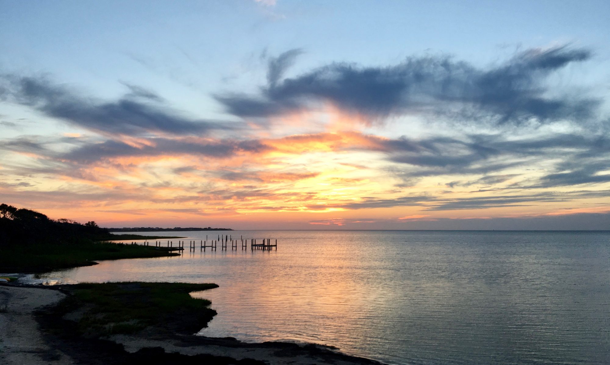

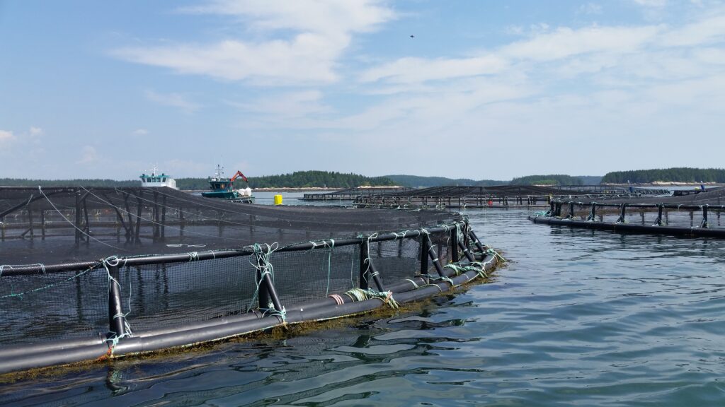
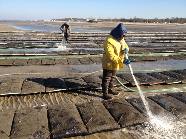
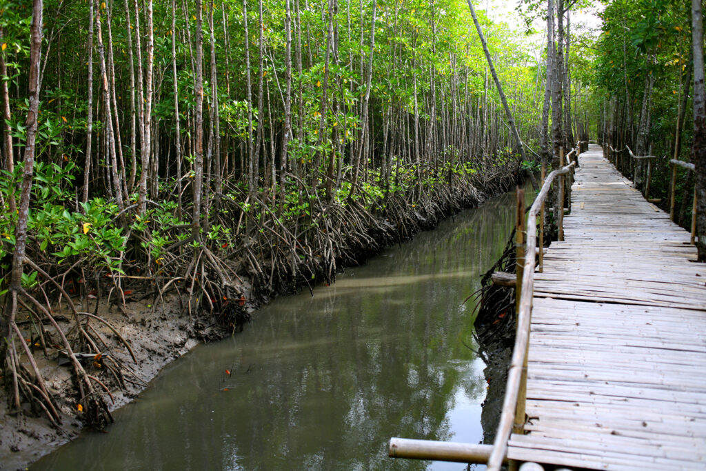
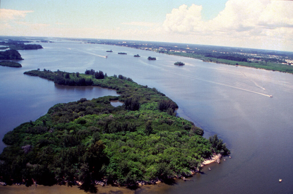
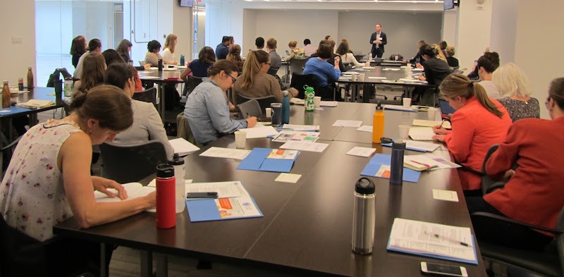
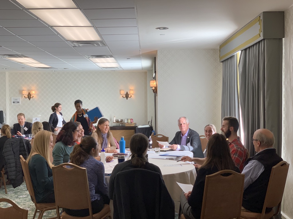
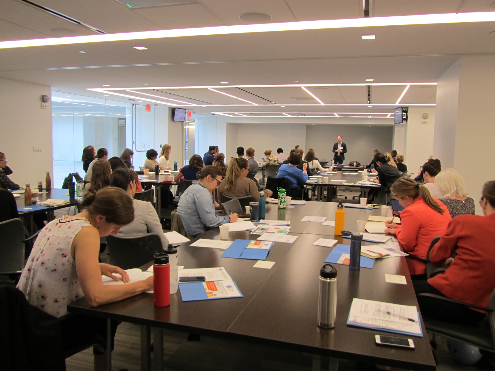
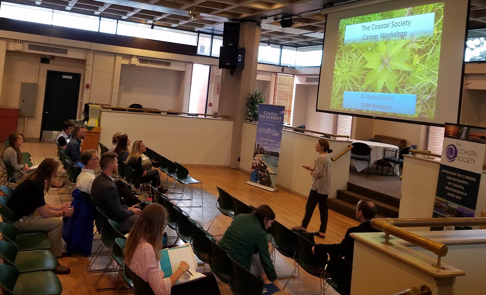
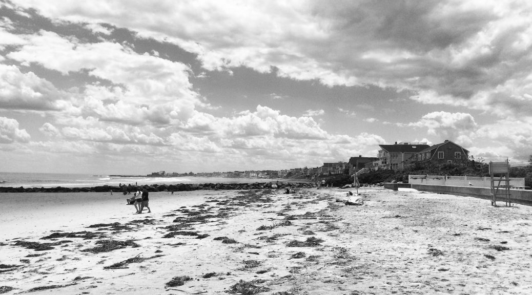


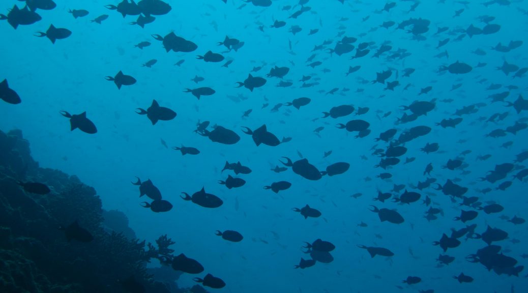


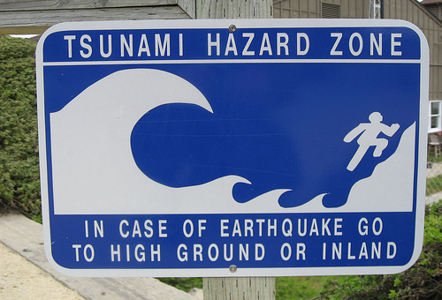

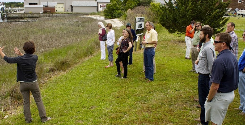


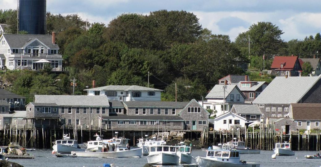


